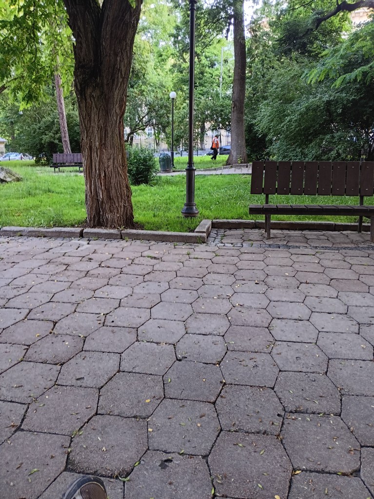
An air raid alarm interupted my first night’s sleep near Rynok Square in Lviv, Ukraine at 2:30 am on June-12, 2024 after 22 hours on a train the day prior. Sirens outside, mobile loud-speakers on the streets, and my cell phone all blared the message “Attention. Air Raid Alert. Proceed to the nearest shelter. Don’t be careless. Your overconfidence is your weakness.” Unsure on what to do, I listened, if there was any commotion outside my AirBnB in the stairways of the 3-story appartment building with residents moving whom I could follow. As there was no such noise, I did nothing, and quickly fell back asleep. At 5 am I woke again, got up to check e-mail when yet another such alarm started. This time I decided to go outside to see what the city does during an air-raid alarm at 6 am. All I saw were a few men my age cleaning the sidewalks and joggers passing me in a forested park:
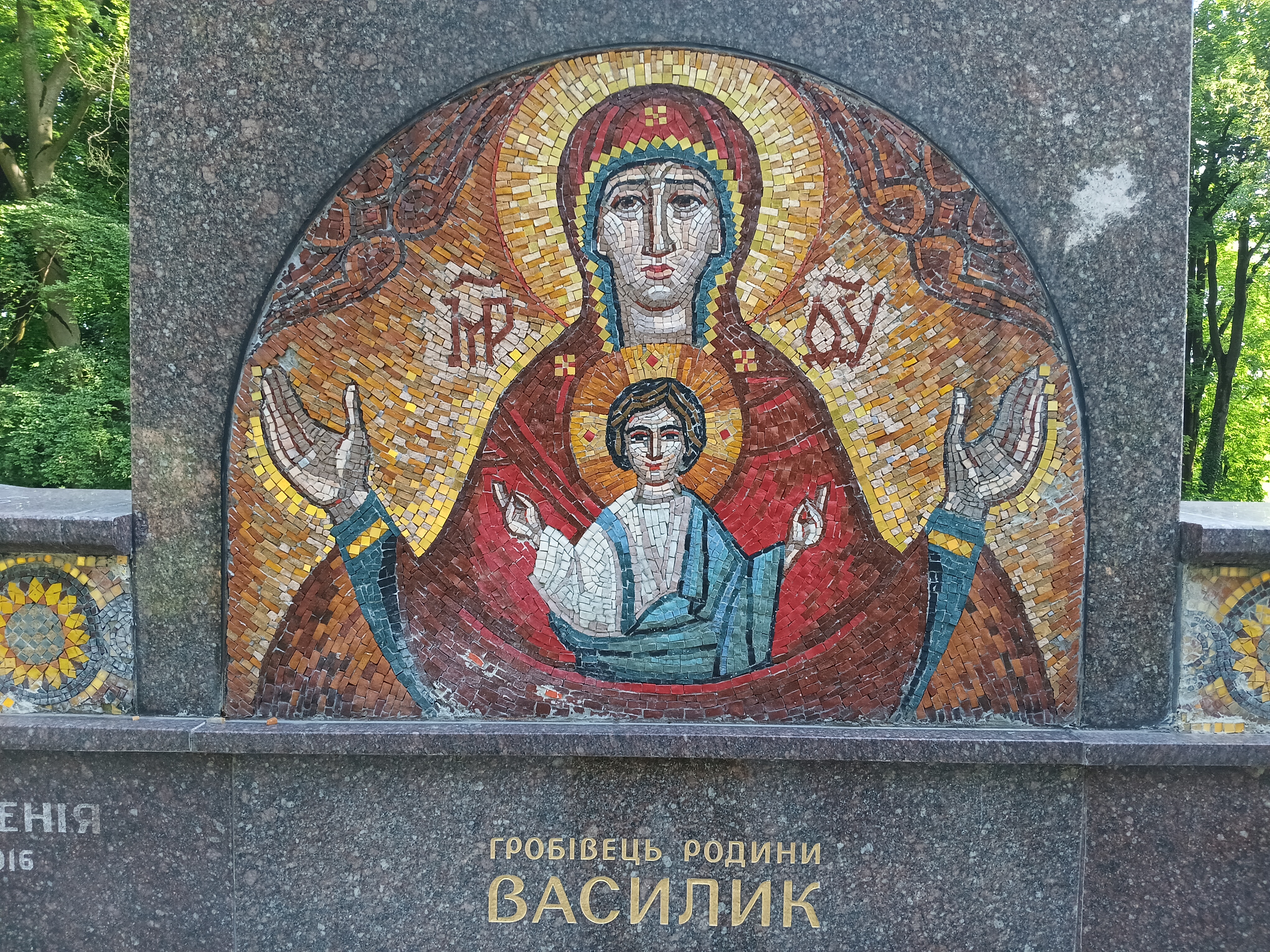
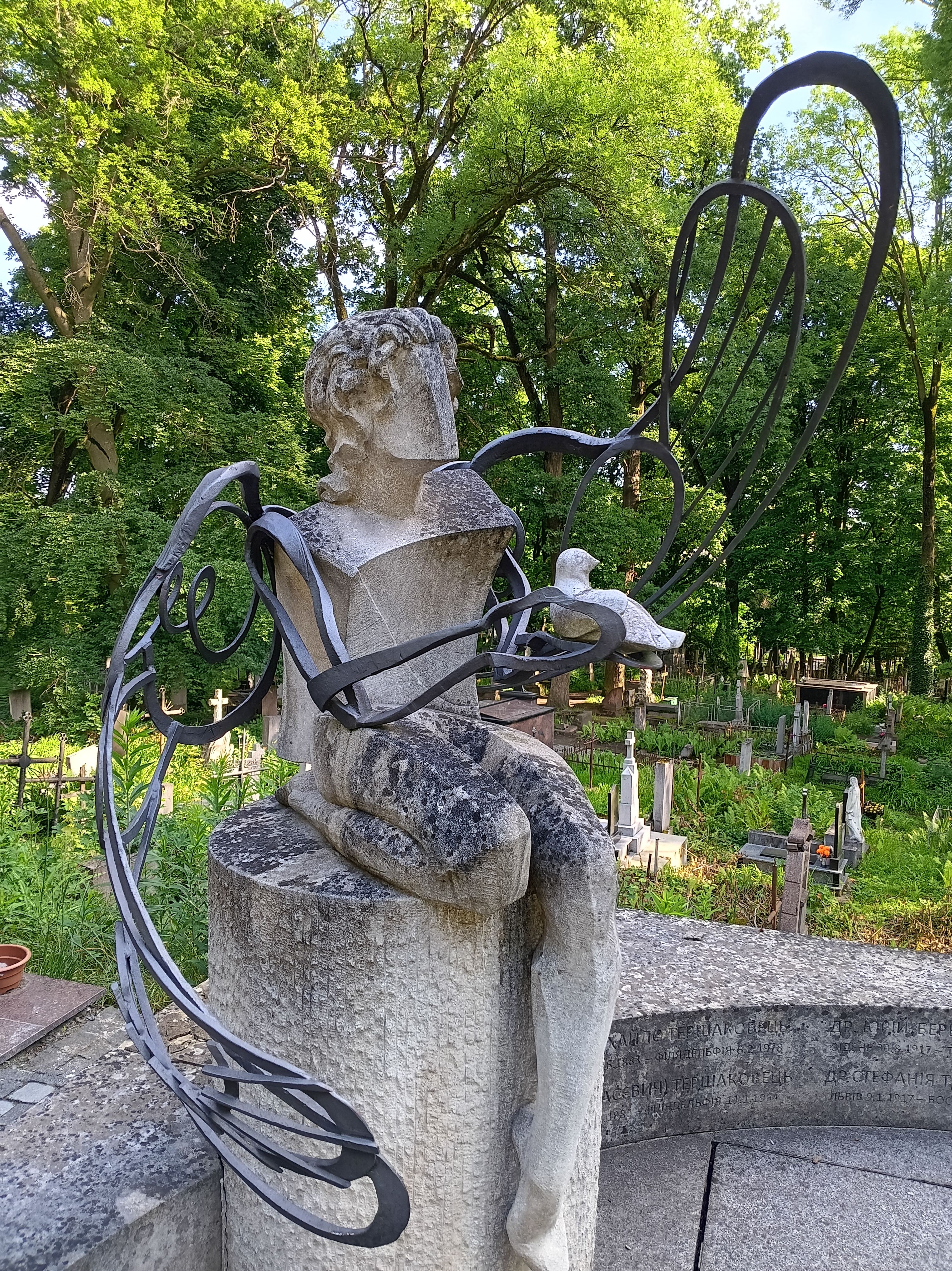
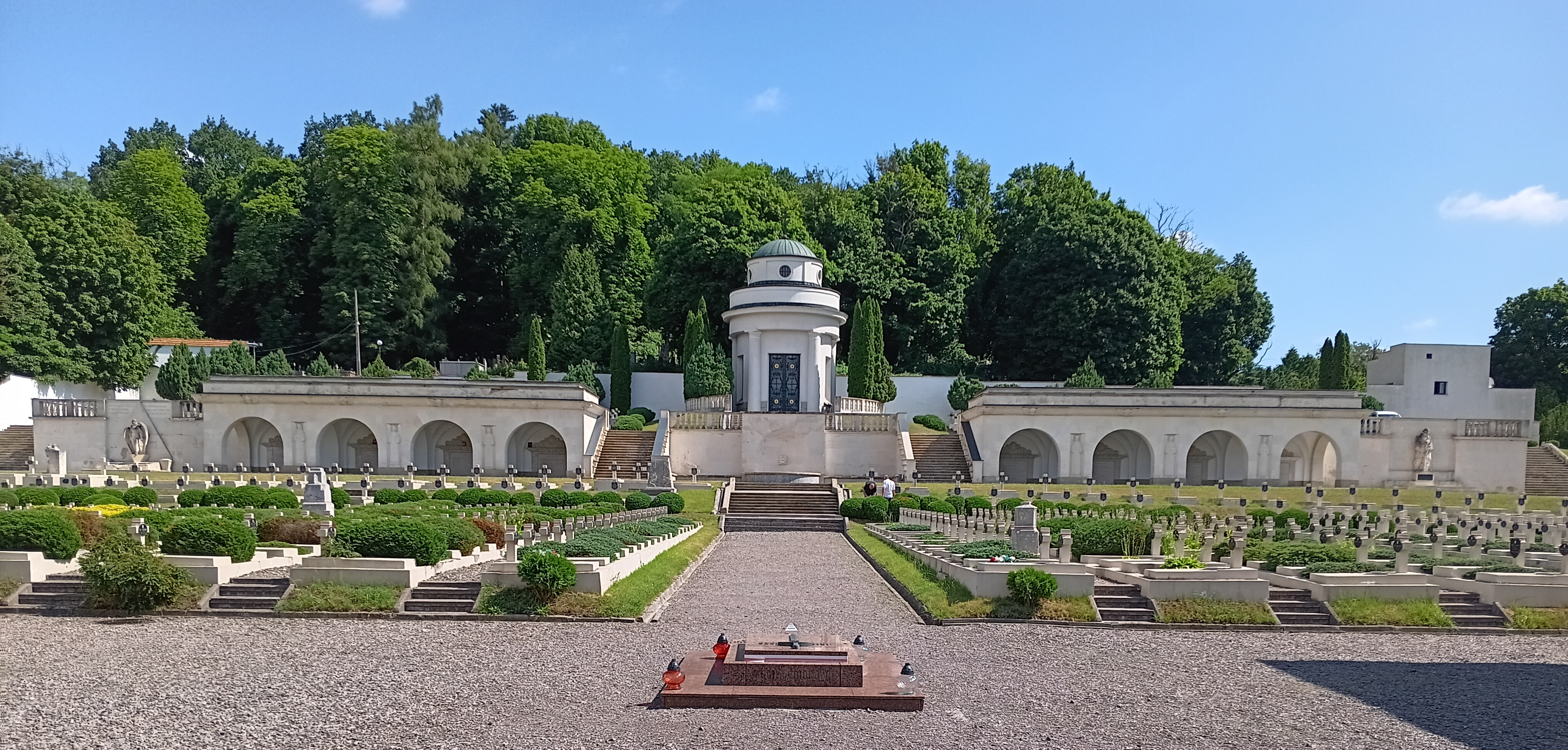
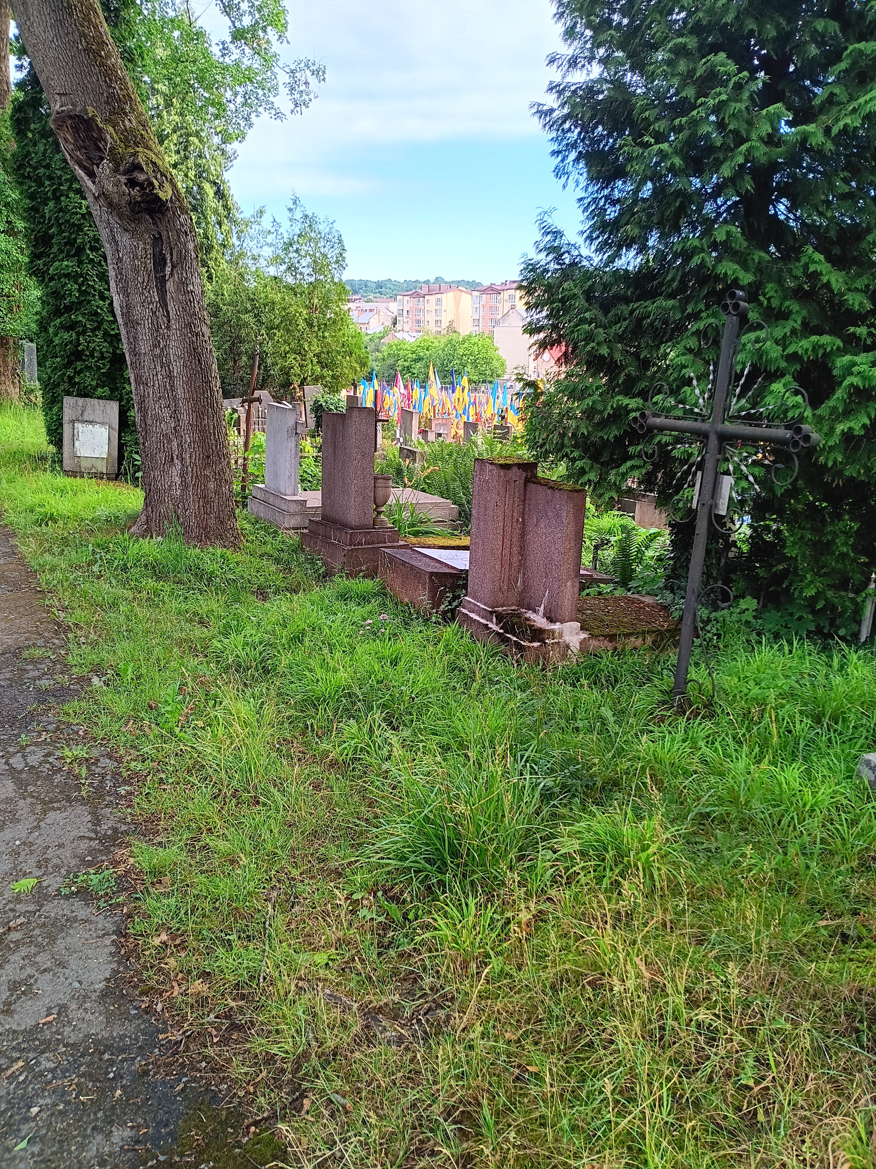
My plan for the day was to find the 250-year old Lychakiv Cemetery that was established 1787 when the Habsburg Empire of Austria-Hungary controlled Lviv and Galicia as a result of the the First Partition of Poland in 1772. The cemetery is a large wooded park in a hilly area near the Botanical Gardens to the East of the city. Today it is a “State History and Culture Museeum” of Ukraine that Polish and Ukrainian volunteers have restored, both lovingly and at times illegally, for the last 50 years. Prominent Lviv citizens of culture, science, and politics as well as soldiers and victims of war and oppression both past and present are buried here. Meandering paths lead through lush vegetation with old trees and artful sculptures, grave stones, and icons.
I spent well over 3 hours wandering along wide and narrow pathways up and down the hillsides to marvel at artful displays to remember those who walked the streets of Lviv the last 250 years. The style of letters, mosaics, sculptures, and vegitation changed from section to section all added over the centuries when different countries ruled Lviv from the Austria-Hungarian empire (1792-1918), the newly establish Poland (1918-39), the Soviet Union (1939-41), Nazi Germany (1941-44), the Soviet Union (1944-91) until it finally became part of independent Ukraine in 1991.
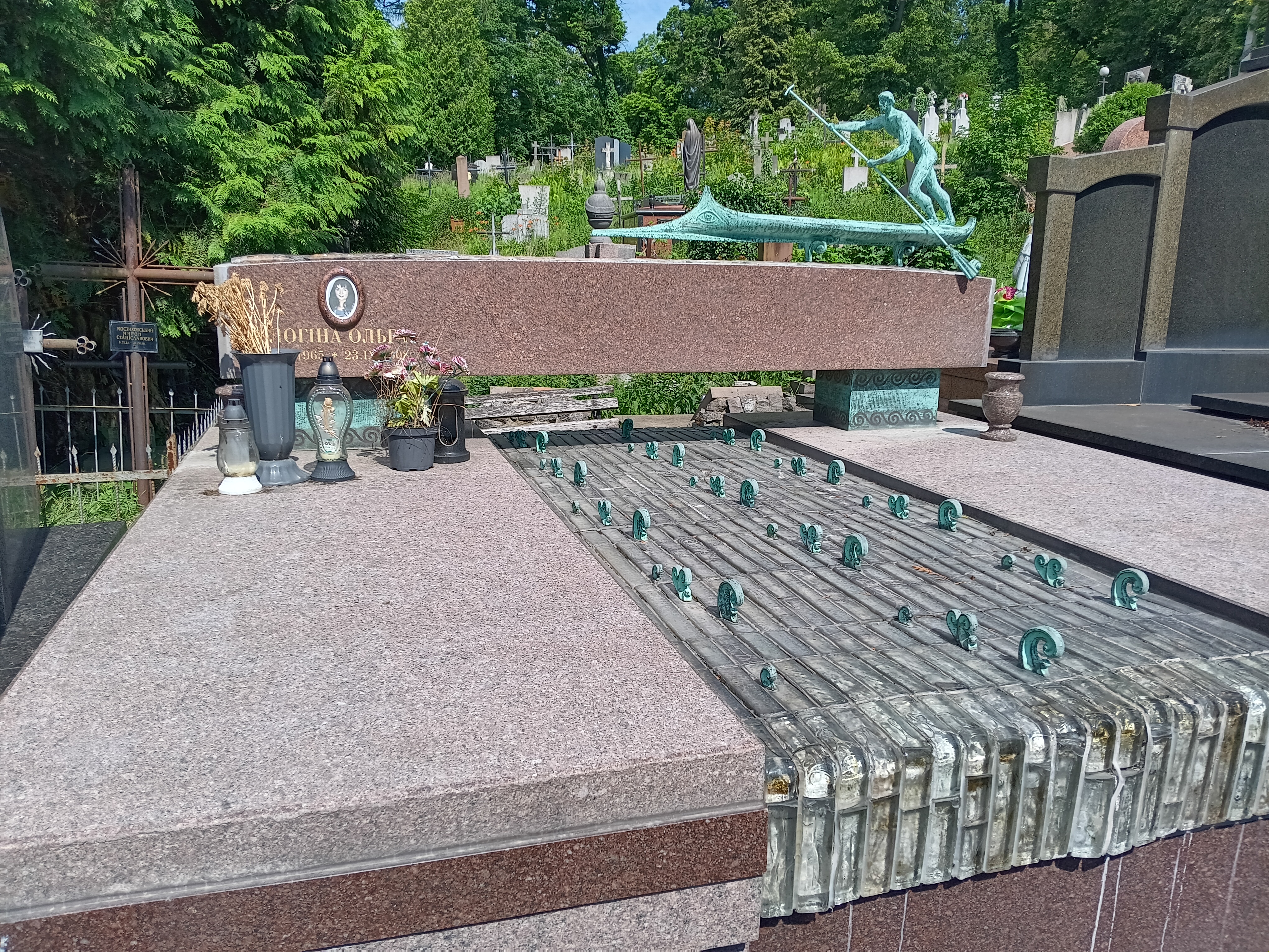
My favorite memorial is that of a person on a boat crossing a wavy river. The copper-colored boat even as an eye at its forward head just above the water line. The river appears to come down from the wooded hill behind it, but the boat floats above the the water bridging the river perhaps indicating another “spiritual” dimension. It all merges in a harmoneous way in multiple directions indicating both time and space. The river falls down at the edge, however, the river also falls farther towards graves of soldiers from both past (1918-19) and present (2014-present) wars. Three Americans aviators such as Edmund Pike Graves are burried here also. More than 100 years ago they supported Polish troops flying early bi-planes against Ukrainian nationalists.
Among the many graves is that of the Polish mathematician Stefan Banach (1892-1945) who did pioneering work in the 1930ies when he was teaching at Lviv University. His fundamental work on vector spaces (“Functional Analysis” in English or “Funktionen Theorie” in German) applies to how I analyze climate data from the waters, ice, and glaciers around Greenland. Learning about Banach and the Lwow School of Mathematics, I discovered that the scientists living and working in Lwow/Lviv until 1939 also contributed to the Manhattan Project and the Nuclear Age. On my subsequent visit to Krakow in Poland 200 miles to the West, I found a bench in a park with a sculpture of Dr. Banach and some of his work:
A young Dr. Banach sits on the right in a conversation during his school years in Krakow. He left to teach mathematics in Lviv in 1918 where he lived until lung cancer killed him at age 53 in 1945. He is burried near the entrance of the cementary.
Figure: Polish Military Cemetery 1918-20 (“Eaglets Cemetery”) in Lviv, Ukraine of the 1918-20 war between Poland and Ukrainian Army of Galicia (bottom) adjacent to the memorial to the Ukrainian Galician Army (top left). Three U.S. American aviators are burried here also (top right).
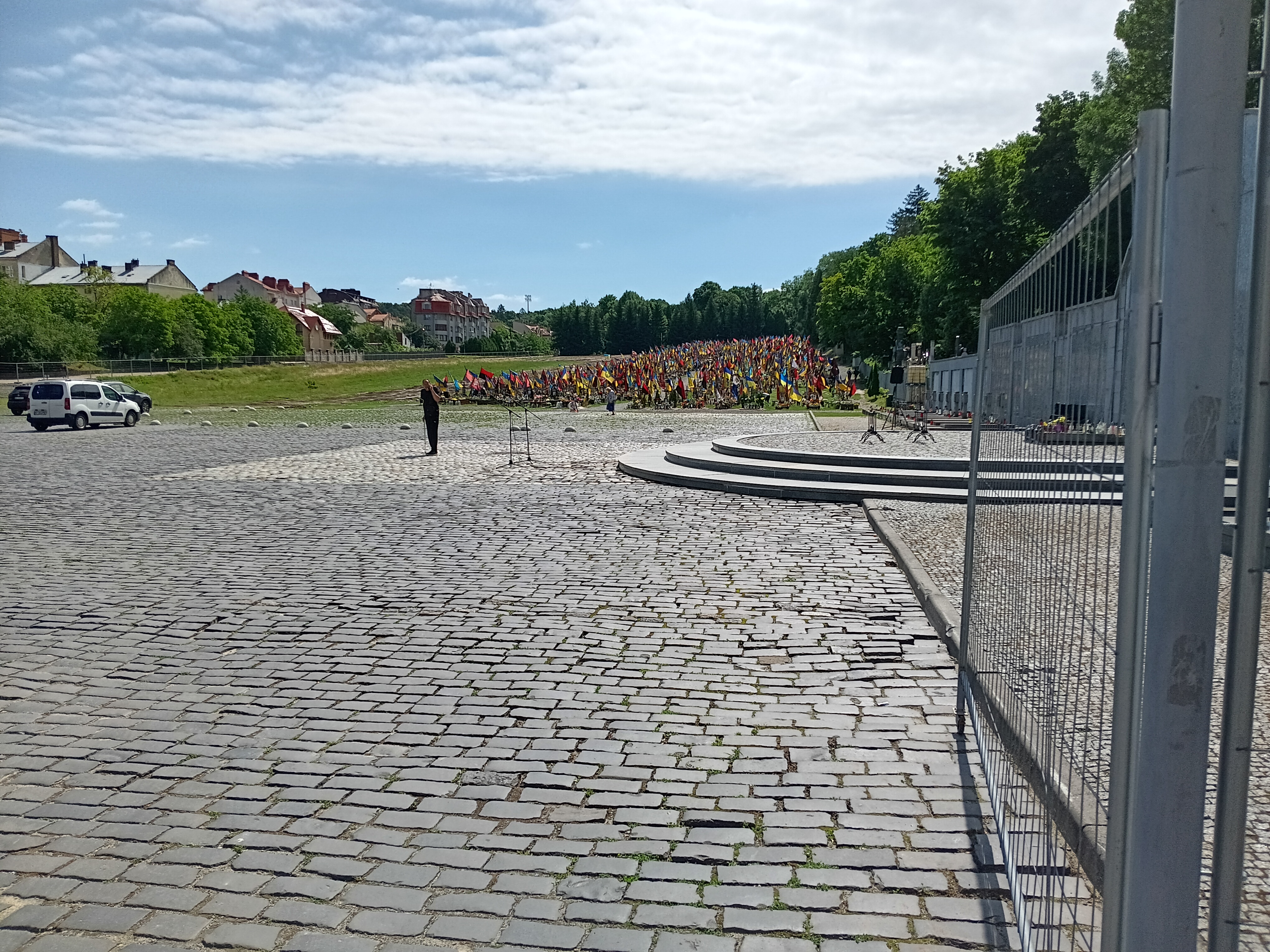
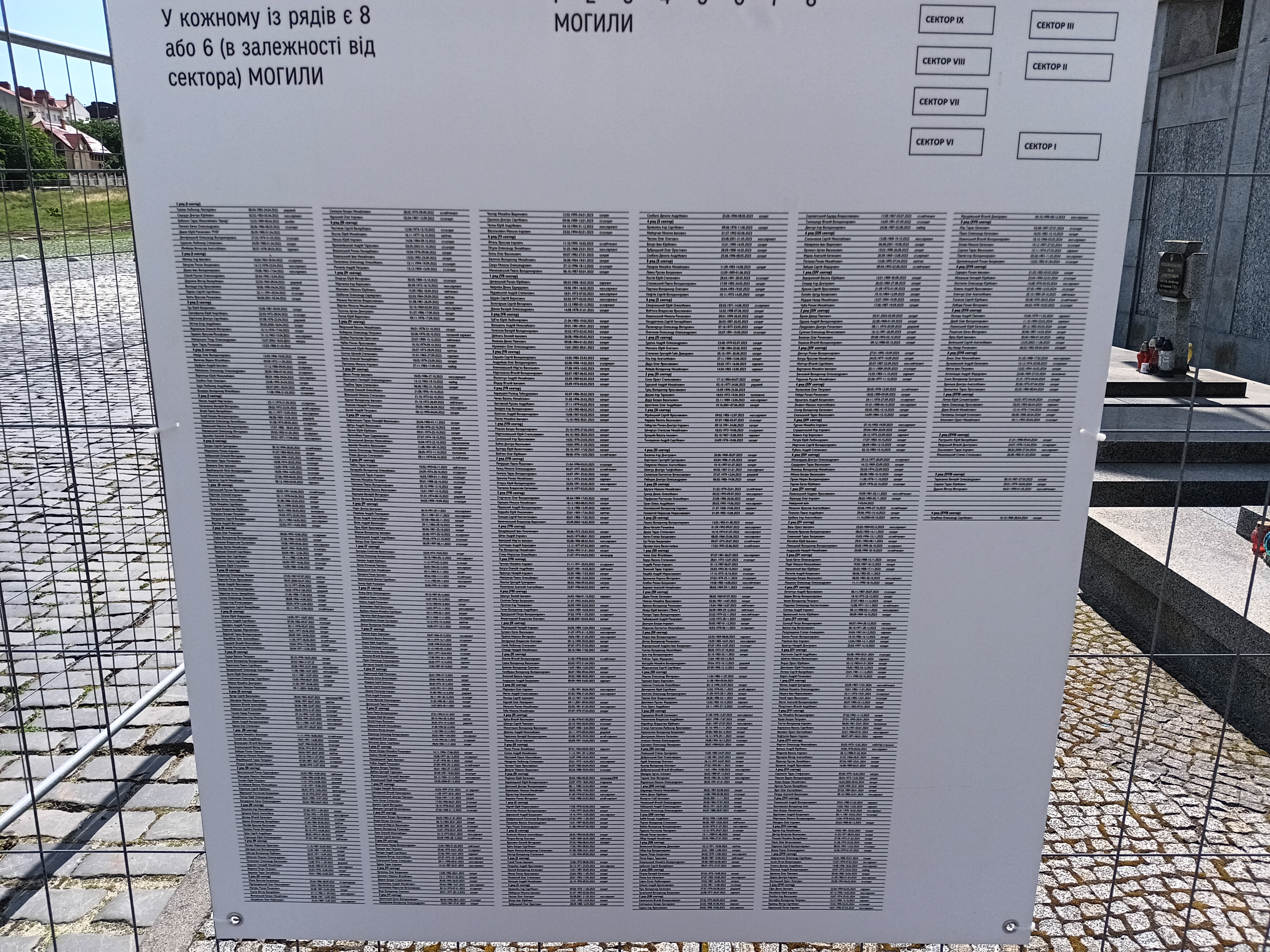
The last burial field I visited only from a distance, because it is here where Lviv buries her current war dead. Almost every day new graves are dug and filled. From the distance it looks like an ocean of flags both of the blue and yellow of Ukraine and a range of battle and historical flags of different military units. I noticed that the people who enter this section first checked a large board near the entrance to see where in this section their loved-ones are buried. The long list of names and grave locations includes the dates of birth (1962-2005) and death (2022-present).
The war and terror forced by Russia onto Ukraine presents itself on main squares in central Lviv as well. One prominent public space that I passed every day included about 16 poster boards of 25-year old combat medic Iryna Tsybukh whom Russian invaders killed near Kharkiv the week before my arrival in Lviv. And every days I saw school children, shoppers, workers, and tourists passing this place dedicated to a brave local women. A year before her burial at Lychakiv Cemetery she wrote to her younger brother describing her wishes in case of her death
I don’t like seeing you mourn, but time and this despair will pass, and we’ll have to continue living life. So don’t waste time suffering; live on.
Iryna Tsybukh (1998-2024)
An equally eloquent obiturary appeared in the New York Times on Aug.-22, 2024. I took the photo of a poster board in Lviv bottom right, the other photos are from her Instagram page and public sources.
This was my only my second of four day as a tourist in Lviv, but here and then I decided to extend my stay. The public life I saw, the people I met, the food I ate, the art I admired, and the history I smelled at every corner made me extend my stay for another 4 days. There was a concert at the Opera and a Ukrainian Wine Festival on the weekend I did not want to miss. Furthermore, I will travel to Lviv again this summer, but this time I will stay for 2-3 weeks as part of a summer language program of the Ukrainian Catholic University. I met one of its mentors on the bus from Lviv to Krakow in Poland as we both returned from there by train to Germany. I am very excited to meet, converse, eat, and live with young Ukrainian students for 2-3 weeks.
References:
Mick, C., 2011: Incompatible Experiences: Poles, Ukrainians and Jews in lviv under Soviet and German Occupation, 1939-44, Journal of Contemporary History, 46 (2), 336-363.
Snyder, T., 2003a: The causes of the Ukrainian-Polish Ethnic Cleansing 1943, Past & Present, 179, 197-234.
Snyder, T., 2003b: The Reconstruction of Nations – Poland Ukraine, Lithuania, Belarus 1569-1999. Yale University Press, New Haven, CT, 367 pp.
Snyder, T., 2010: Bloodlands – Europe between Hitler and Stalin, Basic Books, New York, NY, 524 pp.
Zhurzhhenko, T., 2013: The border as Pain and Memory – Commemorating the Polish-Ukrainian Conflict of 1918-1919 in Lviv and Przemysl, Nationalities Papers: The Journal of Nationalism and Ethnicity, DOI:10.1080/00905992.2013.801416.
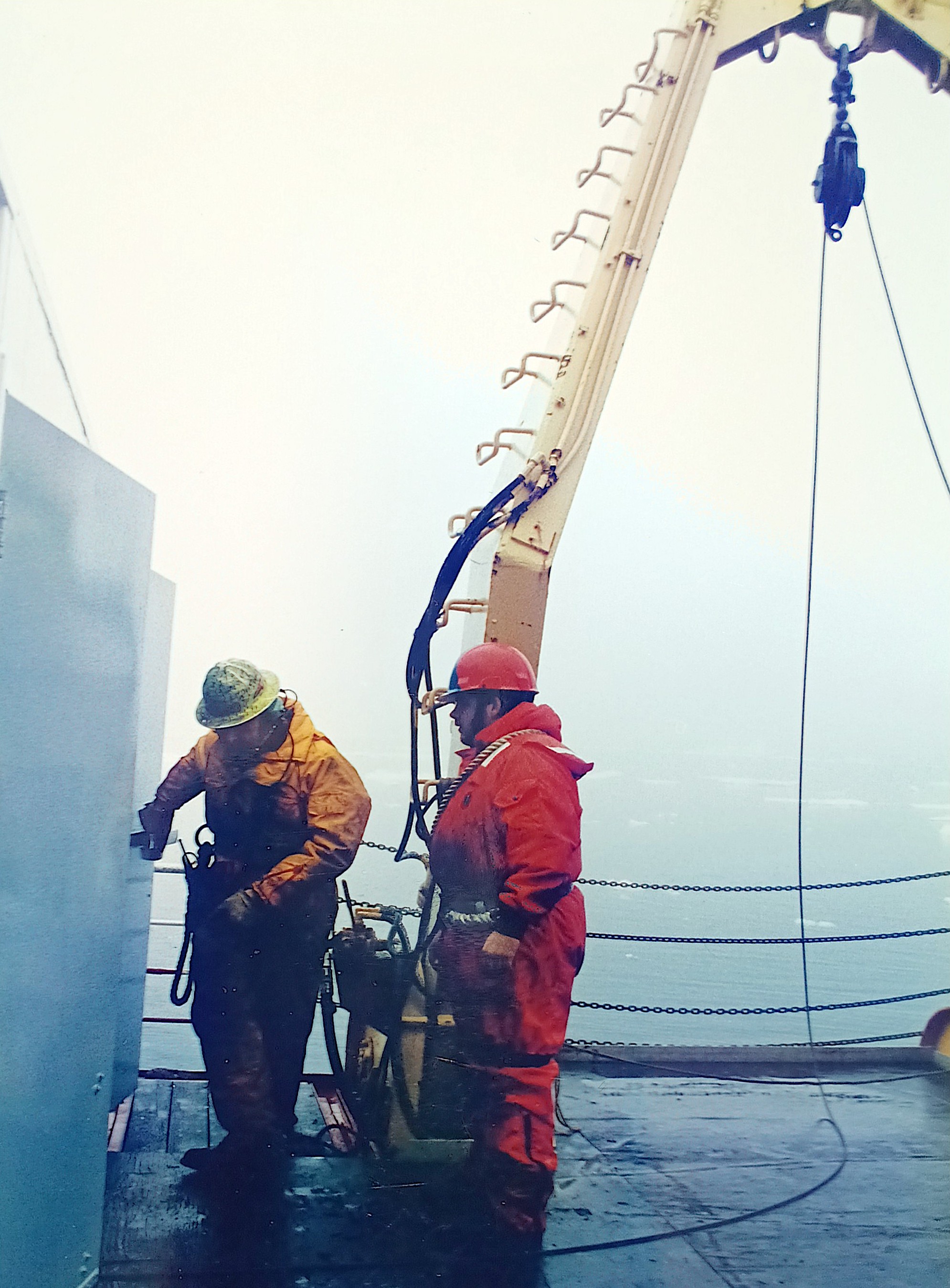
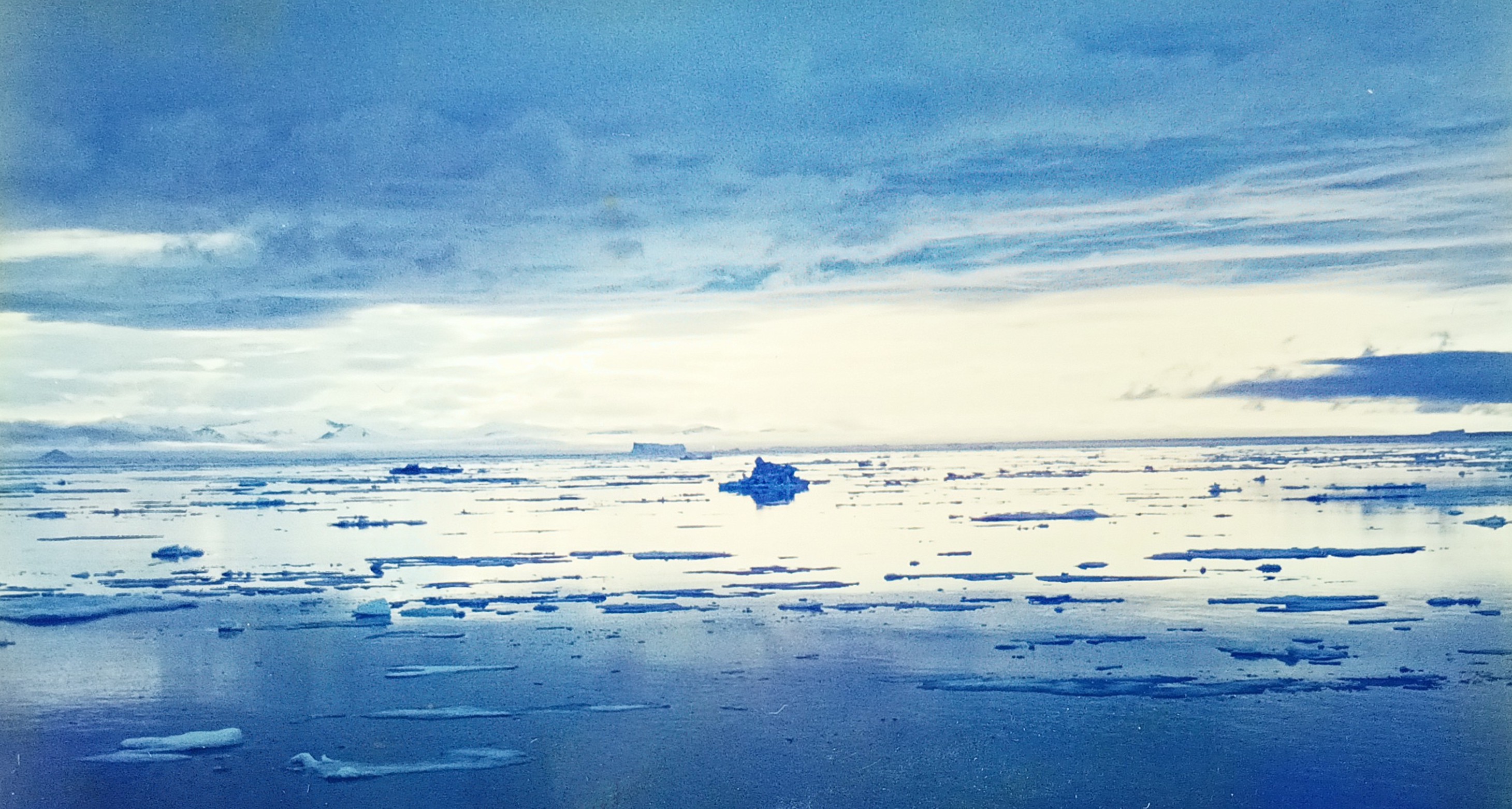
Science and Greenland both combine discovery, adventure, and diverse people. I do this work free of academic constraints, responsibilities, and pay, because I retired from my university three months ago drawing on savings that accumulated since 1992 with my first job in San Diego, California. It was there and then, that my interest in polar physics started, but my first glimpse of Greenland had to wait until 1997 when a Canadian icebreaker got me to the edge of the ice in northern Baffin Bay between Canada and Greenland. It was a cold and foggy summer day as these pre-digital photos show:
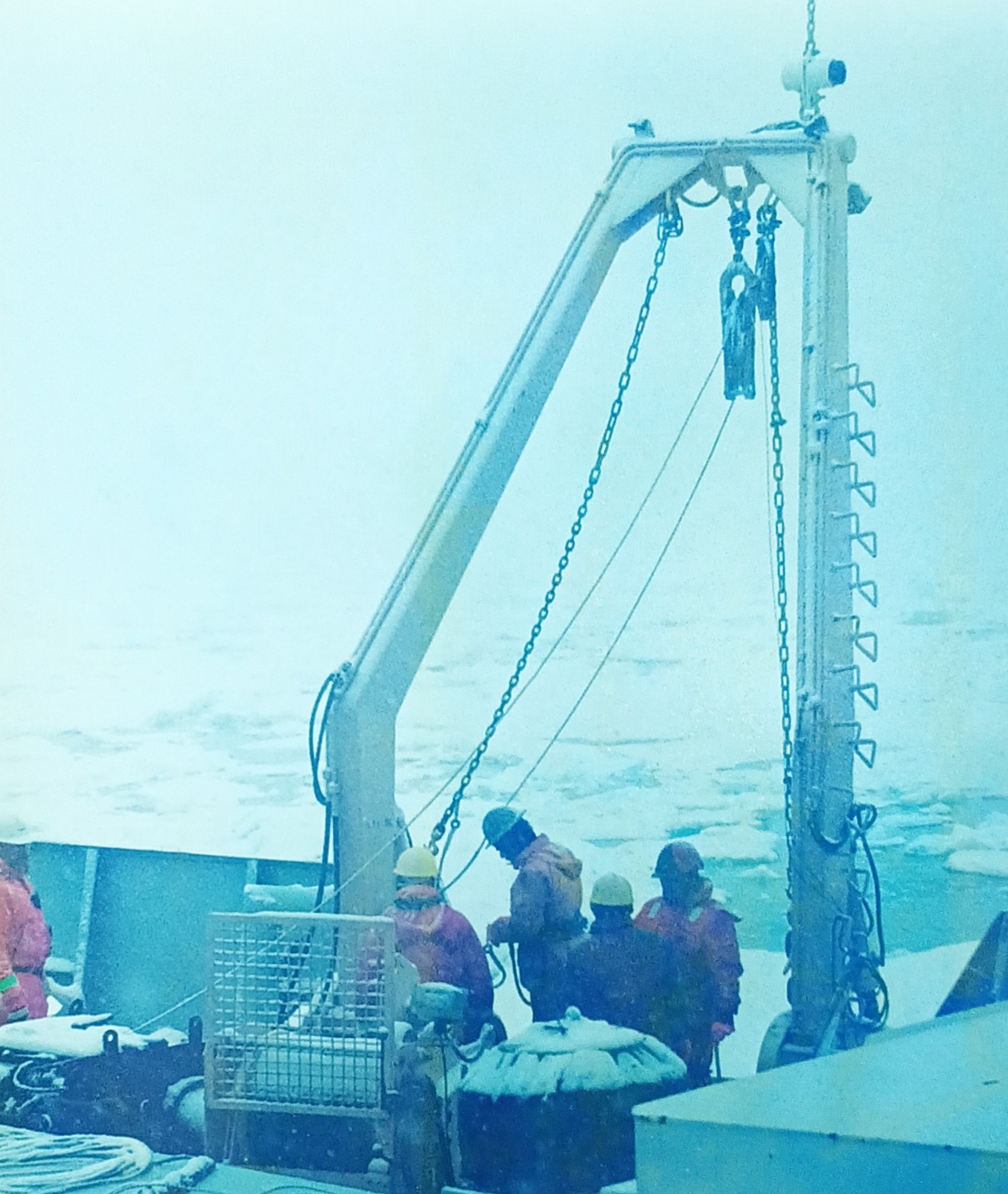
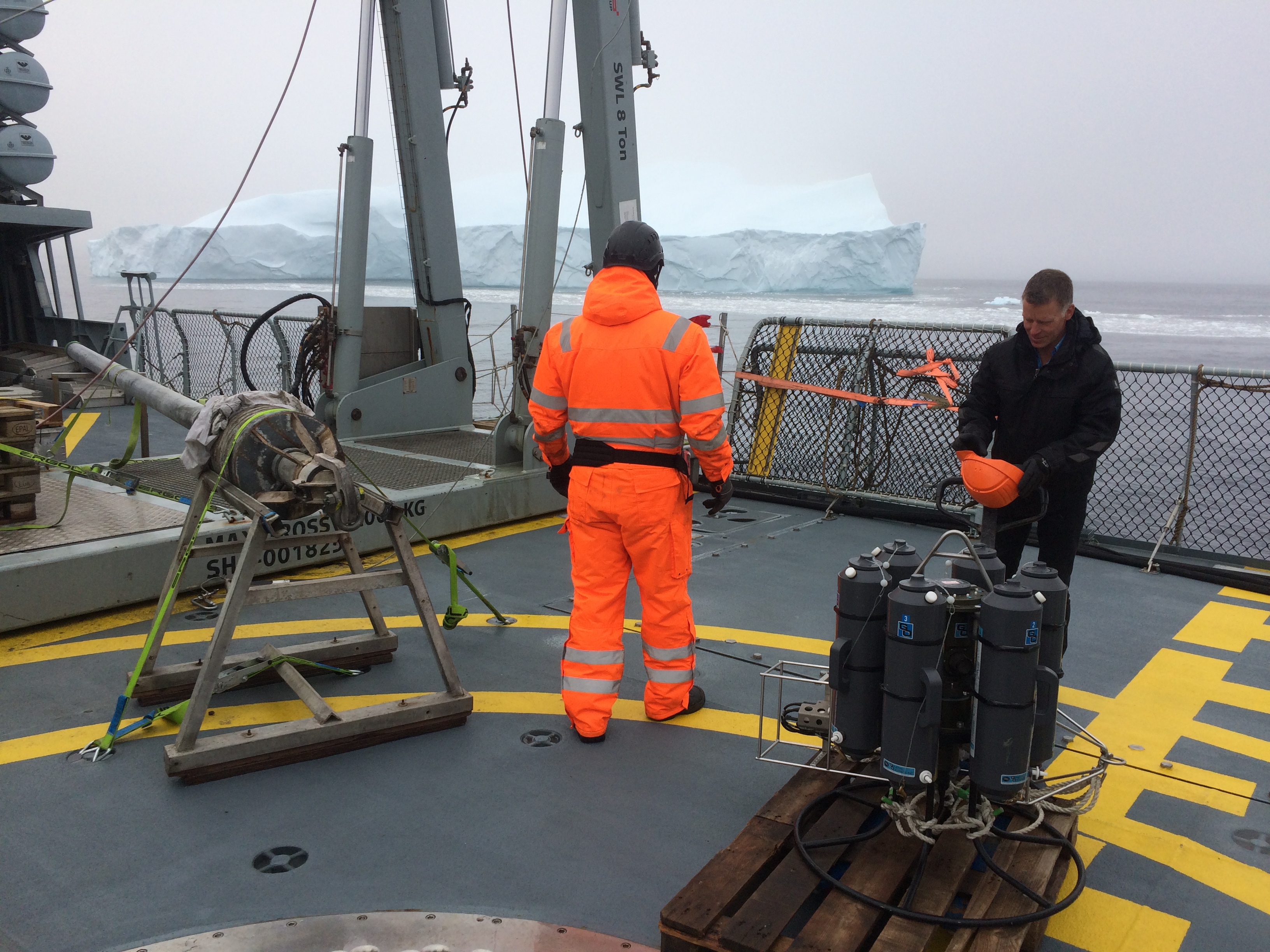
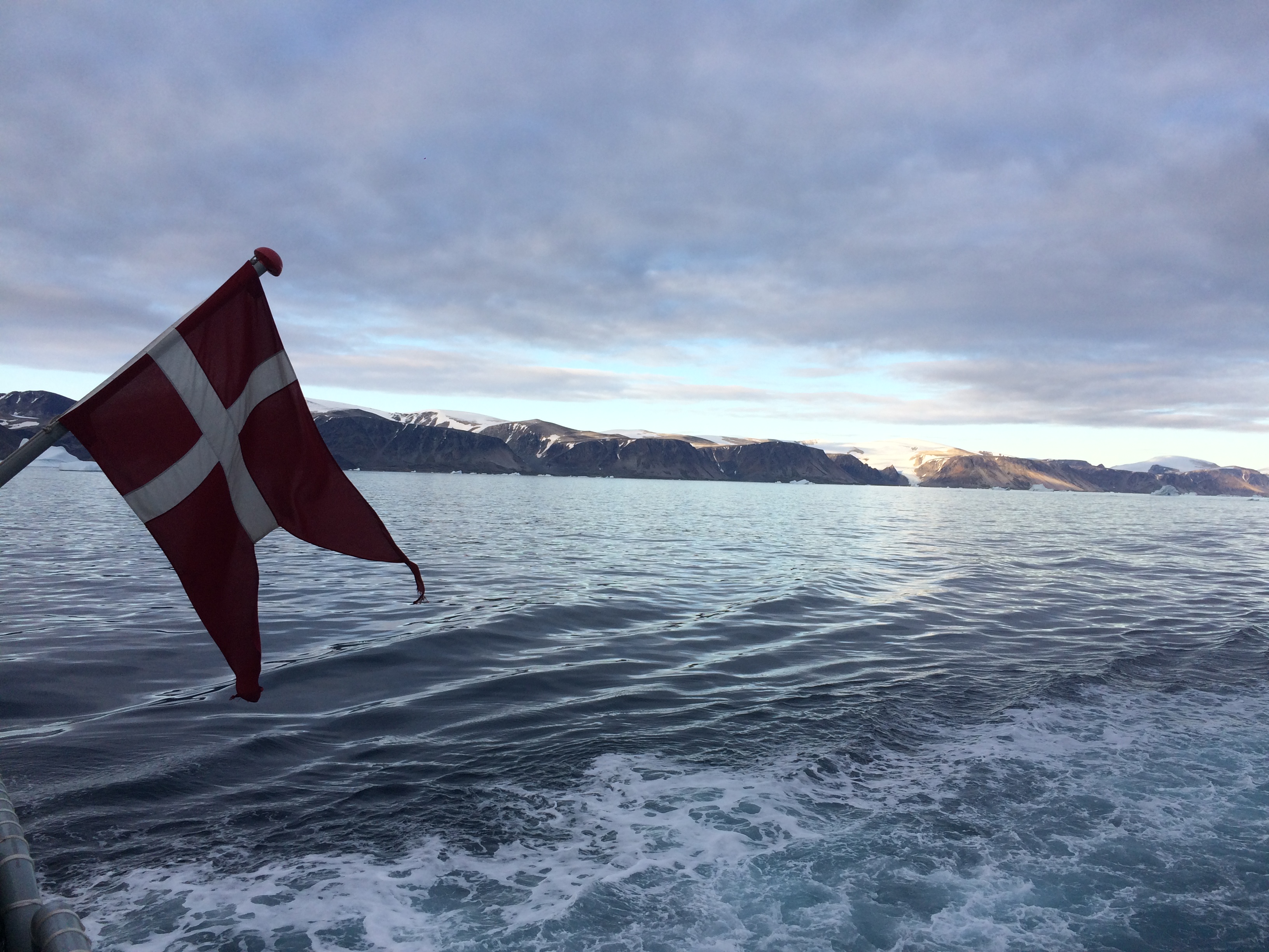
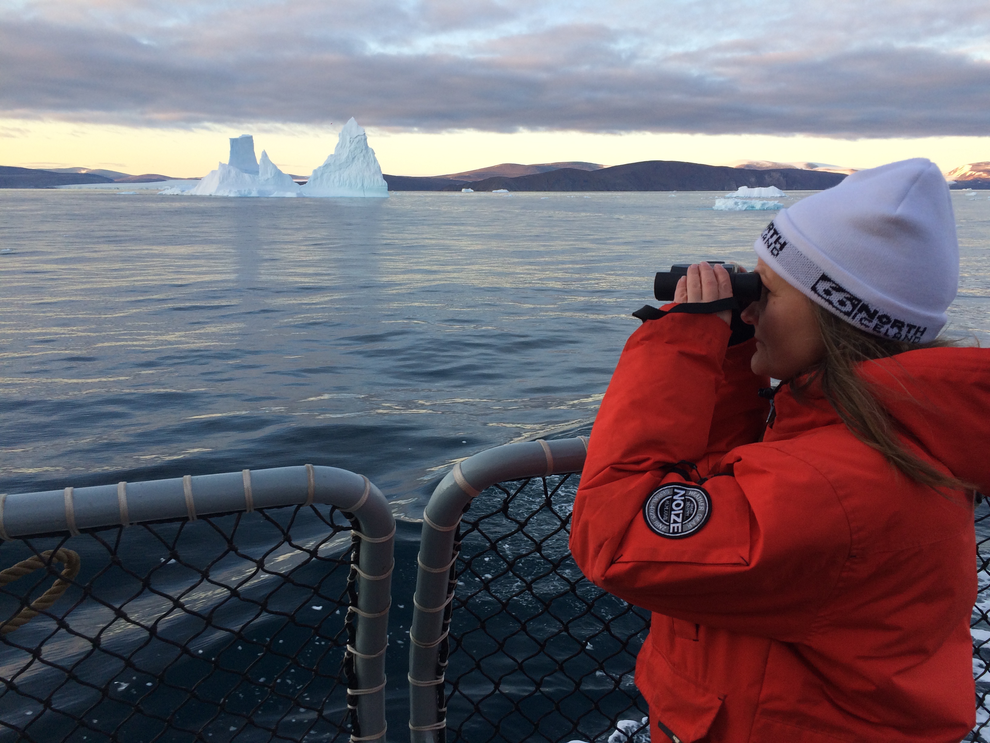
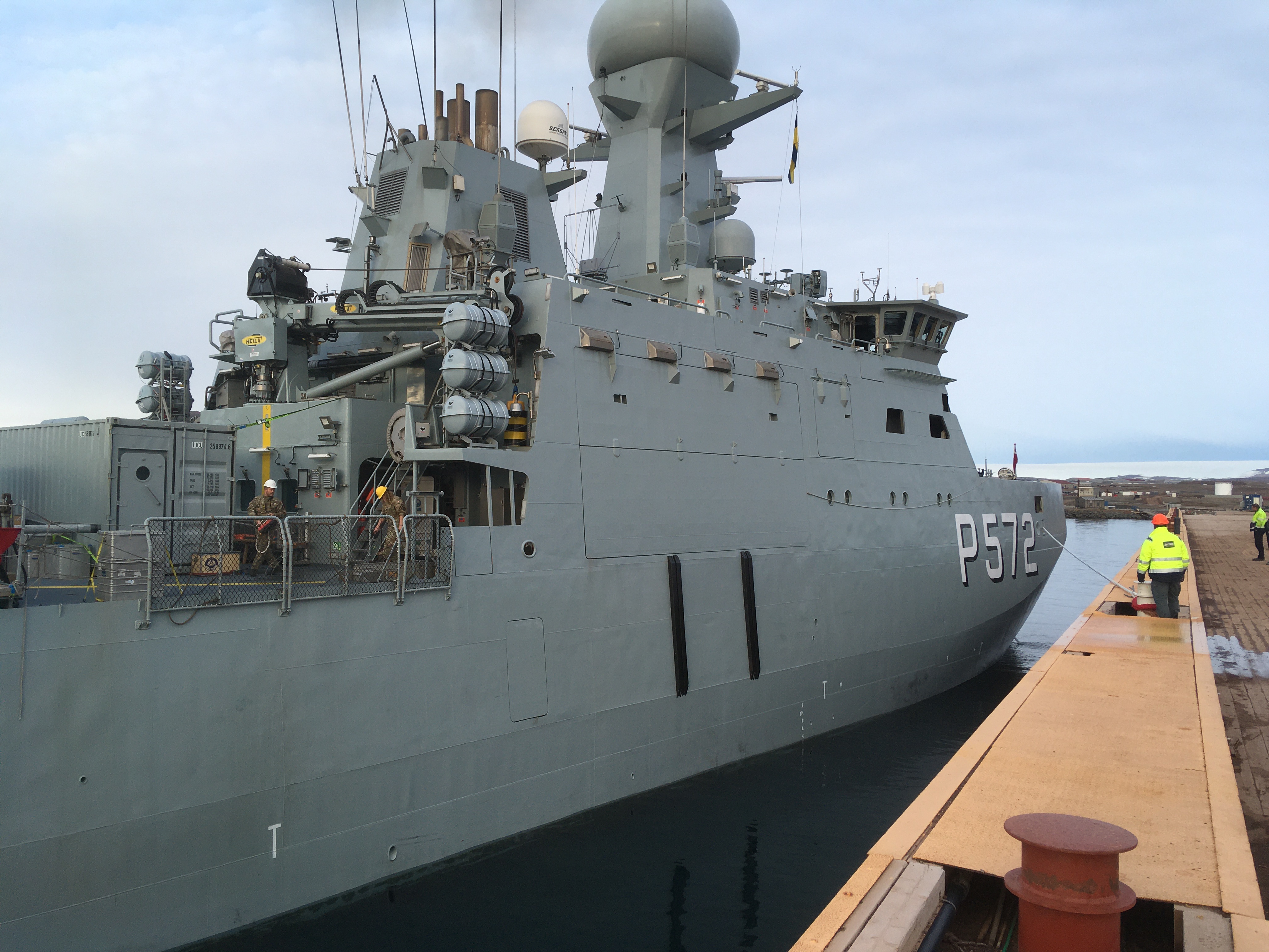
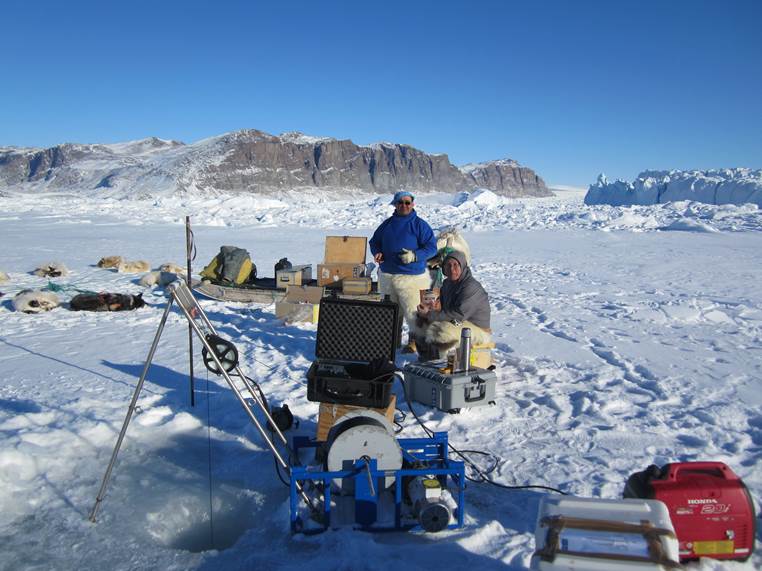
Almost 25 years later I visited the area again with Her Danish Majesty Ship HDMS Lauge Koch, a Danish Navy vessel, which surveyed the coastal waters between Disko Bay in the south and Thule Air Base (now Pituffik Space Base) in the north. Two Danish goverment agencies led this expedition: the Geological Survey of Denmark and Greenland (Dr. Sofia Ribeirio, GEUS) and the Danish Metorological Institute (Dr. Steffen Olsen, DMI). Our small team of 11 scientists and 12 soldiers surveyed the seafloor with fancy acoustics, drilled into the bottom with piston corers, fished for plankton with towed nets, and collected water properties with both electronics and bottle samples. As this was during the Covid-19 pandemic, all scientists had to be both vaccinated and tested prior to boarding the flight from Copenhagen to Greenland. We also quarantined for 3 days in Aasiaat, Greenland prior to boarding the ship.
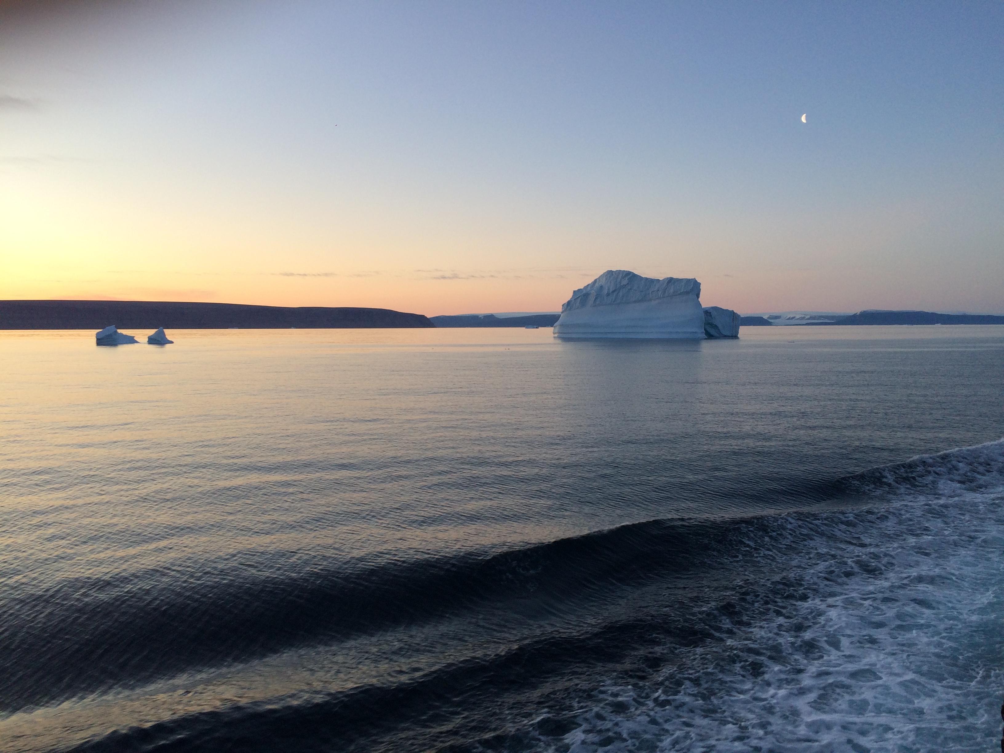
Now in retirement, I thoroughly enjoy the time to just just revisit the places and people via photos that finally get organized. More importantly, I finally feel free to explore the data fully that we collected both on 14 separate expeditions to Greenland between 1997 and 2021. For example, only in retirement did I discover that Baffin Bay was visited in 2021 by both a Canadian and an American in addition to our Danish ship. Data from these separate Baffin Bay experiments are all online and can be downloaded by anyone. I did so and processed them for my own purposes. Furthermore, NASA scientists of the Ocean Melts Greenland program flew airplanes all over Greenland to drop ocean sensors to profile and map the coastal ocean with fjords and glaciers hard to reach by ships. All these are highly complementary data that describe how icy glaciers, deep fjords, coastal oceans, and deep basins connect with each other and the forces that winds, sea ice, and abundant icebergs impose on them.
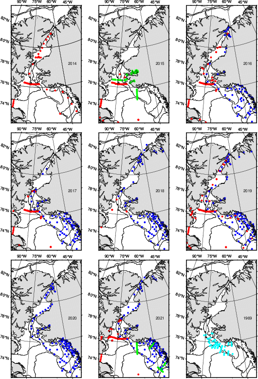
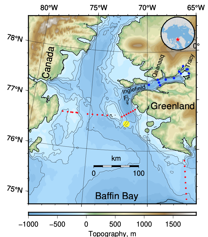
It requires a bit of skill and computer code, however, to process data from different ships, countries, and sensors into a common format to place onto a common map for different years, but here is one such attempt to organize:
There is one map for each of 9 years, i.e., station locations are shown in a top (2014, 2015, 2016), center (2017, 2018, 2019), and bottom row (2020, 2021, 1968). Land is gray with Canada on the left (west) and Greenland on the right (east) while the solid contour lines represent the 500-m and 1000-m water depth. Each colored symbol represents one station where the ship stopped to deploy a sensor package to measure temperature, depth, and salinity of the ocean water from the surface to the bottom of the ocean adjacent to the ship. The different colors represent data from Canada in red, Denmark in green, and USA in blue. The light blue color represents historical data from a study that investigated the waters after a nuclear armed B-52 bomber crashed into the ocean near Thule/Pituffik on 17 Jan. 1968 with one nuclear war head still missing. A Wikipedia story called 1968 Thule Air Base B-52 Crash provides details, references, and Cold War context, but lets return to the data and ocean physics:
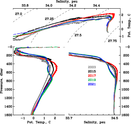
Notice a single red dot near the bottom center of some maps such as 2015, 2017, or 2021. For this single dot I show the actual temperature and salinity data and how it varies with depth (labeled pressure, at 100-m depth the pressure is about 100 dbar) and from year to year:
The two bottom panels show how temperature (left) and salinity (right) change with depth (or pressure). Notice that the coldest water near freezing temperature of -1.8 degrees Celsius (29 Fahrenheit) occurs between 30-m and 200-m depth (30 to 200 dbar in pressure). Below this depth the ocean water actually becomes warmer to a depth of about 500-600 m to then become cooler again. The effects of pressure on temperature are removed, this is why I call this potential temperature and label it “Pot. Temp.” The warmest waters at 600-m depth are also the most salty (about 34.5 grams of salt per 1000 grams of water). This saltiness makes this water heavier and denser than the colder waters above. This is a common feature that one finds almost anywhere in polar regions. The top panel shows the same data without reference to depth (or pressure), but contours of density show how this property changes with temperature and salinity. It takes a little mental gymnastic to “see” how density always increases as pressure increases, but the main thing here is that both salinity and temperature can change the density of seawater.
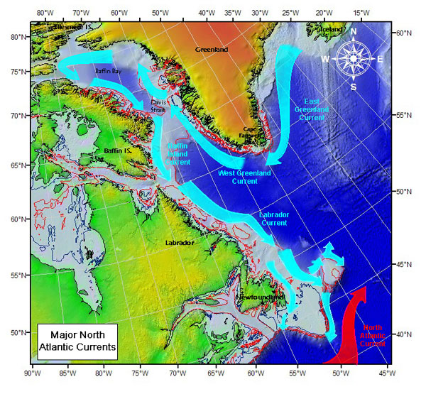
Sketch of ocean current systems off Greenland and eastern Canada. Colors represent topography of ocean, land, and Greenland ice sheet.
U.S. Coast Guard, International Ice Patrol
The origin of the warmer (and saltier) waters is the Atlantic Ocean to the south. Currents move heat along the coast of Greenland to the north. Icebergs in Baffin Bay extend into this Atlantic Layer and thus move first north along the coast of Greenland before turning west in the north and then south along the coast of Canada. This deep ocean heat does reach coastal tidewater glaciers which are melted by this warm ocean water. So the year-to-year changes of temperature and salinity determine in part how much the coastal glaciers of Greenland melt. The temperature and salinity maxima change from year to year being warmest in 2015 and 2017 and coldest in 2019 and 2021. No “global warming” here, but notice what happens closer to the bottom at 1500-m, say. These waters are separated from the Atlantic and Arctic Oceans to the south and north by water depths that do not exceed 600-m in the south and 400-m in the north. These almost stagnant waters increase their temperatures steadily from 2003 to 2015 to 2017 to 2019 to 2021. This is the global warming signal.
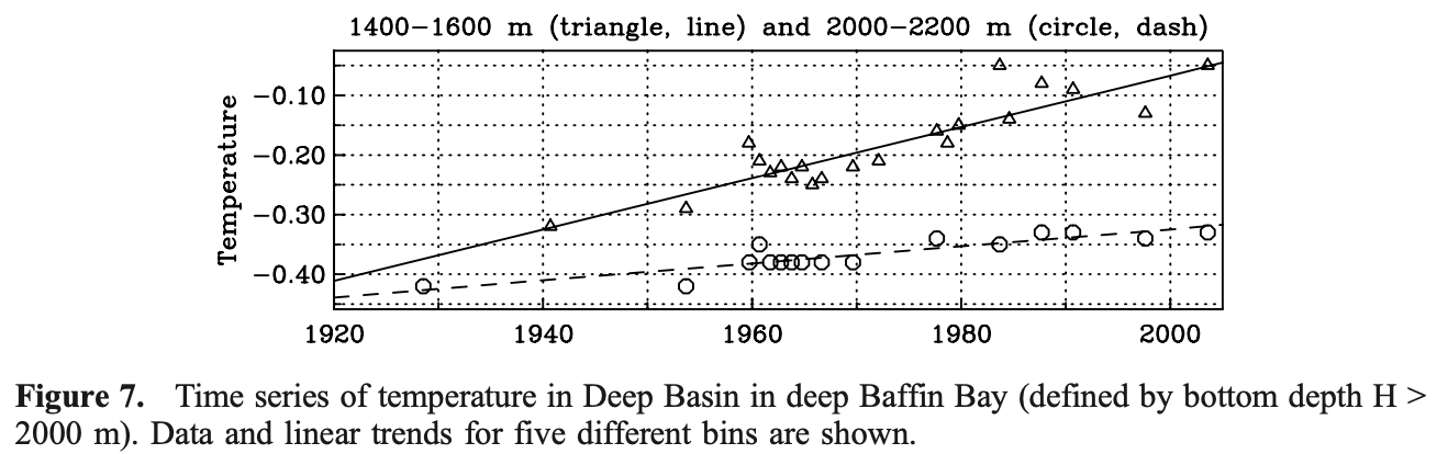
My former student Melissa Zweng published a more thorough and formal study in 2006 using all then available data from Baffin Bay between 1916 and 2003. Her Figure-7 shows the results for those parts of Baffin Bay that are deeper than 2000-m for two different depth ranges. Notice that the year to year variations (up and down) is small, but a steady increase in temperature is apparent from perhaps -0.3 Celsius in 1940 to -0.05 in 2003 for the 1400-1600 m depth range. We also did a very formal error analysis on the straight line we fitted to the data and find that deep temperatures increase by +0.03 C/decade. We are 95% sure, that the error or uncertainty on this warming is +/- 0.015 C/decade. So there is a 1 in 20 chance, that our deep warming trend is below +0.005 C/decade and an equal 1 in 20 chance, that our warming trend exceed +0.045 C/decade. In 19 out of 20 cases the (unknown) true warming value is between 0.005 and 0.045 C/decade.
So, more than 20 years have passed since Melissa’s work. The data I here showed between 2003 and 2021 thus gives us a chance to test our statistical predictions that we made 20 years ago. So, deep temperatures should be between 0.01 and 0.09 degrees Celsius warmer than they were in 2003. I have not done this test yet, but science is fun even if the data are old.
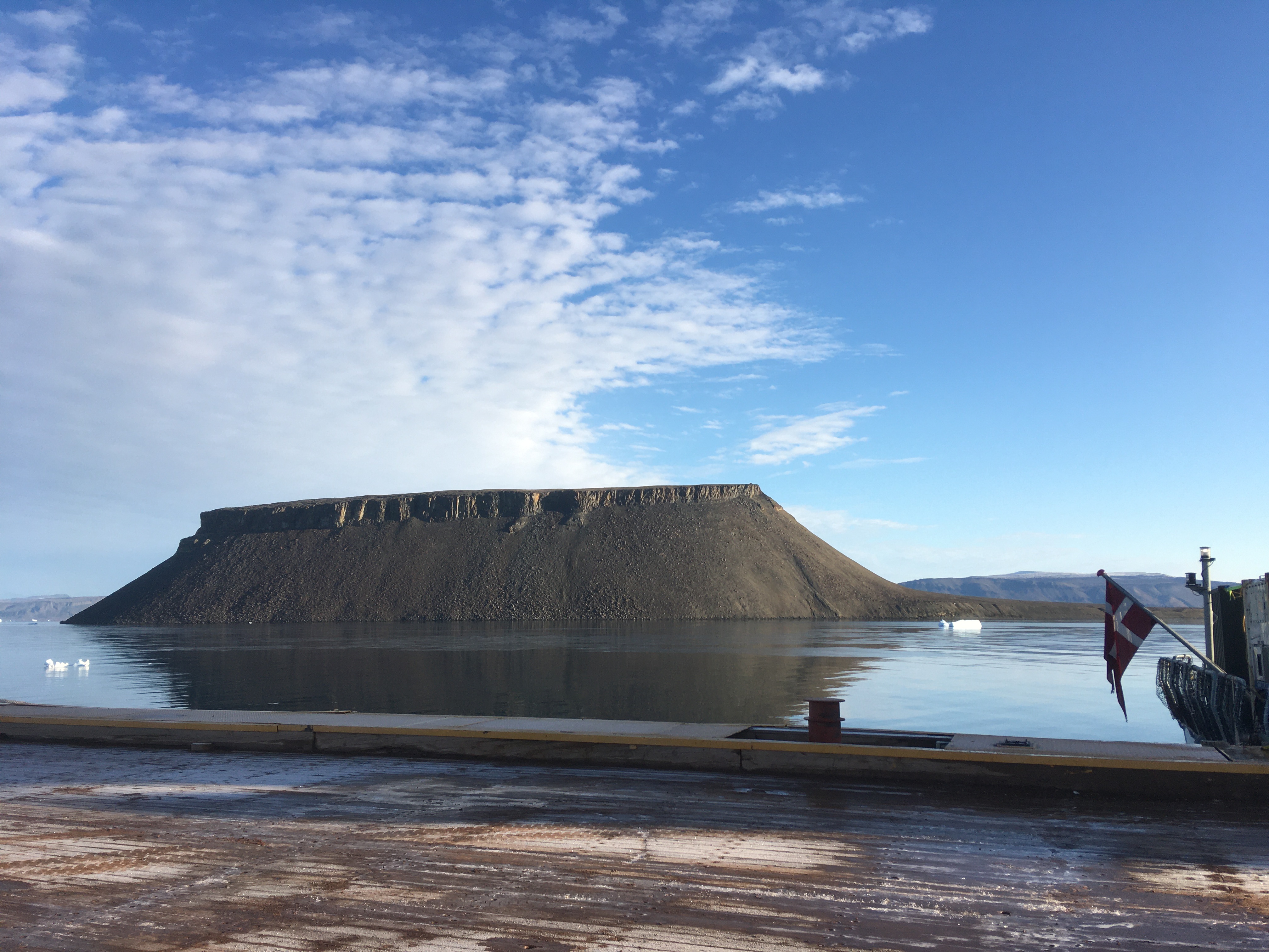
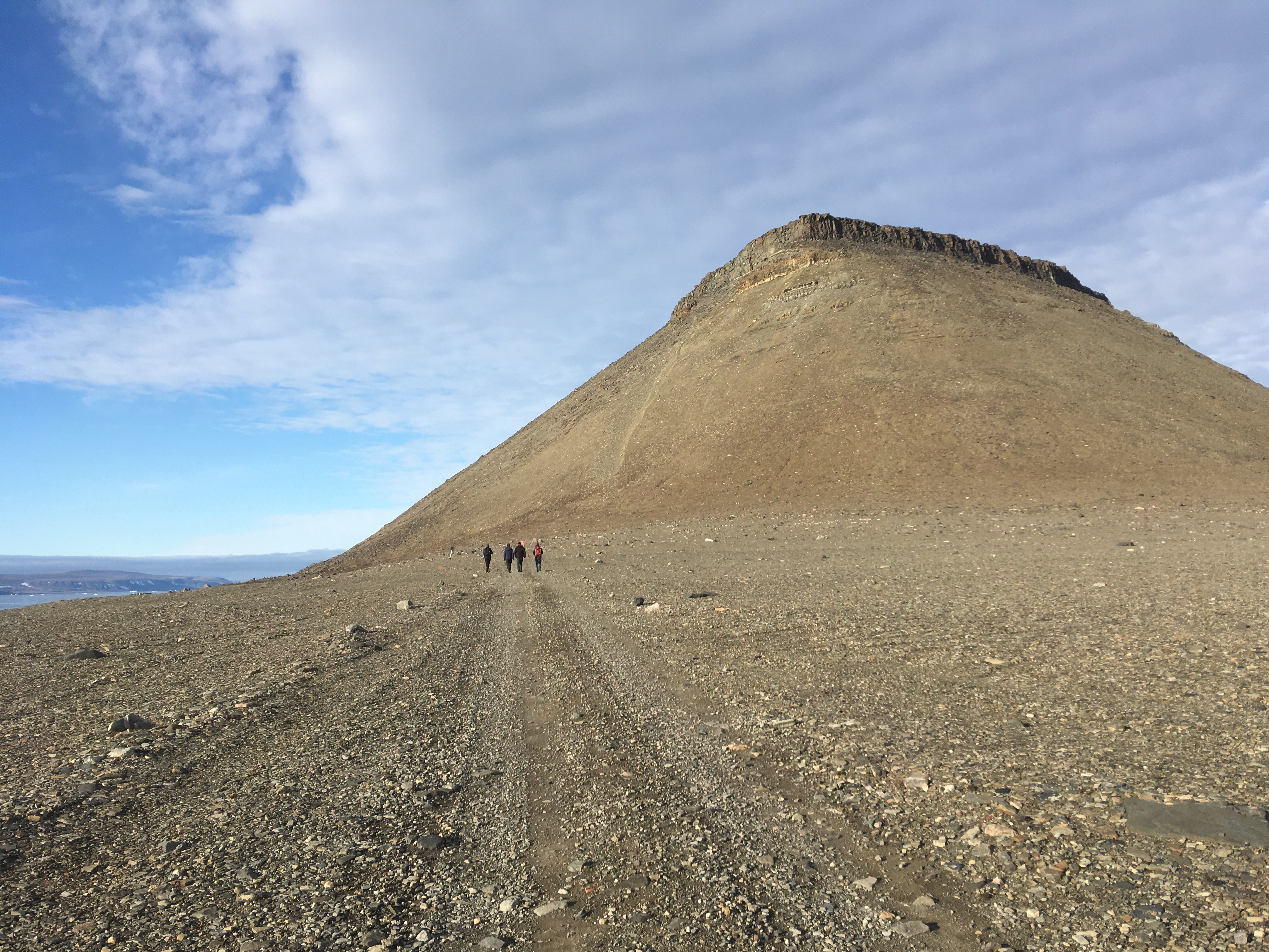
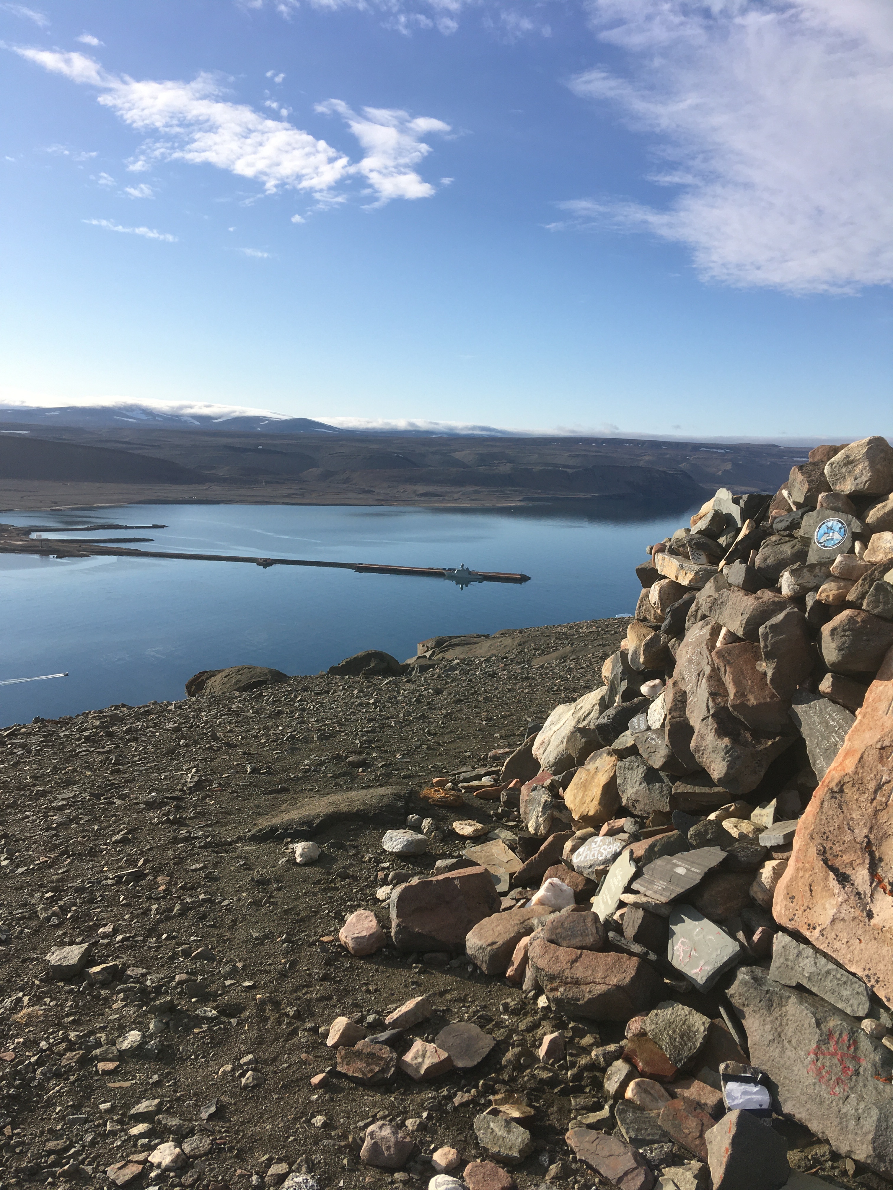
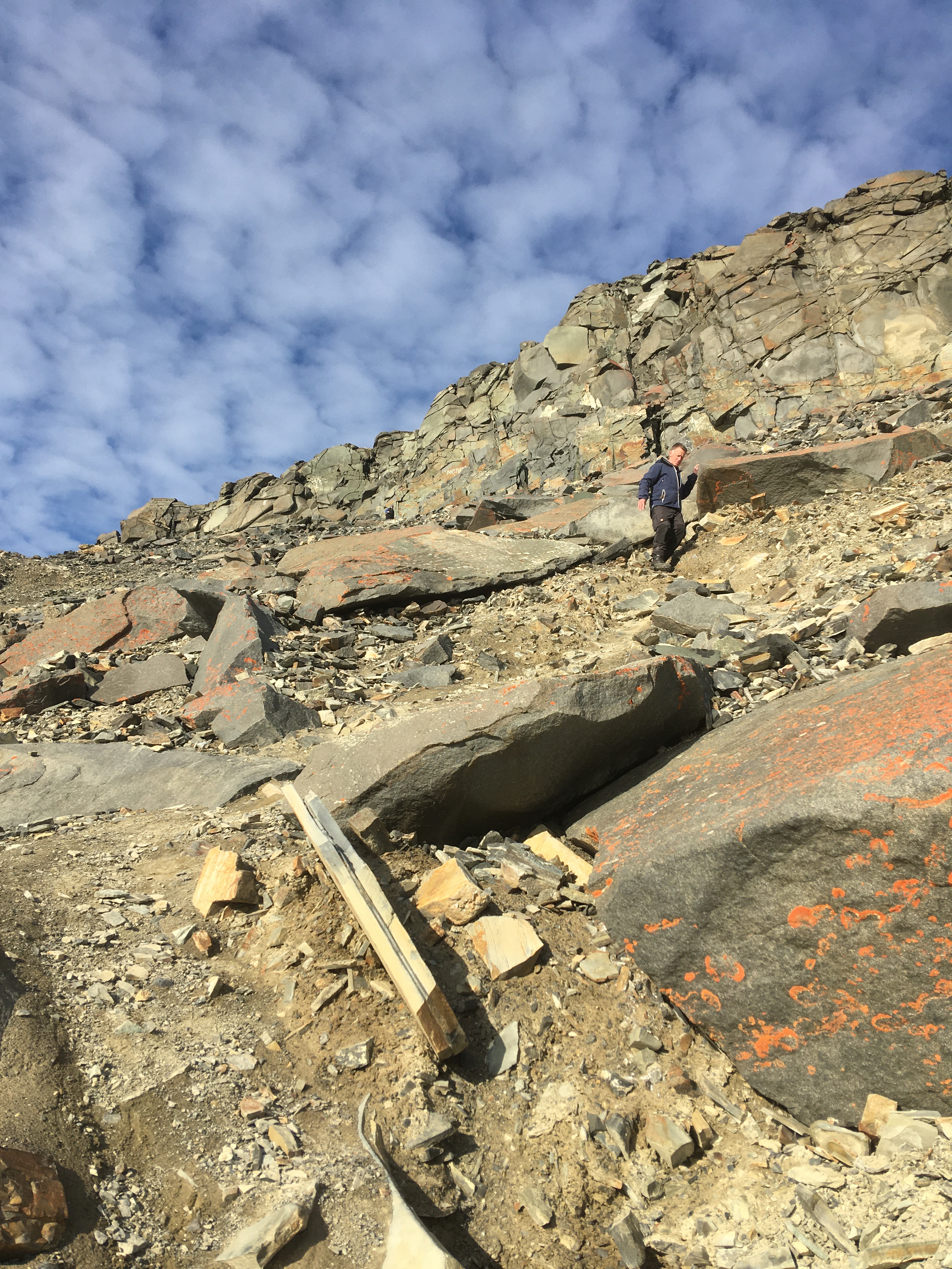
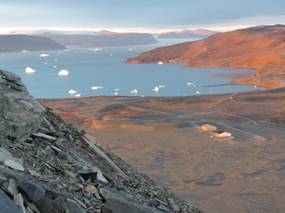
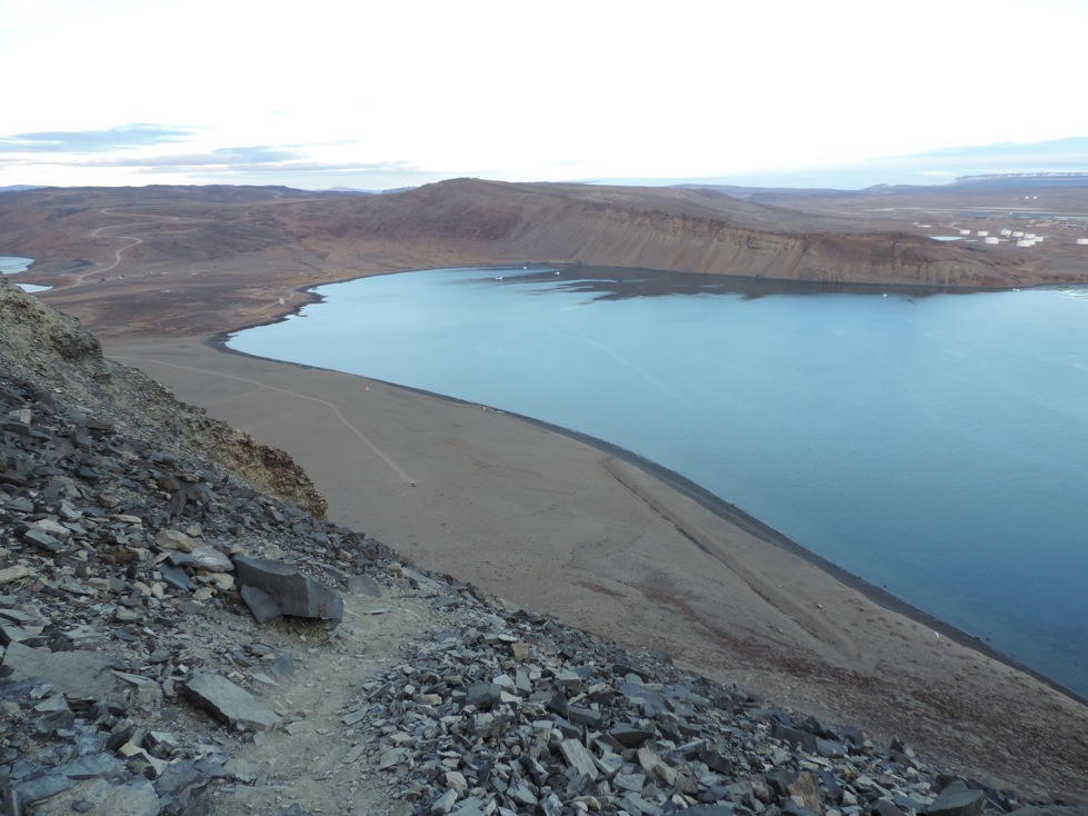
After getting off the ship at Thule Air Base (now called Pituffik Space Base) in 2021, us scientists climbed Dundas Mountain to stretch our legs, take in the varied landscape, and view our ship and home for a week from a distance. Notice how small HDMS Lauge Koch at the pier appears. All photos below were taken by geophysicist Dr. Katrine Juul Andresen of Aarhus University, Denmark:
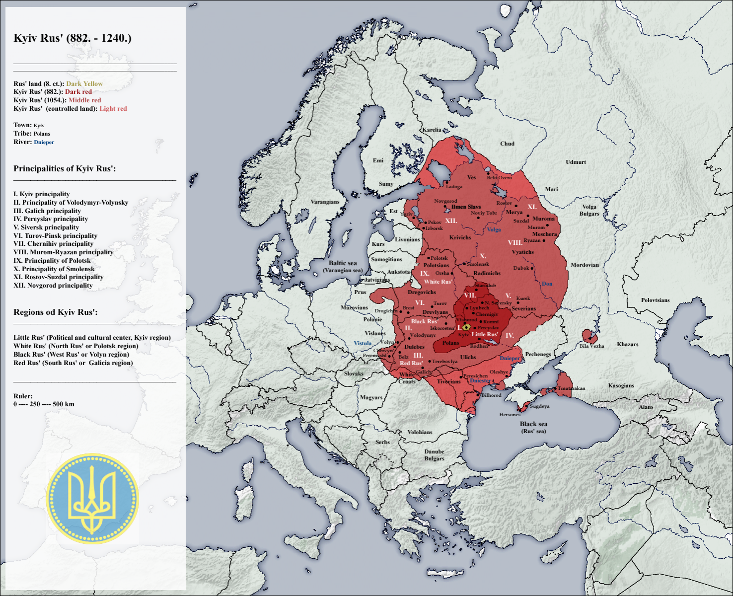
The Russian dictator Vladimir Putin claims Ukraine based on a false reading of “Kyivan Rus” (see map below) about 1100 years ago. With equal ignorance I here claim it for Sweden or Denmark or Lithuania or Poland, because the Kyivan Rus were a mishmash of Slavic, Viking, and nomadic tribes who settled and ruled the forests and steppes between the Baltic and Black Seas between 800 to 1100 AD. Furthermore, while “Rus” is the root for “Russia” (or “Russland” in German), “Rus” derives from the Old Norse “rods” which means “men who row.”
Putting another spin on old histories, I proclaim that Russia is, historically, a fringe principality that belongs to Ukraine. So, lets call Putin’s claim to Ukraine what it is: A colonial, imperialistic land grab along the same lines of an Adolf Hitler and a Joseph Stalin who divided Eastern Europe in 1939 with no regard to the people they both oppressed and slaughtered. Visiting Lviv in the summer of 2024, I find the bloody histories of these “Bloodlands” (Snyder, 2010) everywhere:
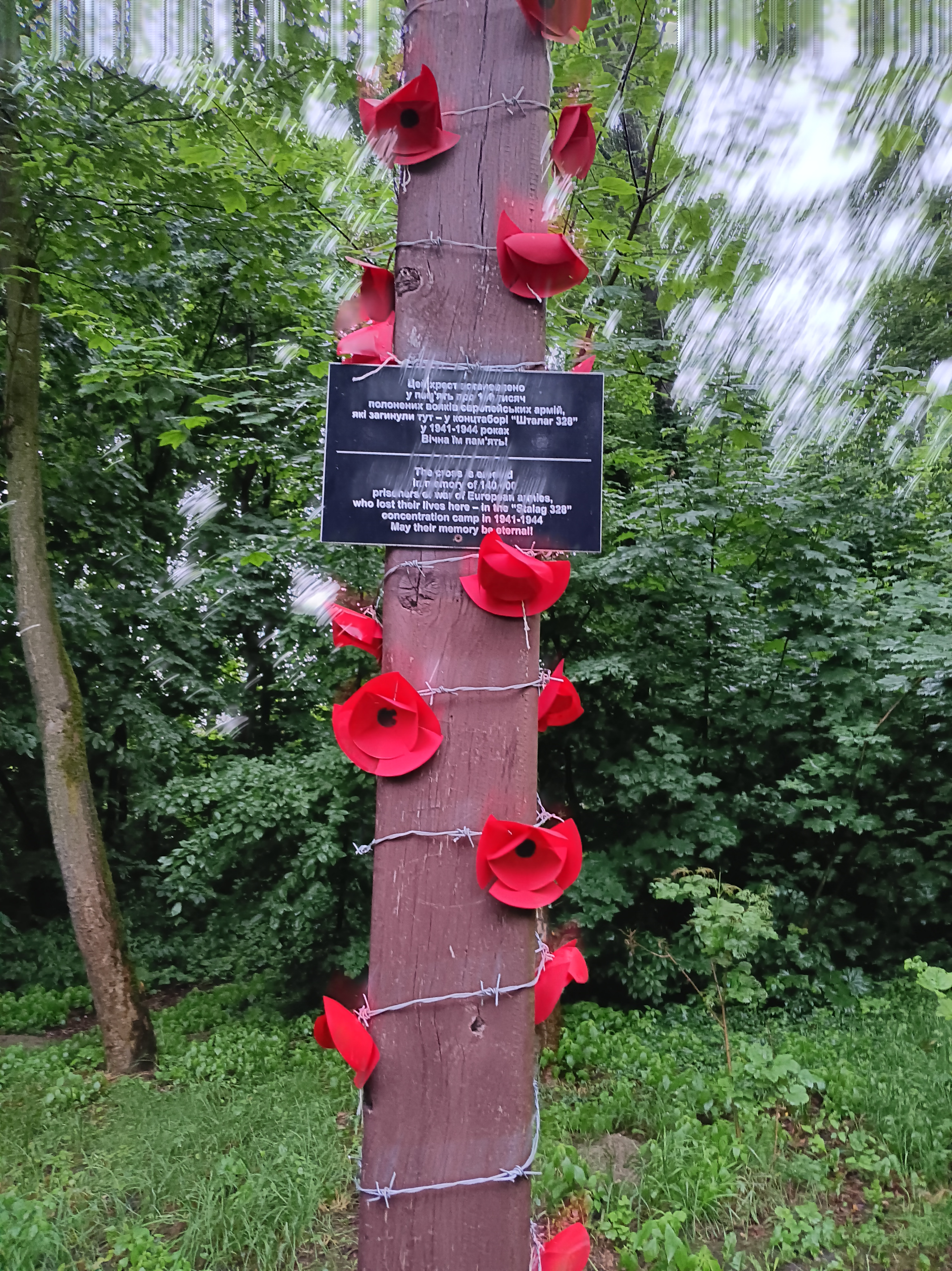
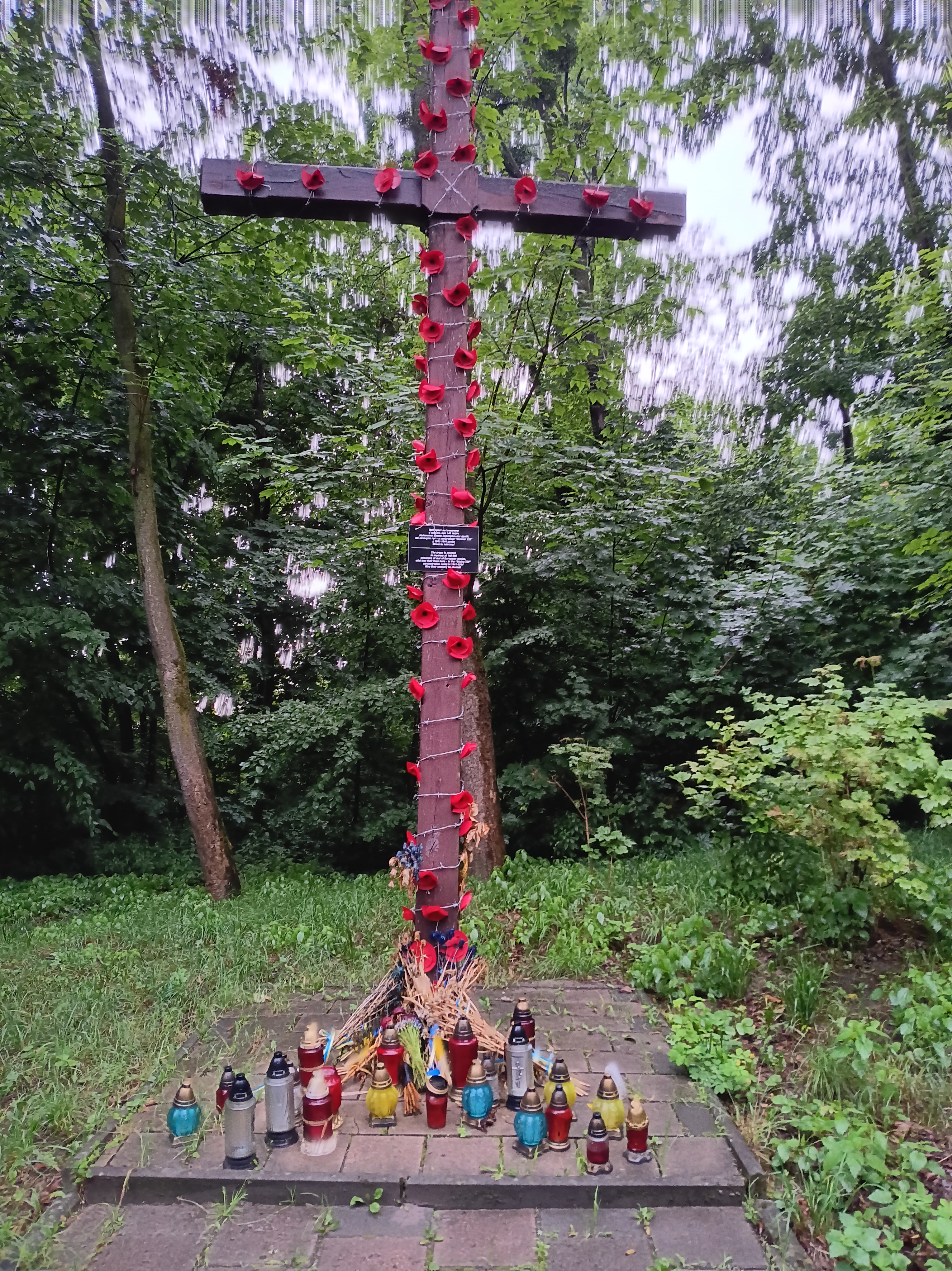
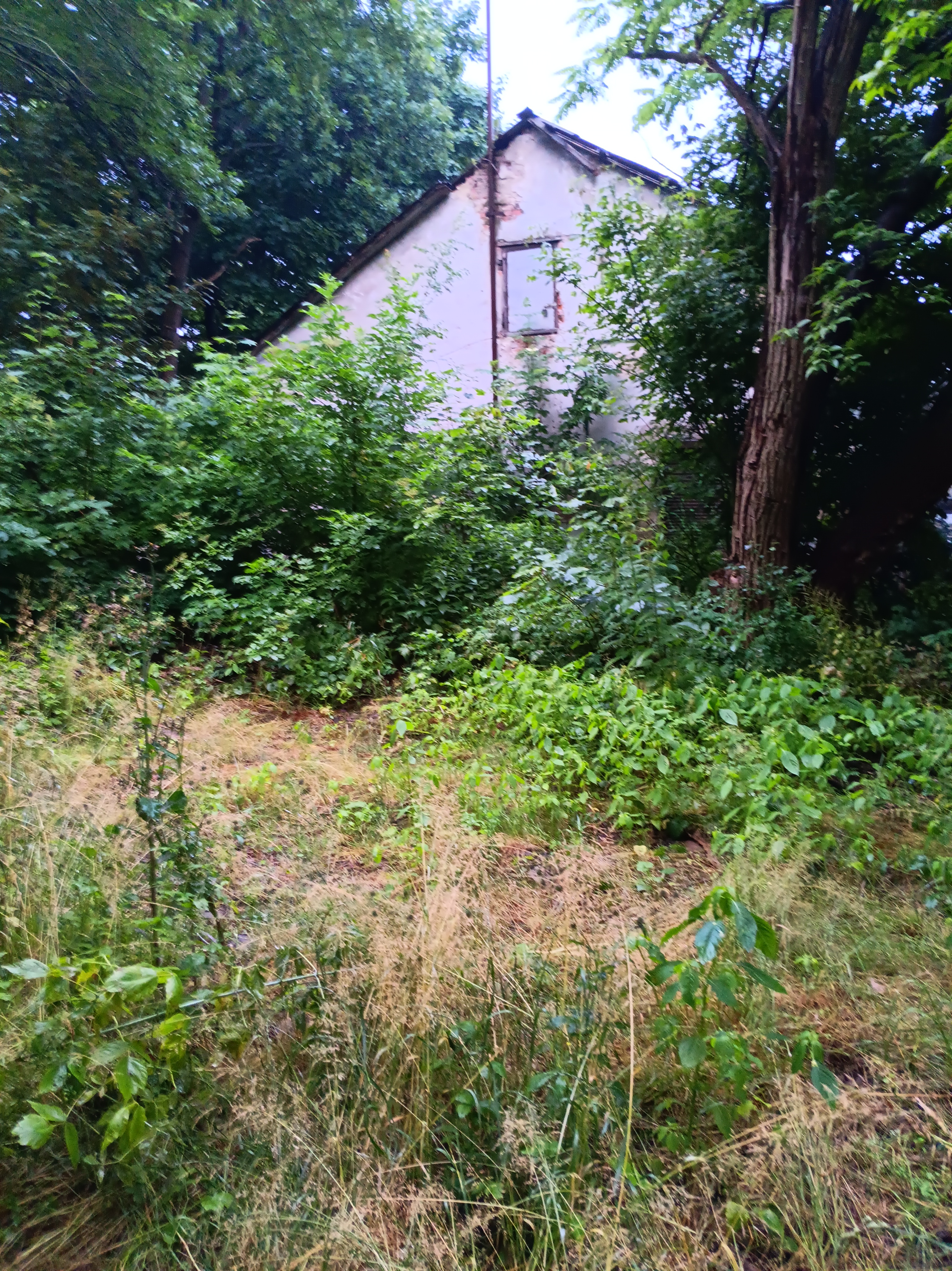
On my evening stroll on my first day in Lviv I stumble across an overgrown and unkept green space at the end of a small and winding residential street up a hill. Along my accidental path I find a 10 feet high wooden cross near semi-collapsed and overgrown one-story buildings that resemble barracks. Red poppies and barbed wire enclose the cross while burnt candles litter its base. An inscription in both Ukrainian and English tells me, that I am standing within Stalag-328 where 140,000 prisonors of war (POW) were murdered 1941-44. Nazi-Germany maintained this POW camp where the death rate among its Soviet, Belgian, French, and Italian soldiers exceeded 50%.
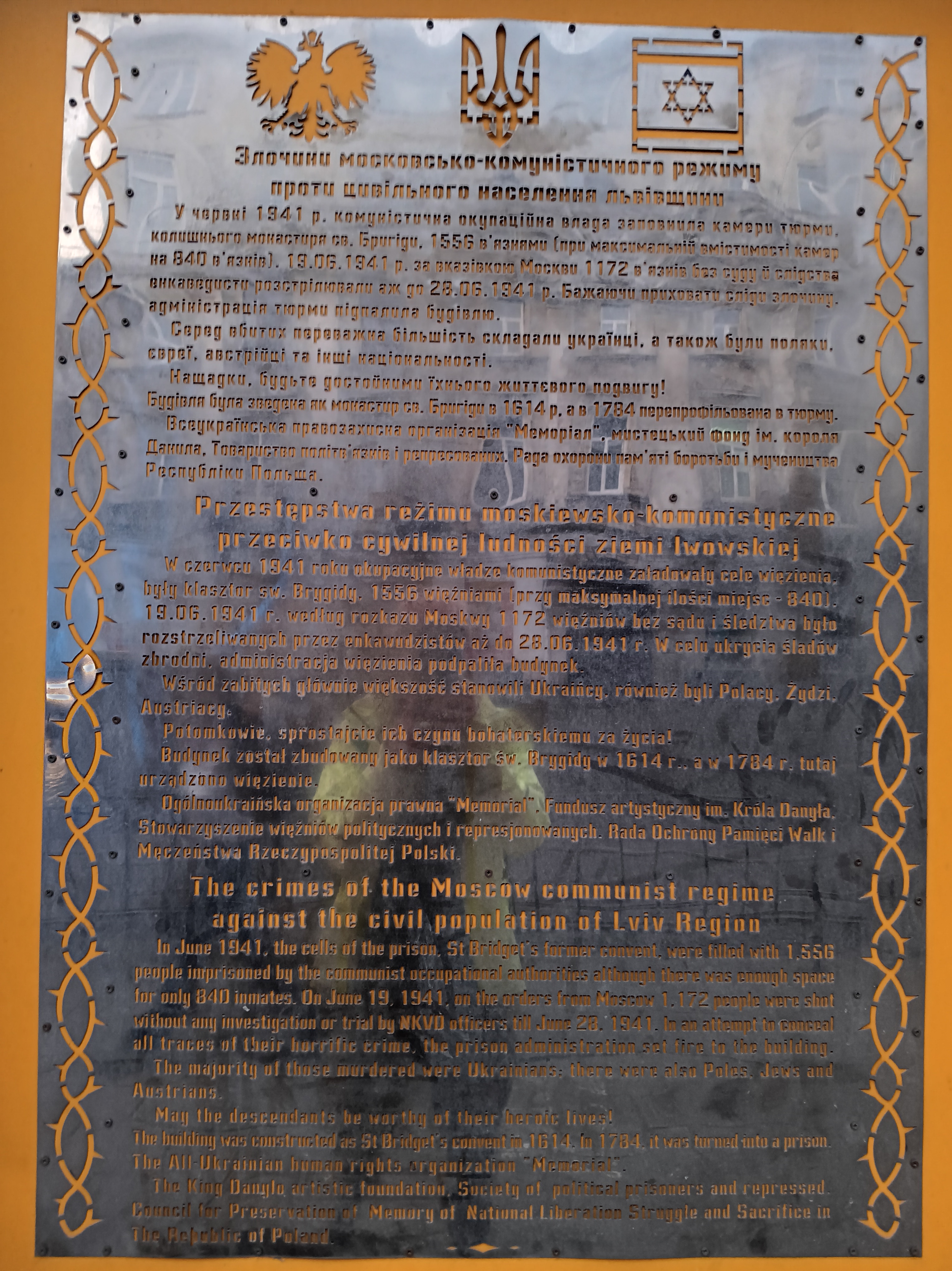
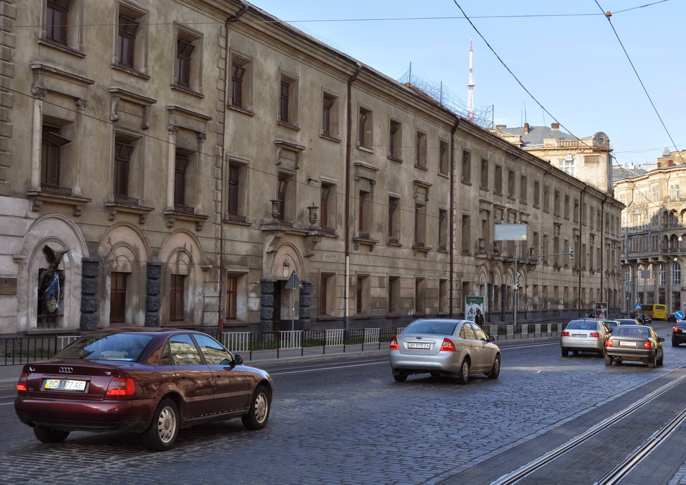
Half an hour later I find a huge 3-story building along a busy road that covers an entire city block. Later I find out, that this is the St. Bridget’s Convent for Women built in the 17th century, but it serves as a prison for the last 250 years which perhaps explains its decrepit look on Horodotska Street. On one of its walls I find a plaque in Ukrainian, Polish, and English stating that the Stalin’s Secret Police, the NKVD, shot 1,172 citizens of Lviv in this building on 19th of June 1941. This massacre at the Brygidki prison was part of a mass killing throughout Soviet occupied Poland and Ukraine.
For context, the Hitler-Stalin treaty of 1939 divided Poland such that Lviv was occupied by Stalin’s troops from 1939-41. About 1.25 Mil. “Enemies of the People” of Polish and Ukrainian descent where deported in 2 years. This occupation ended when Nazi-Germany invaded the Soviet Union and captured Lviv on 30th of June 1941. Throughout Lviv, Poland, and Ukraine the NKVD committed massacres of local populations. In Lviv alone about 7,000 Ukrainian, Polish, and Jewish citizen were shot or blow up in their prison cells days before Hitler’s troops entered the city to start another massive killing cycle.
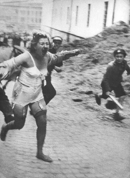
Immediately after German troops occupied Lviv progroms of the Jewish population started. Encouraged and supported by German authorities members of the Organization of Ukrainian Nationalists (OUN) belonging to militias of Stepan Bandera participated in the progroms June 30 to July 2 and July 25 to July-30 (Himka, 2011). More than 6,000 Jews were murdered this first month of German occupation of Lviv. Inciting the local population to round-up, humiliate, and kill Jewish men, women, and children, German propaganda justified the progroms with the NKVD massacres by falsely blaming the Jewish population for it. While OUN leadership never directly endorsed participation in the progroms, they also did nothing to stop their members who participated enthusiastically. Their hatred of Poles and Jews, however, was part of an ideological program modeled on the German and Italian totalitarian regimes headed by Adolf Hitler and Benito Mussolini.
The photo above was taken the first day of the Lviv Progrom July-1, 1941 by an unknown photographer who stands on Vesela Street a block north-east of the Opera House. I walked those streets admiring street art and murals not knowing what had happened on these streets 83 years before: A grown woman has her dress ripped off, has her face bloodied, and is chased with wodden sticks by a mob of teenagers. She has only shoes and undergarments left to protect her, as she runs up a hill in terror while a large crowd of spectators in the background care not. Himka (2011) reproduces this photo and places it into a larger context.
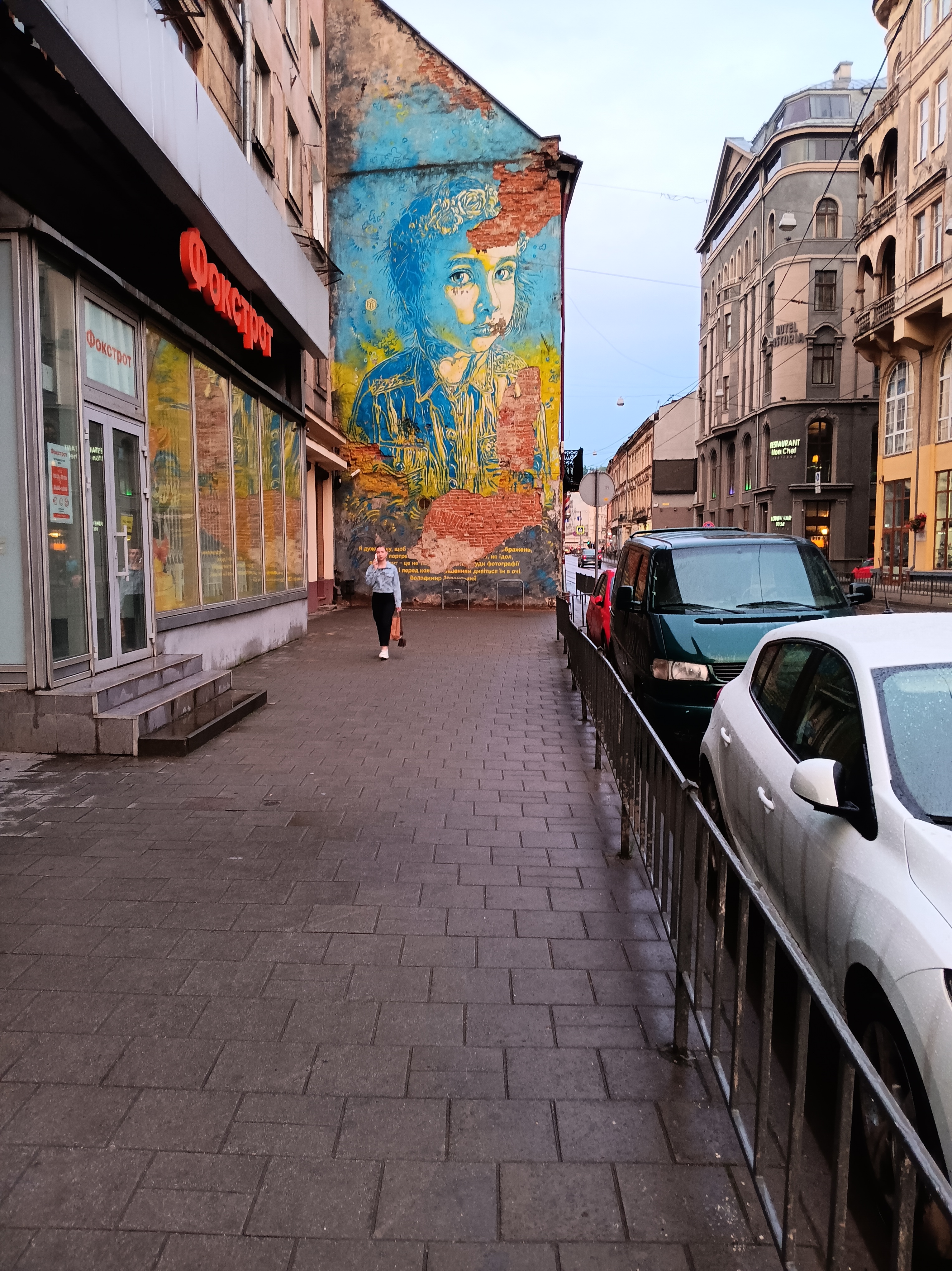
On my way home from Brygidki Prison I pass a beautiful mural that brings me back into the present. The blue and yellow of the mural reminds me of the colors of the Ukrainian flag. The braided flowers on the head perhaps symbolize this person as a women from Ukrainian. In my present sad mind, I see the the same human in both the symbol of a Ukrainian woman in this mural and the actual Ukrainian women in the 1941 photo. The paint peeling reveals red brick and an arch, but I also see an accidental thumbs-up sign in red. The mural is about two blocks west of the Opera House and thus near the center where the Lviv progroms took place.
The bottom photo shows the Opera House from the north. There probably is a story in the small peaceful statue and the building directly behind it, but I do not (yet) know it.
Later that day my first Air Raid Alarm woke me up at night. In this war Vladimir Putin wants to re-establish the old Soviet Empire with the boundaries that Hitler and Stalin had agreed upon in 1939. The past is in the present and both are insane.
P.S.: Edited Oct.-20, 2024 by rewriting the last paragraph and removing some ill-fitting photos.
References:
Himka, J.-P., 2011: The Lviv Pogrom of 1941: The Germans, Ukrainian Nationalists, and the Carnival Crowd. Canadian Slavonic Papers, Vol. 53, No. 2/4, 209-243.
Plokhy, S., 2021: The Gates of Europe, a History of Ukraine, Basic Books, New York, NY.
Snyder, T., 2010: Bloodlands, Europe between Hitler and Stalin, Basic Books, New York, NY.
Lviv lies about 40 miles east of the Polish border in Ukraine. It is closer to peaceful Hamburg in Germany (1200 km) than it is to destroyed Mariupol in Ukraine (1250 km). Leaving Hamburg by train, I arrived 20 hours later in Lviv where I spent the next 7 days. As a scientist I planned to collect my own data to calibrate media reportings. I wanted to test second-hand opinions to perhaps revise them based on first-hand observations to better anticipate the future and my actions within it. How can I best support Ukraine in its current war with Russia?
The U.S. Department of State advises “Ukraine – Level 4: Do not travel” in dark red letters, because it is a country at war. I ignored this advice, but nevertheless registered details of my travel plans with the Smart Traveler Enrollment Program. I also followed my government’s advice on how to prepare for travel to high-risk areas such as making a notarized will and to communicate daily with my wife. I do the same when backpacking for 30 days in Yosemite, Adam Ansel, and John Muir Wilderness areas in California. Looking back, I believe that visiting Lviv is less dangerous than visiting Fordyce, Arkansas (population 3,400). Death by random shooting in this town is about 1 person killed for every 1000 residents as of yesterday. In Lviv death by random Russian missile is about 1 person killed for every 100,000 residents. The last Russian missile hit Lviv (population 700,000) a year ago and killed 7 people. Air defences, too, have improved the last 12 month thanks to Norwegian, U.S., and German systems.
My voyage to eastern and across central Europe brought me into spaces that were violently contested during the last 1000 years. Recall that the current border between Poland and Ukraine was drawn in 1939 when Adolf Hitler of Germany and Joseph Stalin of the Soviet Union divided Poland (as well as Finland, Estonia, Latvia, and Lithuania) a mere 10 days before World War Two. The Yale historian Timothy Snyder calls these lands “Bloodlands” where the totalitarian regimes of Germany and the Soviet Union killed between 10 and 20 Million women, children, and men from 1933 to 1945. My father was born 1934 and my family celebrated his 90th birthday the weekend before I left for Lviv.
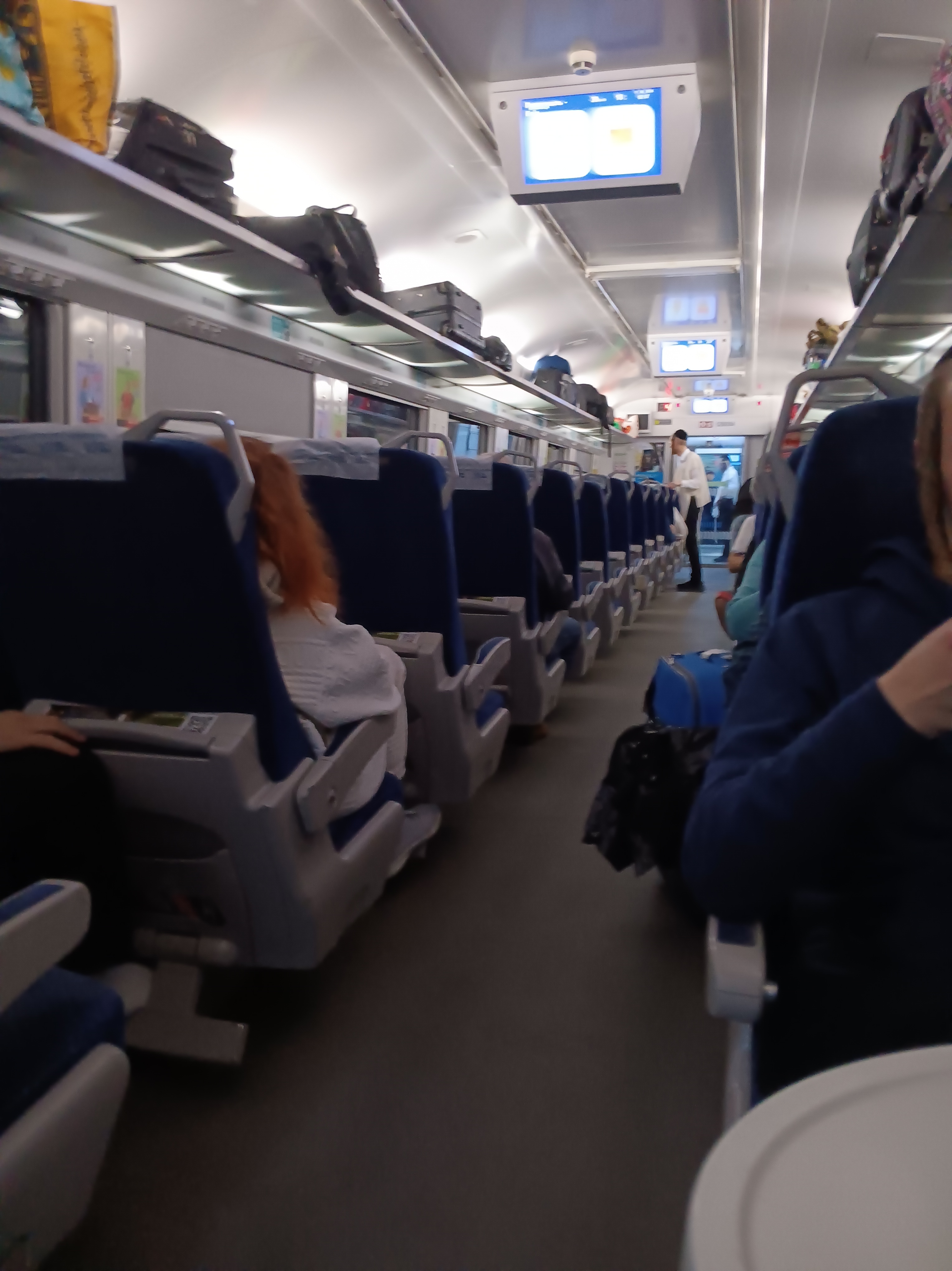
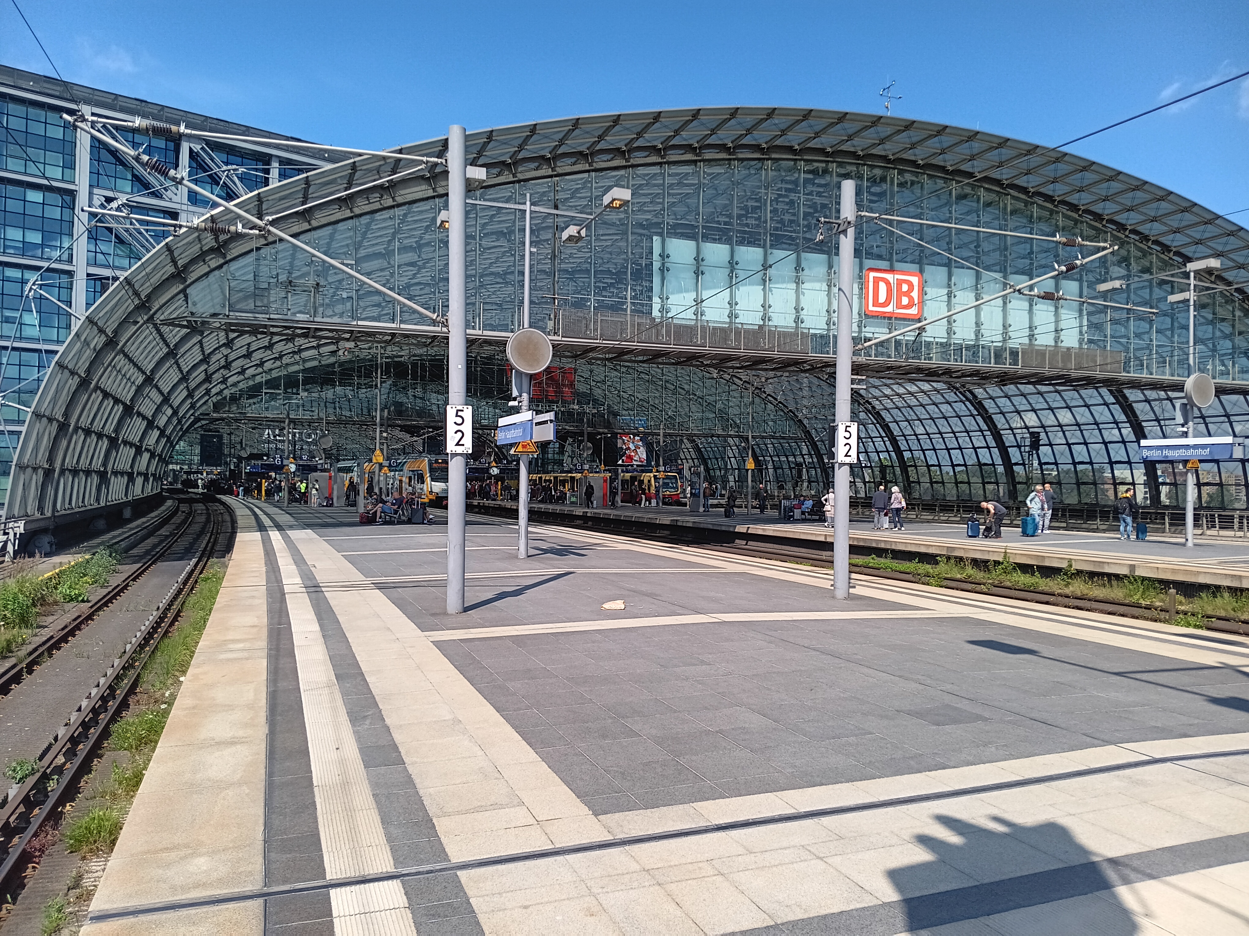
My voyage started at my parents home in Neustadt on the western edge of the Baltic Sea at 6 am. A first train got me to the old Hanseatic town of Luebeck, a second train to Hamburg, and a third train to Berlin. Here I bought the missing train ticket #5 from Przemysl in Poland to Lviv in Ukraine before boarding train #4 from Berlin to Przemysl. My reserved seat for the next 10 hours placed me opposite to a young Ukrainian artist traveling home to Kyiv. Along the way she introduced me to Lviv where she had lived in a prior life. Her pointers of Lviv places to visit, eat, and walk provided me with major initial reference points. As she had crossed the border into Ukraine many times before, we went for a evening stroll in Przemysl and found a busy beer-garden where we had a beer and gin tonic. Despite this “delay,” we still had to wait for 3 hours to be allowed on the next train that was 2 hours late. A large group of perhaps 20 Orthodox Jewish men with U.S. passports were waiting as well. I asked one of them what language they were speaking and he replied “Jiddish.” Bente Kahan’s music from her album “Farewell Cracow” was on my mind even more now than it was prior to this voyage. Once this last train left Poland just before midnight, the mood became somber.
Ukrainian border guards checked passports on the train while different heavily armed military personel counted the number of passengers at least 3 times independently of each other. It was pitch dark outside without any lights visible anywhere. The train, too, had lights dimmed. After a very short 45 minutes the train to Kyiv made its first stop in Lviv and I got off.
It was about 3:30 am local time and I had no idea how to get the 2 miles from the train station to my bed. During the general curfew from midnight to 5 am all public transportation stops. Nobody at Lviv’s station spoke English and I could not read the cyrillic signs. So I stumbled along dead tired hoping, first, that my GPS would lead the way and, second, police enforcing the curfew may be sympathetic towards a tired and lost American tourist.
Sun light came out when I arrived in my small appartment at 4 am. The Wifi worked flawlessly and I called my wife via WhatsApp. It was only 9 pm in Delaware and we talked for an hour on what had happened this long day. Then I let my Ukrainian AirBnB host, Olya, know that I had arrived:
Olya: Everything went well. A person found me at the train station. He did not speak English, but I had pen and paper prepared as well as lat/lon of your place on my GPS that I use for hiking in the woods. He followed my direction and got me within 200 m. The rest was easy including the hour-long WhatsApp phone call with my wife from inside your appartment using your Wifi. It “only” took me 22 hours total door-to-door, so I will now head for some sleep … which is hard, because it is light outside, curfew is over, and I already saw so many cool stuff in the dark that I want to head outside to explore more, but my wife told me to sleep a few hours and wise man is one who listens to his wife … or so i am told by wiser men than myself. ~Andreas
I was writing the above lines with this view of the bed, desk, fridge (red), and the door to the bathroom, shower, washing machine and dryer. The entrance is the door on the right. This was my home away from home for the next 7 days where I rested after long walks to explore Lviv, its culture, history, public life, and people. The internet speeds in Lviv were faster than those in either Germany or at home in Delaware.
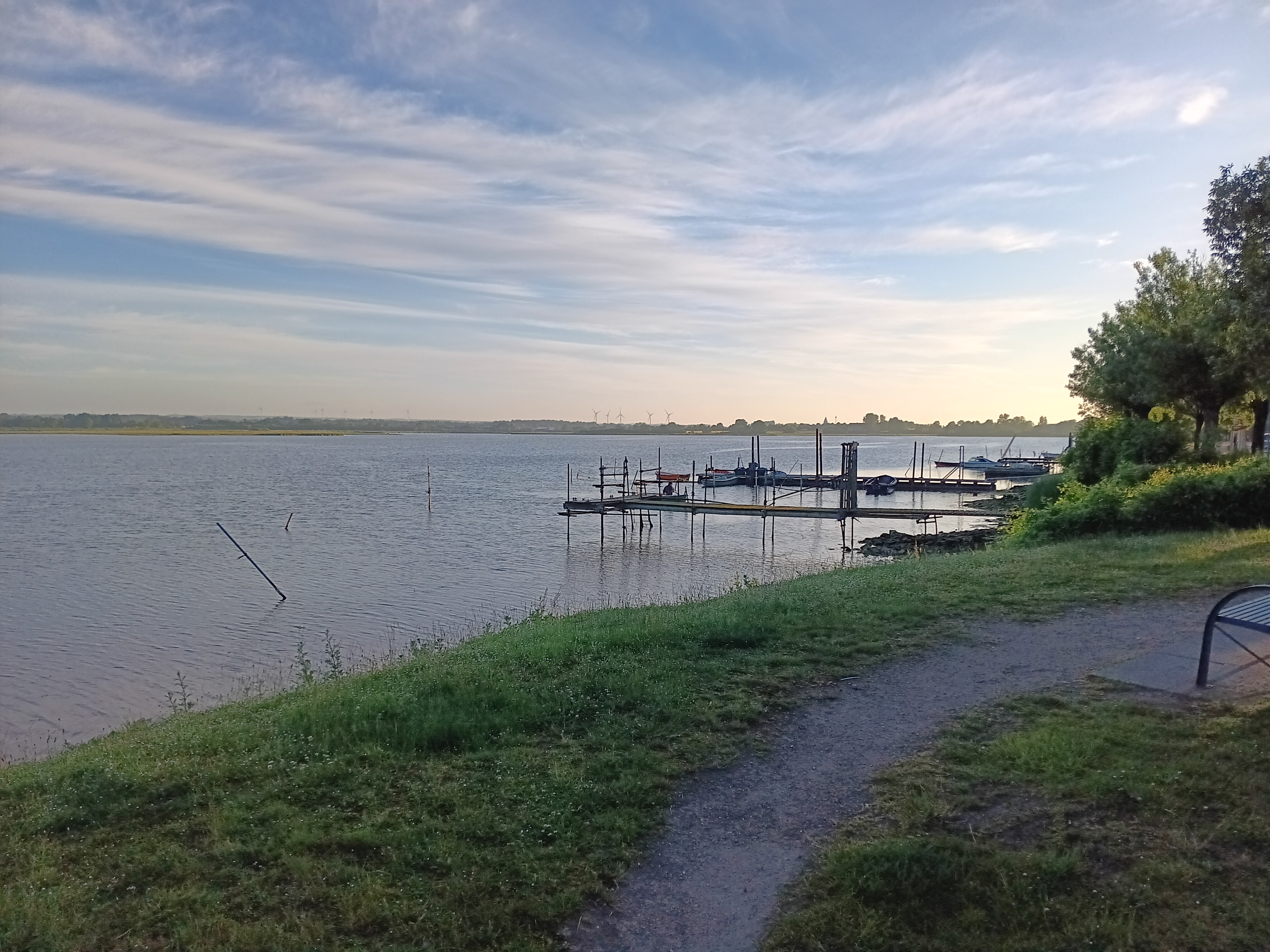
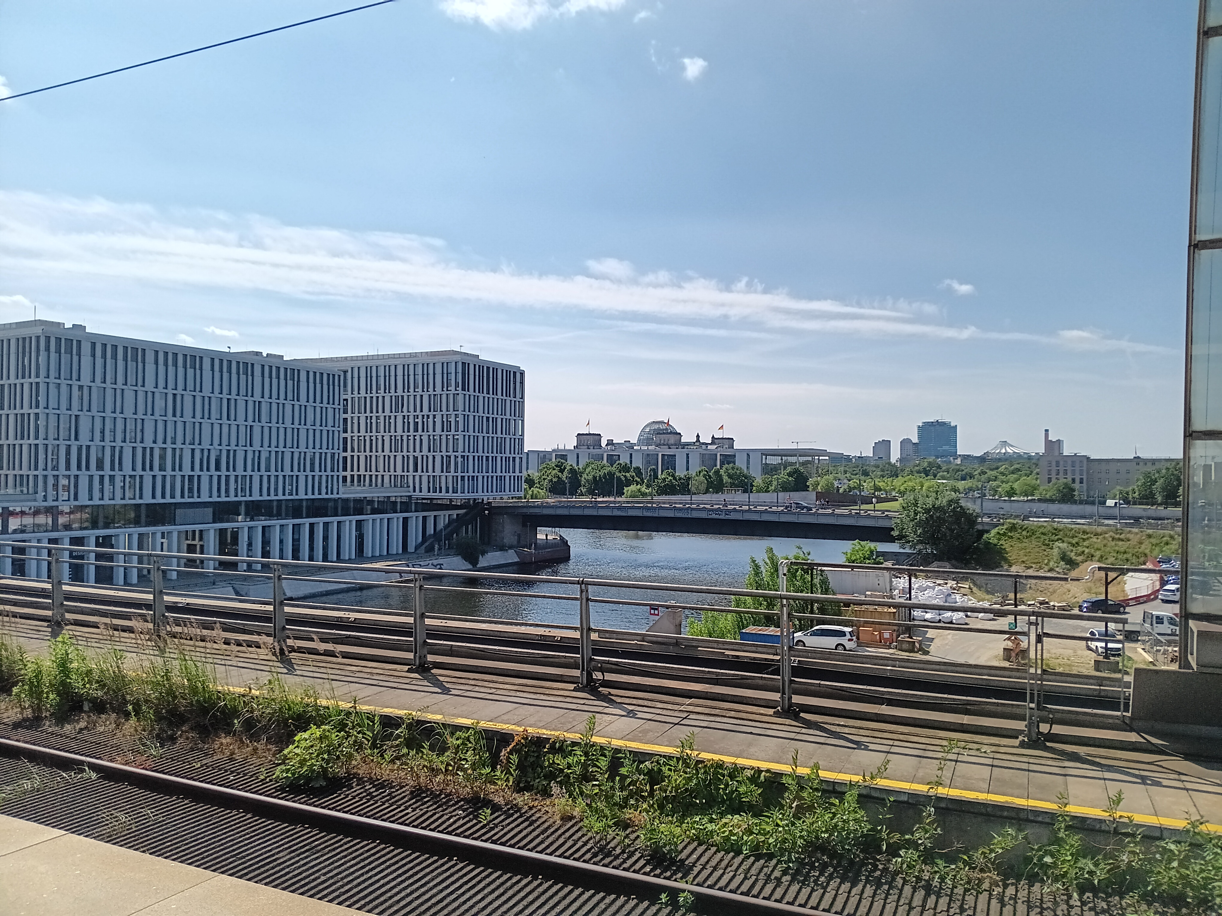
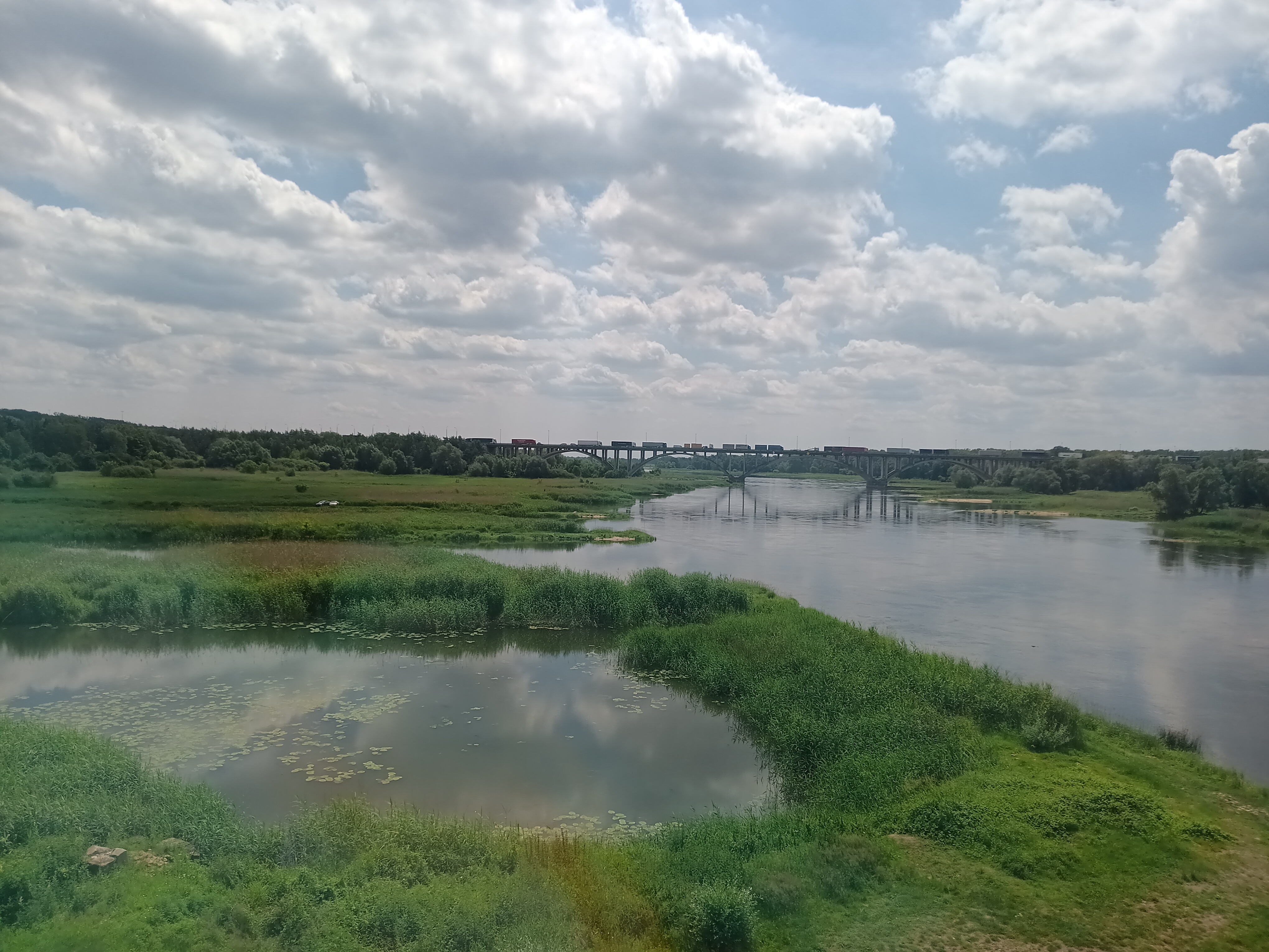
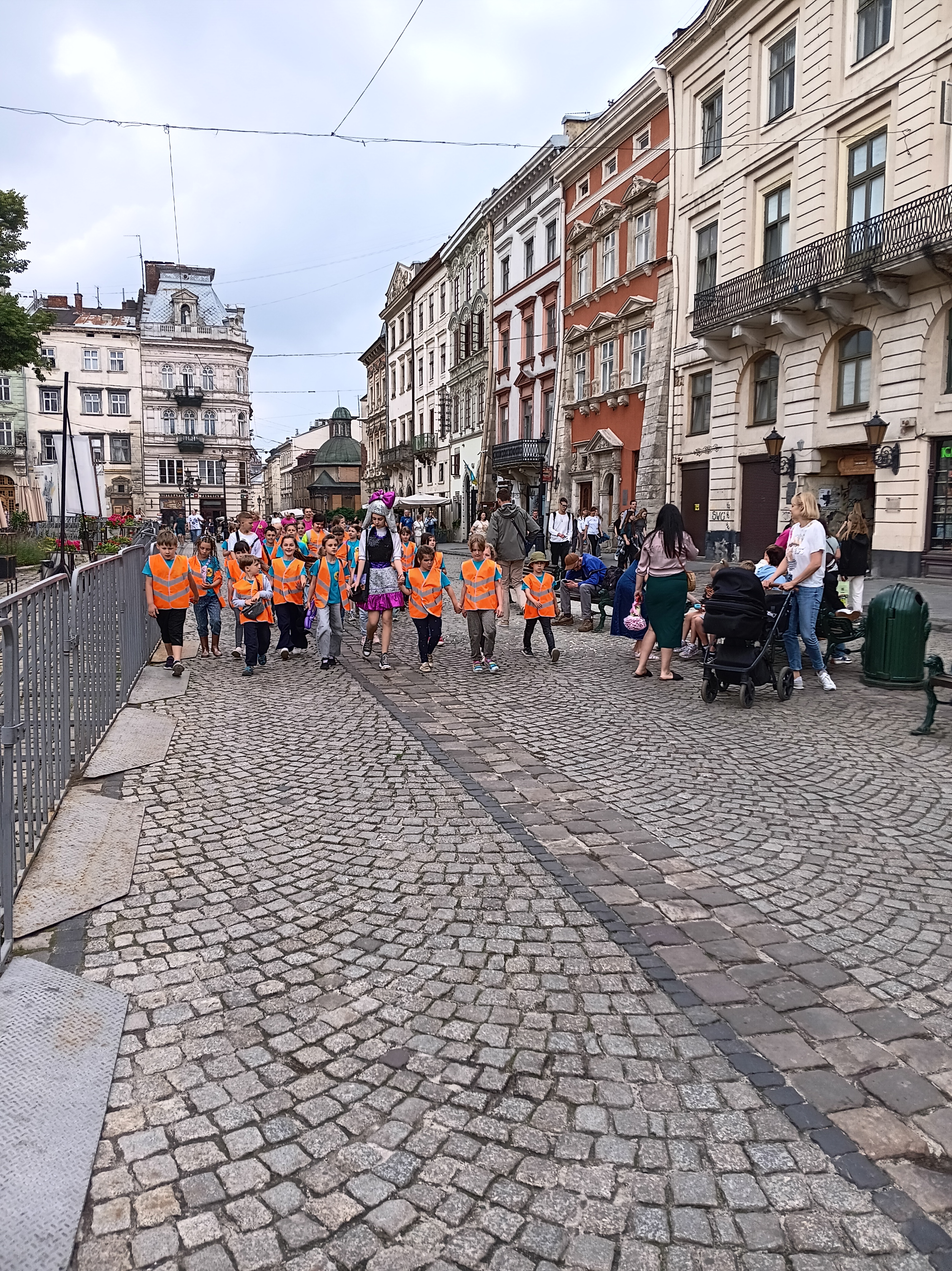
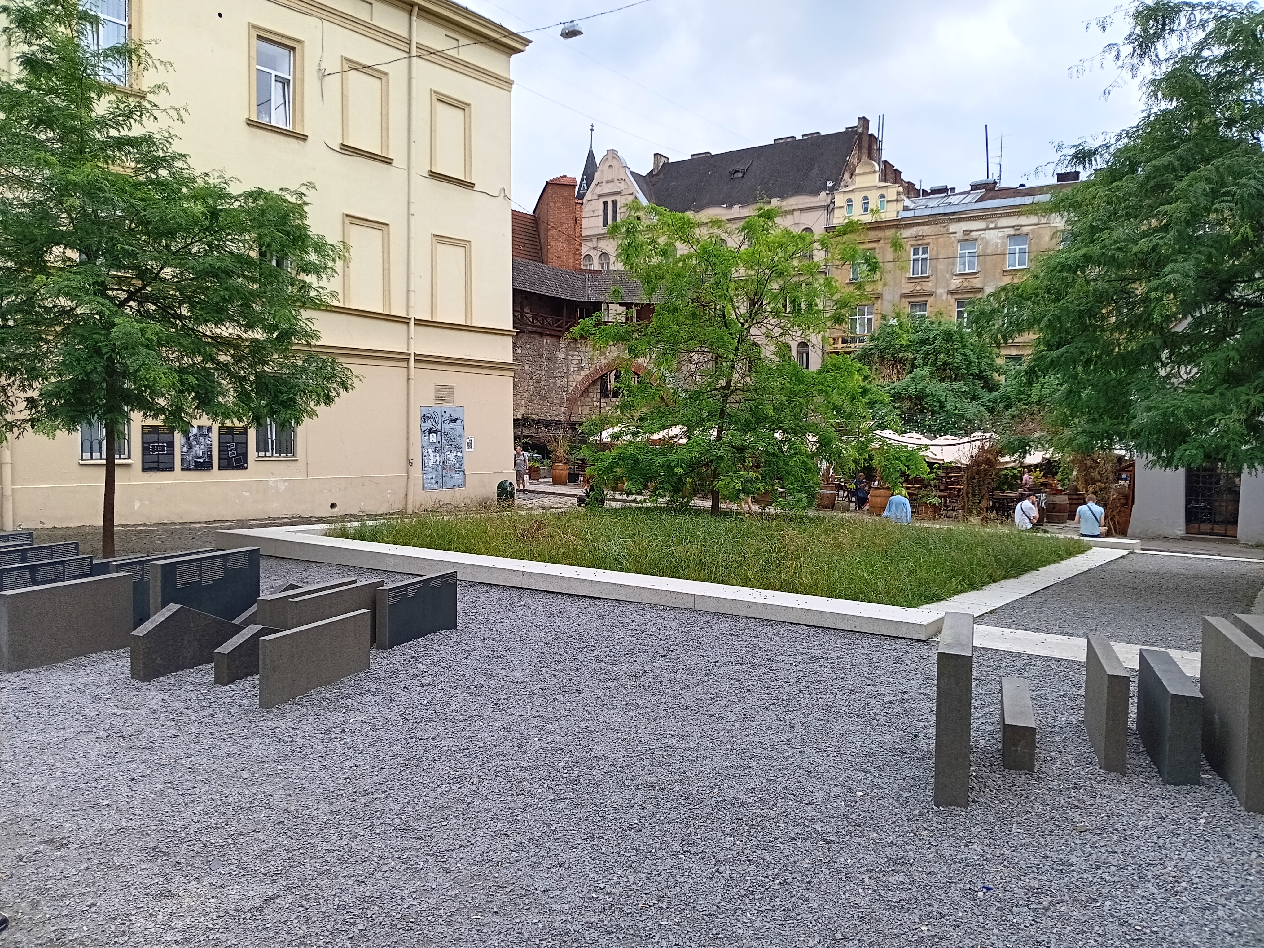
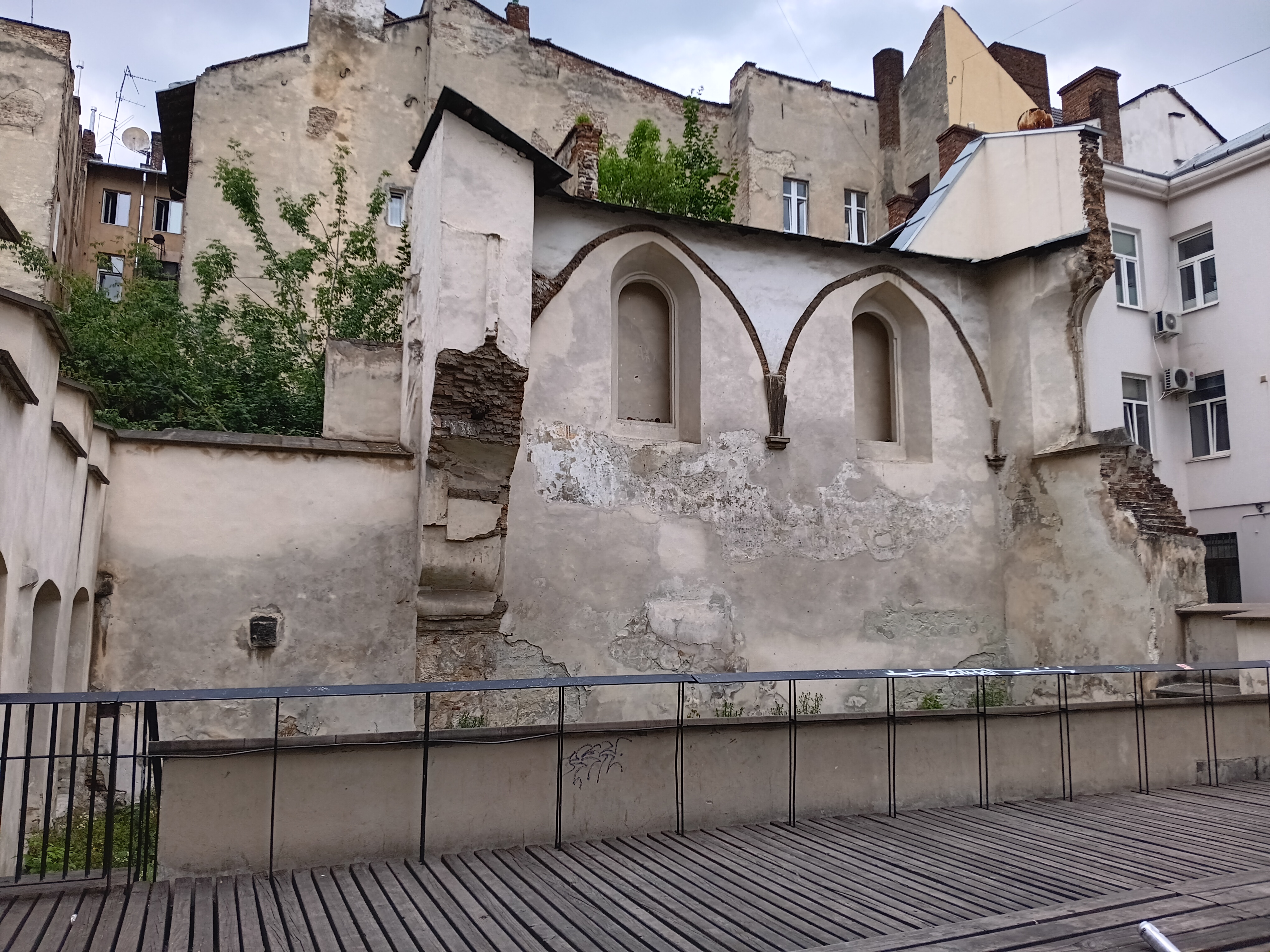
As a teaser for my next post I show the first three photos that I took the next morning after 4 hours of sleep within 5 minutes walking from my bed in Lviv.
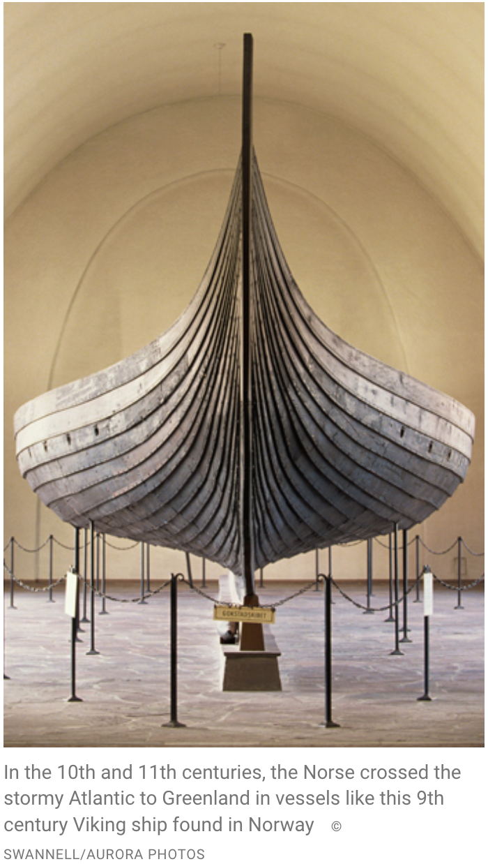
While Viking rulers of Kyiv in Ukraine formally converted to Christianity in 988 CE at the outer limits of eastern Europe, two small viking settlements emerged at the southern tip of Greenland close to the Americas. The Norse settlers of Greenland left Iceland with 25 ships, but 11 of these either turned back to Iceland or were lost at sea. The remaining 14 boats arrived near 61 N latitude to establish an “Eastern” settlement which over time grew to more than 190 farms and 12 churches. Farther north near 64 N latitude a smaller “Western” settlement eventually grew to about 90 farms and four churches near Nuuk, today’s capital of Greenland. The “Western” settlement had a warmer and milder continental climate, because their farms were located far inland within a wide and complex fjord system that sheltered the farmers from atrocious coastal storms. The “Eastern” settlement was hit harder by these storms, because here the farms were closer to shore, closer to the icesheet, and closer to the center of the North-Atlantic storm activity.
North-Atlantic location map with Norse trading routes between Europe and Greenland adapted from Jackson et al. (2018)
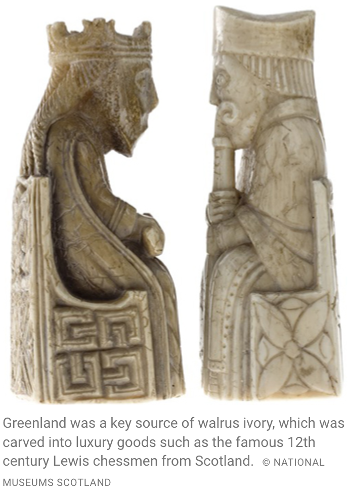
For about 200-300 years the settlements flourished and reached a population of about 4,000 people. They paid taxes to the King of Norway, donated tithes to their churches, and imported clothing, iron, and food stuff from Scandinavia. They paid with ivory from narwhales and walrus that they hunted in Disko Bay at 69 N latitude. Three viking hunters scratched their names in stone on a cairn they built about 1333 CE on an island near Upernavik at 73 N latitude (Francis, 2011). At these “Northern Hunting Grounds” the vikings from both “Eastern” and “Western” settlements likely met the Inuit of the Thule culture who at the time were moving south along West Greenland after a 3000 km migration from coastal Alaska within a few generations.
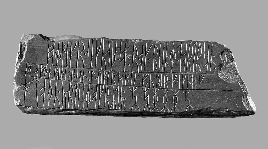
Runestone of Kingittorsuaq found at 72°57′55″N 56°12′45″W stating “Erlingur the son of Sigvat and Bjarni Þorðar’s son and Eindriði Oddr’s son, the washingday (Saturday) before Rogation Day, raised this mound and rode…” [Photo Credit: Ukendt /Nationalmuseet, Danmark]
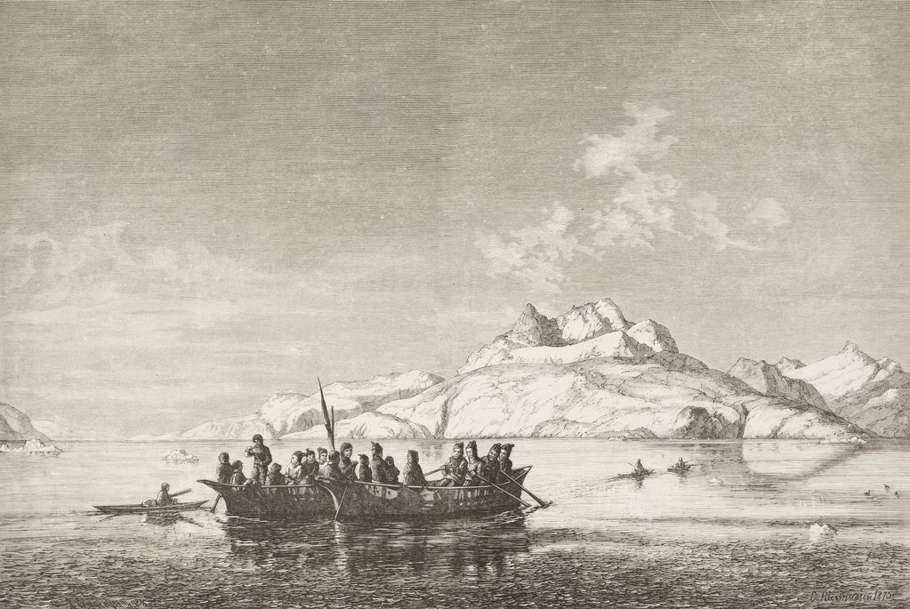
The modern Inuit of the Thule culture arrived in Greenland about 200-300 years after the vikings did. They arrived on foot, by dog sled, and in umiaks from the Bering Sea area of Alaska and Siberia (Friesen, 2016). They were equally adept to hunt caribou on land with bow and arrow, seals on sea ice with spears, and whales on open ocean with sophisticated harpoons. They crossed Smith Sound at 79 N latitude about 1300 CE to reach Greenland spreading south towards the viking settlements and north-east towards Fram Strait separating Greenland from Svalbard. On a beach off Independence Fjord in North-East Greenland at almost 83 N latitude Eigil Knuth found the frame of one of their skin-hulled umiak in 1949 (Knuth, 1952).
The vikings built “permanent” houses of stone, farmed the land, and kept sheep, goat, and cows. They hunted walrus and narwhal for its ivory to trade with Europe to import metals, clothes, and foods. Their diet until about 1300 CE was high on terrestrial and low on marine resources as indicated by isotopic studies of their bone structure. This changed when a cooling climate challenged animal husbandry in Greenland and the Norse transitioned towards a marine-based diet of fish, seals, and marine mamals (Jackson et al., 2018).
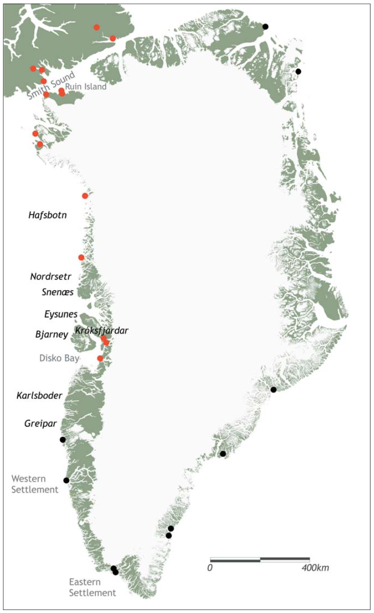
Map of Greenland and Ellesmere Islands adapted from Gullov (2008). Red symbols indicate Norse artifacts found at Inuit sites occupied in the 13th and 14th century while black dots represent location of such artifacts at 15th and 16th century.
In contrast, the Inuit embraced a more mobile life-style as entire family units moved large distances to new sites from year to year and seasonally from summer to winter camps. Their hunting was tied to the sea ice and they developed fancy techniques to hunt larger whales, walrus, and polar bears for food, fuel, and clothing. Their technologies and behaviors adapted rapidly in an extreme environment and climate that kept changing in time. Inuit often viewed themselves and their animal prey as mutually connected with energies flowing from animal to Inuit and vice versa. Both were part of one nature which changes in time on many different cycles that one needs to read and understand for survival. This view differed from that of the more pastoral vikings who saw themselves and their homes as “safe inner spaces” and everything on the outside as “wild and hostile” nature. They constantly tried to modify, improve, and control the landscape while the Inuit moved and adapted within it (Jackson et al., 2018).
Viking settlement on Greenland (left), chess figures from walrus ivory (center), and viking longboat from the 10th century.
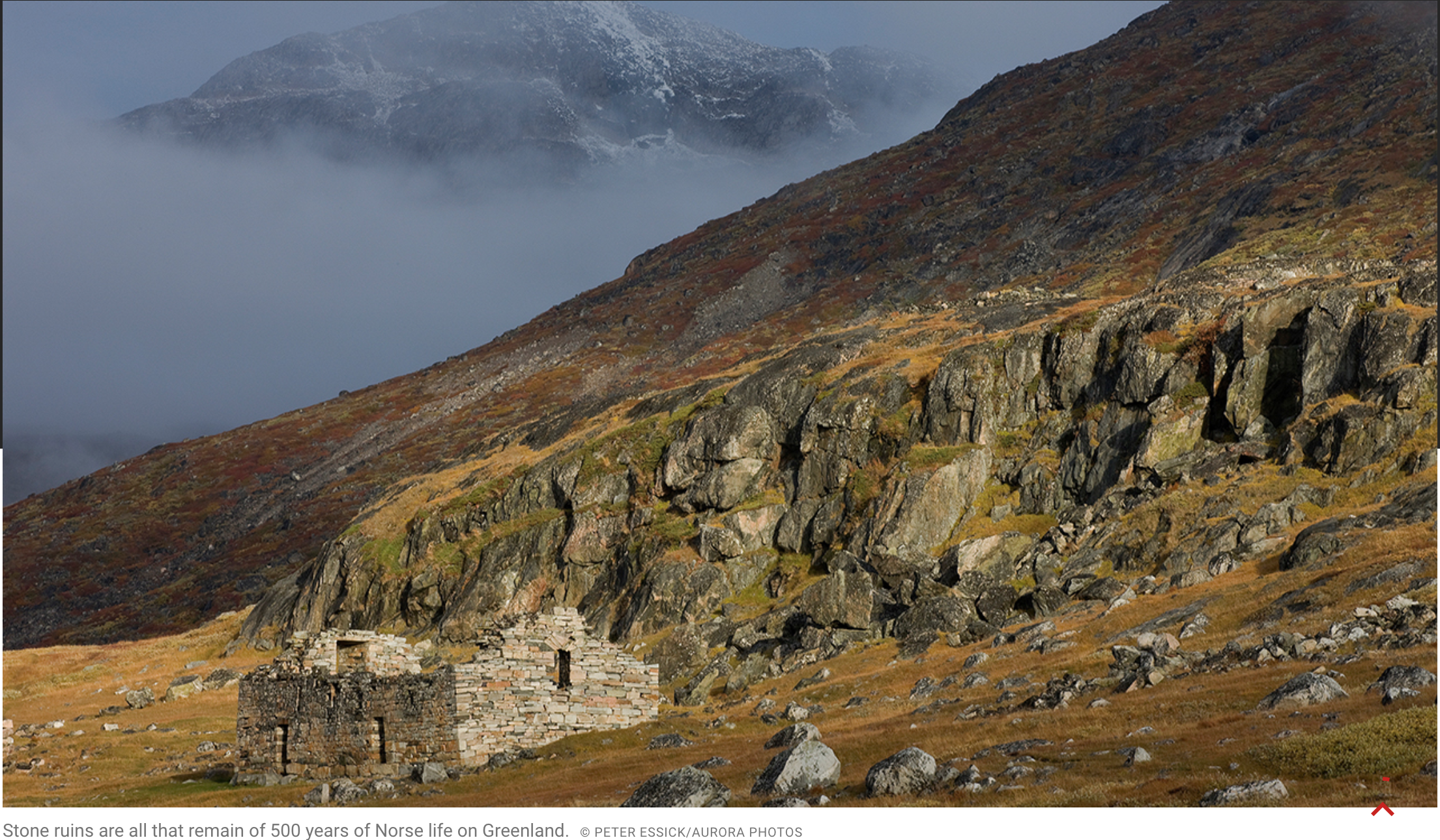
The vikings vanished without a trace in the 15th century. Their fate is still researched and debated in academic and popular outlets alike. In contrast, the Inuit expanded their range along all of Greenland where in the 18th and 19th centuries they were “re-discovered” in the South by Danish and Moravian colonists and missionaries and in the North by the English Navy, American adventurers, and Danish scientists.
In 1910 two Danes Knut Rasmussen and Peter Freuchen established a trading post at North Star Bay near 77 N Latitude. They called “Thule.” Over the next 20 years Thule became a focal point of about 200 nomadic Inughuit that all are direct descendants of the Thule culture Inuit. There are about 700 of them today and most still live in Qaanaaq. Linguist Stephen Pax Leonard lived among them for a year in 2010/11 when he produced a 10 minute video that documents contemporary Inuit life and language.
Contemporary photos of Qaanaaq and Thule region. Photos on left panel by Dr. Steffen Olsen near Tracy Glacier in Inglefield Fjord while images in right panel are of North Star Bay and Thule Air Base by the author.
References:
Francis, C.S., 2011: The Lost Western Settlements of Greenland, 1342, California State Univ. Sacramento, MA Thesis, 84 pp.
Friesen, T.M., 2016: Pan-Arctic Population Movements, Chap.-28 of “The Prehistoric Arctic,” Oxford Univ. Press, 988 pp.
Gullov, H.C., 2008: The Nature of Contact between Native Greenlanders and Norse, J. North Atlantic, 1, 16-24.
Jackson, R., J. Arneborg, A. Dugmore, C. Madsen, T. McGovern, K. Smiarowski, R. Streeter, 2018: Disequilibrium, Adaptation, and the Norse Settlement of Greenland, Human Ecology, 46 (5), https://doi.org/10.1007/s10745-018-0020-0.