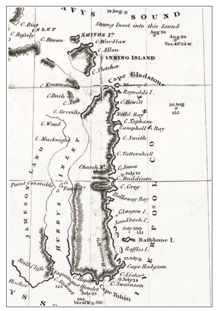
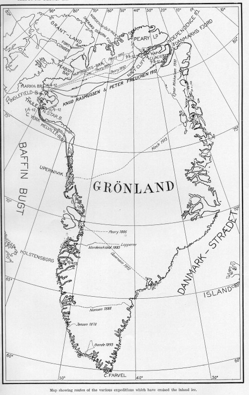
Reading Halldor Laxness’ epic novel “Independent People,” I am in Iceland for the last 10 days. I re-discovered this author after reading a small essay the New Yorker published last week. This book is set in Iceland of the early 1900s to the mid 1920ies. Sheep, starvation, and spirits evil and otherwise all play roles as does time that changes people, politics, and procreation. Finishing it sunday, I feel I have been here before.

My first Laxness novel “Islandklukken” (Iceland’s Bell in English) I read as a 20-year old during the Cold War when I served my country for 16 month more than 40 years ago. At the time I dreamt of the world as it had not yet revealed itself to me. My pre-college mind had a romantic notion of walking remote and wild areas of Norway and Iceland after an unromantic 1981 motorcycle trip across southern Norway the prior summer. I now worked as a paramedic in the drizzly gray German town of Husum by the North Sea. During this first winter away from parents and High School friends I bought my first Laxness and immediate afterwards “Die Saga von Egil” (Egil Skallagrimsson Saga). This Icelandic saga was written about 1200 AD and it chronicles the life of a viking poet farmer who killed many men for the 91 years after his birth in 904 AD. Along with this book I also bought a topographic map of Iceland published by the Touring Club of Iceland at a scale of 1:750,000 printed in 1979 in Reykjavik. It cost me 29.90 Deutsche Mark or about 10% of my monthly income at the time. Such armed, I followed Egil Skallagrimsson across Iceland starting at his place of birth about 35 miles north of Reykjavik.

Oil on canvas: “Summer in the Greenland coast circa the year 1000” painted by Danish painter Carl Rasmussen in 1874.
The same map follows me on my current travels across Iceland until I find the many databases of the Icelandic Geodedic Survey. High-resolution (1:50,000 scale, say) are generated instantly whereever I want. For days now I am hiking for days across the Icelandic highlands in the East and West, across interior deserts in the center, and wet coasts in the North. My first trip was across the Highlands from Pingvellir to Reykir past the glacier Langjoekull to the North and West and the glacier Hofsjoekull in the East and South. My maps locate many backcountry huts where I stay or pitch my tent. I here follow Dieter Graser’s excellent descriptions, photos, and GPS waypoints when he hiked the “Kjalvegur” alone in 2007. I even stole this map from his content-rich web-site where I spent the last 2 days traveling with finger on maps, books, and internets
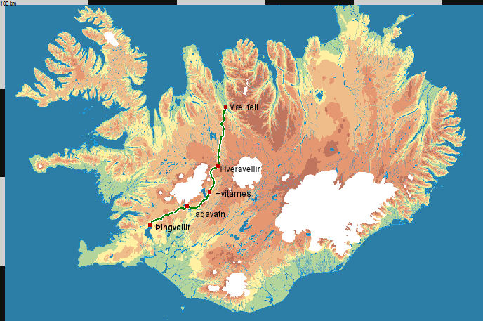
I even got a first intinary: My direct Iceland Air flight leaves Baltimore on Aug.-16 at 8:30 pm in the evening and arrives in Reykjavik the next morning at 6:25 am. A Grey Line bus gets me into the Highland for less than $48 in 2 1/2 hours, but it does not leave until 8 am on the next day. Hence there is plenty of time in iceland’s capital city to explore, get provisions, and perhaps visit the Landsbjoerg which is Iceland’s Search and Rescue organization. It is good practice to let someone local know when you will be where and back as one heads into the backcountry. The bus will let me off in Hviternes from where it is a 40 km hike to Hveravellir where there are two web-cams: the first points to the West while the second points East. I got 5 days to do this 3-day hike, so there is time for a day or two to do nothing, read, or just soak in the scenery and/or a hot spring and/or both at the same time. The bus will pick me up at the hot springs of Hveravellir at 2:30 pm on Aug.-22 to get me back to Reykjavik at 7:30 pm which is plenty of time to catch my plane back home the next day at 5:10 pm with an arrival 6 hours later. The return flight comes to $746 and even includes my backpack (<50 lbs).
There is just one problem … my passport expired.
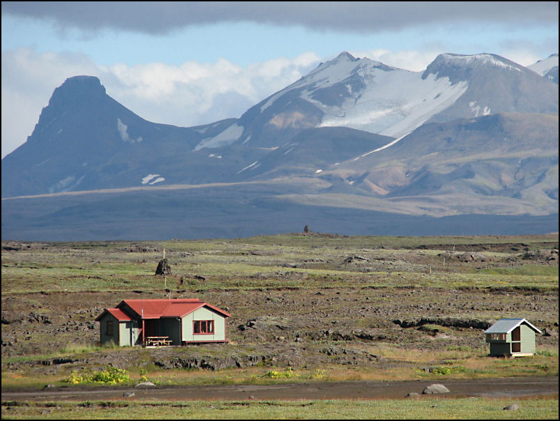
P.S.: The three photos below are all from Dieter Graser who shared them at his outstanding web-site at http://www.isafold.de/


![Marine layer at the entrance of Scoresby Sund on Aug.-20, 2018. Photo by Dragonfly Leathrum]](https://i0.wp.com/icyseas.org/wp-content/uploads/2019/07/img_2678.jpg?w=330&h=220&ssl=1 "IMG_2678")
![Fog at noon on Aug.-20, 2018 to the south of Scoresby Sund. [Photo by Dragonfly Leathrum]](https://i0.wp.com/icyseas.org/wp-content/uploads/2019/07/img_2642.jpg?w=162&h=108&ssl=1 "IMG_2642")
![Kap Brewster in the clouds (foreground) at the southern entrance to Scoresby Sund. View is to the north-west into the entrance of the fjord. In the background the northern shores are visible behind the iceberg. [Photo by Dragonfly Leathrum]](https://i0.wp.com/icyseas.org/wp-content/uploads/2019/07/img_2654.jpg?w=162&h=108&ssl=1 "IMG_2654")
![Evening sun on mountains on the Volquart Boons Kyst in Scoresby Sund on August 20, 2018. [Photo by Dragonfly Leathrum]](https://i0.wp.com/icyseas.org/wp-content/uploads/2019/07/img_2774.jpg?w=246&h=164&ssl=1 "IMG_2774")
![Kap Brewster at the southern entrance of Scoresby Sund on Aug.-20, 2018. View is to the south-east out to the open foggy sea. [Photo by Dragonfy Leathrum]](https://i0.wp.com/icyseas.org/wp-content/uploads/2019/07/img_2738.jpg?w=246&h=164&ssl=1 "IMG_2738")