Category Archives: Petermann Glacier

Petermann Glacier, Ice Islands, and Changing Climate

Petermann Glacier is a tidewater glacier in the remote north-west of Greenland. The glacier is grounded at about 600-m below sea level. It has calved two large ice islands, a 4-Manhattan sized island in 2010 and a 2-Manhattan sized one in 2012. These losses cover much of the area shown in this 2009 photo:

Eastern wall of Petermann Fjord as seen from CCGS Henry Larsen’s helicopter in August 2009 with the floating ice shelf. Most of the visible ice shelf has been lost during the 2010 and 2012 calving events. [Photo Credit: David Riedel, British Columbia.]

From selected imagery, I created a short movie (0.7 MB) which shows (a) the 2010 calving, (b) the advance of the new front in 2011 and early 2012, and (c) the 2012 calving. The glacier has moved at a rate of about Continue reading

New Petermann Ice Island forming July-16, 2012

This morning Petermann Glacier lost another ice island of a size comparable to what it lost in 2010:

MODIS-Aqua image of July 16, 12:00 UTC of a new ice island forming from Petermann Glacier.

The break-off point has been visible for at least 8 years in MODIS imagery propagating at speeds of 1 km/year towards Nares Strait. The fracture also extended further across the floating ice sheet from the northern towards its southern side.

This event is still evolving, Trudy Wohleben of the Canadian Ice Service noticed it first (as in 2010) after reviewing MODIS imagery. Several people in several countries are monitoring and assessing the situation, but a first estimate of its size is 200 km^2 (3 Manhattans), I will revise this figure as soon as I got my hands on the raw data 120 +/- 5 km^2 or about 2 Manhattans.

The Canadian Coast Guard Ship Henry Larsen is scheduled to travel to Nares Strait (and Petermann Fjord) to recover moorings placed in 2009. These mooring data, if recovered, will contain ocean current, temperature, salinity, and ice thickness data at better than hourly intervals from 2009 through 2012.

UPDATE: For comparison, I here show the 2010 imagery on the same scale using the same processing and colors. There will be more imagery this evening as MODIS-Terra passes over the area closer to nadir (better resolution or sharpness of the images). Furthermore, clouds seem to be disappearing.

The 2010 Petermann Glacier calving event also indicates the crack that broke off this morning as indicated. Note that the entire floating ice shelf moves by about 1 to 1.3 km per year, slightly less than a mile per year. The crack in 2010 is where the 2012 ice island formed.

EDIT: Changed 2012 MODIS-Terra figure which now has the correct (July 16, 2012) date that the data were taken.

Petermann Ice Islands Stuck in Ice

Several pieces of the Manhattan-sized ice island that broke off Petermann Glacier, Greenland in 2010 arrived, dispersed, and melted off Newfoundland last summer. They provided stunning displays visible to the naked eye from the coast. The Canadian Ice Service just distributed this set of radar images showing 4 pieces that are all grounded and/or stuck in ice. None are moving.

Overview of fragments of Ice Islands that broke off Petermann Glacier, Greenland in 2010 as of June-11, 2012 from RadarSat composites. [Credit: Luc Desjardins, Canadian Ice Service]

In the open ocean ice is moved by winds stressing the ice from above and by ocean currents stressing the ice from below. Typical sea ice varies in thickness from 1-5 meters (3-15 feet) which is much less than the 30-130 meters (90-400 feet) thick ice islands. Winds thus push thick ice islands much less than they do push the thinner sea ice. Thick ice islands are moved by ocean currents, not winds.

This is why oceanographers like myself love these bits of ice islands to bits: they tell us about the ocean below the surface that satellites do not see, but, sadly, all fragments are stuck either to the seafloor in shallow coastal waters or are cemented in place by immobile sea ice that is “land-fast:” Think of it as ice that is glued to land and to each other. This sheet of glued-together ice extends some distance offshore. The distance can be a few yards during a cold winter night in Maine or 100s of miles off Siberia. Offshore islands, rocky outcroppings, or grounded ice islands all anchor land-fast ice by adding local support and thus strength and stability to the immobile land-fast ice.

Too much talk, lets explain this with an image of the largest ice islands, called PII-B1. It is about 4 km wide and 9 km long. I dropped a black dot in its center as it is hard to see where to look in this image. I also show land in grey, open water in blue, and ice in shades of white and yellow:

Land-fast and mobile sea ice off Baffin Island with Petermann Ice Island PII-B1 grounded near the 150 meter isobath (black dot). Thick lines are 100, 200, and 300-m bottom depths. MODIS Terra data at 250-m resolution from June-6, 2012, 15:05 UTC.

There is clearly a 30-km wide band of ice attached to the land with a line of blue water separating it from ice that is mobile and has different signatures. A blue band of ocean has emerged, I speculate, as the result of winds from the south that moved the mobile ice to the north-east (to the right in the image). Neither the land-fast nor the grounded ice island PII-B1 embedded in it moved, so open water appears where there was mobile ice before. This is called a shore lead and I bet there are plenty of seals and whales feasting there now. Note also the arched entrance to Home Bay (bottom left) where loose ice is scattered towards the headland of Henry Kater Peninsula.

As summer is arriving fast in the Arctic, the land-fast ice will disappear, breaking up as the sun and air above and the ocean below weakens the ice by melting. This will expose the thicker ice islands and icebergs to wind-forced storms and waves more violently than it does now. And even those ice island grounded to the bottom of the ocean in shallow water will become free during a time of higher than normal sea level, perhaps during a spring tide, perhaps during strong winds from the north. Then these currently stuck-in-the-ice ice islands will continue their journey south towards Newfoundland and the Atlantic Ocean that they began in 2010 when they were born in northern Greenland.

EDIT: For context I append an earlier RadarSat image from October-18, 2010 when all segments were much closer in space.

Petermann Ice Islands in northern Baffin Bay of Coburg Island, Canada at 76 N latitude on Oct.-18, 2010, about 2 month after they separated from Petermann Glacier, Greenland at 81N latitude. [Credit: Luc Desjardins, Canadian Ice Service]

Petermann Ice Island(s) 2010 through 2011, Part-1

An ice island 4 times the size of Manhattan spawned from a remote floating glacier in north-western Greenland the first week in August of 2010, but it quickly broke into at least 3-4 very large pieces as soon as it flowed freely and encountered smaller, but real and rocky islands. A beacon placed on the ice transmit its location several times every day. It shows a rapid transit from the frigid, ice-infested Arctic waters off Canada’s Ellesmere, Devon, and Baffin Islands to the balmier coasts of Labrador and Newfoundland:

Track of Petermann Ice Island from Aug.-2010 through Aug.-2011 traveling in shallow water from northern Greenland along Baffin Island and Labrador to Newfoundland.

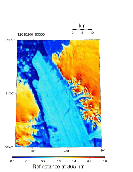
Initial progress was slow as it took the new ice island almost 30 days to wiggle itself free of the narrow constraints of Petermann Fjord:

Petermann Glacier discharges its large ice island into Nares Strait on Aug.-30, 2010.

As soon as it left its home port, it hit broke hit tiny Joe Island on Sept.-9, 2010 and broke into two pieces, PII-A and PII-B for Petermann Ice Island A and B. Not a good start for a new island setting out to sail all the way to Newfoundland where PII-A arrived a year later, but I am getting ahead of my story.

Petermann Ice Island breaks into two segments on Sept.-9, 2010 as seen in this radar image provided by the European Space Agency. Greenland is at the bottom right, Canada top left, the Arctic Ocean is at the top right.

Once in Nares Strait both ice islands experienced a very strong and persistent ocean current. PII-A, about 1.5 the size of Manhattan went first followed by the larger (about 2.5 Manhattans) and thicker PII-B. Their tracks follow each other closely and they almost kiss on Oct.-8, 2010 when both are caught in the same eddy or meander of a prominent coastal current flowing south along Ellesmere and Devon Islands.

Pieces of Petermann Ice Island on Oct.-8, 2010 off southern Ellesmere Island about 600-km to the south of their origin. RadarSat imagery is courtesy of Luc Desjardins of the Canadian Ice Service, Government Canada.

Within a week the larger 136 km^2 piece PII-B breaks into three pieces of 93.5, 28.9, and 11.3 km^2 by Oct.-16 while PII-A stays largely intact at 73.6 km^2. These are all very large islands, the land area of Manhattan is about 60 km^2 for comparison. Some of these pieces approach the coast, some become grounded for a few days to a few weeks, some break off smaller pieces and spawn massive ice bergs that are not always visible from space. PII-A enters Lancaster Sound a week ahead of PII-B on Nov.-14, but exits it within 2 weeks:

Multiple pieces spawned from Petermann Ice Island as seen by RadarSat on Nov.-26 and Nov.-28, 2010 composited and anotated by Luc Desjardins of the Canadian Ice Service, Government Canada.

Notice also the evolution of a string of segments that Luc Desjardins of the Canadian Ice Service identified as pieces from Petermann Glacier. Glacier ice has a darker radar backscatter signature than the sea ice around it. All these pieces eventually enter the Baffin Island Current, a prominent large ocean current that extends from the surface to about 200-300 m depth. The Petermann pieces are moved mostly by ocean currents, not winds, because there is more drag on the submerged pieces of the 40-150 meter thick glacier ice. In contrast, the much thinner sea ice is mostly driven by the winds. This is also the reason one often finds areas in the lee of icebergs and islands free of older ice which is swept away by the winds as the iceberg moves slower as it is driven by deeper ocean currents. I will talk more of these in a later post.

As part of a large oceanography program in northern Baffin Bay and Nares Strait in 2003, we collected ocean temperature, salinity, chemistry, and current data along lines roughly perpendicular to both Baffin Island in the west and Greenland in the east along with the trajectory of PII-A in the fall of 2010 (red dots) and the almost identical track of a much smaller ice island from Petermann Glacier that passed the area in 2008:

Map of the study area with trajectory of a 2010 (red) and 2008 (grey) beacons deployed on Petermann Glacier ice islands over topography along with CTD station locations (circles) and thalweg (black line). Nares Strait is to the north of Smith Sound.

I will talk about these data and the subsequent tracks of PII-A and PII-B from 2010 into 2011 in Part-2 of this summary on how the first of this piece (PII-A) arrived off coastal Newfoundland in the late summer of 2011. Rest assured that there are many more pieces coming to coastal Labrador and Newfoundland in 2012 and 2013 where they put on a majestic display of abundant icebergs such as this last remnant of PII-A as seen from the air on Nov.-2, 2011 in Notre Dame Bay, Newfoundland.

Last surviving fragments of PII-A on Nov.-2, 2011 from a survey by air of southern Notre Dame Bay conducted by Canadian Ice Service, Government Canada..