
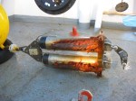
I will travel to Spitsbergen in six weeks to board the German research icebreaker Polarstern. She will sail west across the Fram Strait towards northern Greenland where some of the last remaining glaciers exist that still discharge their ice via extensive floating ice-shelves. If all goes well, we will deploy instruments on the bottom of the ocean across a 30 km wide submarine canyon (Norske Ore Trough). The instruments profile ocean velocities from the bottom to the surface of the canyon that connects the deep (warm) ocean to the shallow continental shelf areas which then connect to two large outlet glaciers, Zachariae and 79N Glaciers. These are two of three glacier that terminate the North-East Greenland Ice Stream (NEGIS) which contains about 15 per cent of Greenland’s ice sheet:
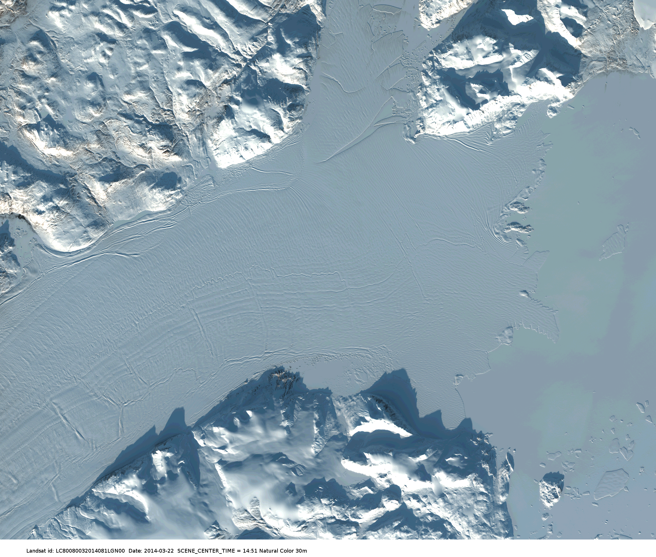
![Speed of Greenland's ice sheet movements. NE indicates the fast-moving (red) North-East Greenland Ice Stream with 3 branches connecting it to the ocean. [From Mauri Pelto's blog]](https://icyseas.org/wp-content/uploads/2014/04/greenland_velocity-basene.jpg)
Speed of Greenland’s ice sheet movements. NE indicates the fast moving (red) North-East Greenland Ice Stream with 3 branches connecting it to the ocean. [From Mauri Pelto’s blog]
Landsat image of Nioghalvfjerdsfjorden on Mar.-22, 2014.
Our 2014 study area is actually to the east, just outside the frame of the above image. The reason is lack of ship time, as this year’s deployment is just a small pilot study to better prepare and understand a larger German-led experiment that will take place both on the glacier and its adjacent ocean and land in 2016 and, I hope, beyond. Furthermore, we are scheduled to be there in June, a tad early for all the sea ice to clear out of the area (79N Glacier MODIS summer imagery) which also explains my intense interest in how the ice develops. And a first fairly clear MODIS image came about yesterday morning:

Ice-covered coastal waters off northeast Greenland April 14, 2014. Red contour indicates 100-m water depth. The “horseshoe-shaped red island is Belgica Bank with Norske Oer Trough to its south-west.
Belgica Bank is about as big as the Georges Bank in the Gulf of Maine. In past decades rafted multi-year ice and tabular icebergs often grounded over shallow Belgica Bank and thus provided an anchor to maintain stability for a year-round land-fast ice cover called the Norske Oer Ice Barrier. This year-round land-fast ice area, however, disintegrated in 2003 and has become an intermittent and not a regular feature for unknown reasons.
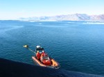
Before I can get onto the German icebreaker in Spitsbergen, my 3500 kg of equipment had to be repaired, rebuilt, re-powered, and shipped from British Columbia to Germany via rail, ocean freighter, and truck. It all arrived in 86 pieces only last friday, two weeks behind schedule, because of ice and confused shipping schedules in the Canadian Gulf of St. Lawrence. Lots of great people in Canada, the USA, and Germany made it happen. Wish us luck for the next step in this exciting scientific exploration to reveal one of many of Greenland’s glacier and ocean mysteries.
-
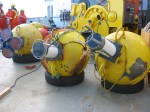
- Fishing for ocean instruments deployed 3 years before.
-
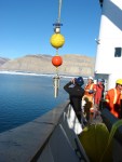
- Bringing acoustic Doppler current profiler mooring aboard ($100,000 on that line).
-
- Surviving encounters with icebergs, just barely.
-
- Corroding acoustic releases to get instruments back.
-
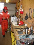
- Working the instrument shop at sea.
-
- Planning the mooring assemblies.
Hughes, N., Wilkinson, J., & Wadhams, P. (2011). Multi-satellite sensor analysis of fast-ice development in the Norske Øer Ice Barrier, northeast Greenland Annals of Glaciology, 52 (57), 151-160 DOI: 10.3189/172756411795931633
Wadhams, P., Wilkinson, J., & McPhail, S. (2006). A new view of the underside of Arctic sea ice Geophysical Research Letters, 33 (4) DOI: 10.1029/2005GL025131


Quite exciting. Would enjoy hearing details about the instruments themselves. That is quite a bit of gear to hoist around.
Hi Andreas,
That is exiting, that is the right area to be this season, because I believe there will be a lot of action around especially Zachariae Isstrøm, with the front now cleared “the Monster” will start to move and really live up to its name “Isstrøm”, Chuck Dee up there!
Further action at Zacharie : https://forum.arctic-sea-ice.net/index.php/topic,400.msg24181.html#msg24181
Espen
Whow, that’s an incredible high speed of the glacier front to me. Northern crevasses are stretched out as the northern boundary does not participate in the motion … it also shows grounded vs. mobile iceberg … This must be today’s Landsat image that I could not find online this morning. Let me run off to find it … we should be more quantitative on this speed-up.
Pingback: Coastal Oceanography off North-East Greenland | Icy Seas