Tag Archives: nature

Back-Packing to Pioneer Basin in California’s High Sierra: Beaches and Swimming and Trout

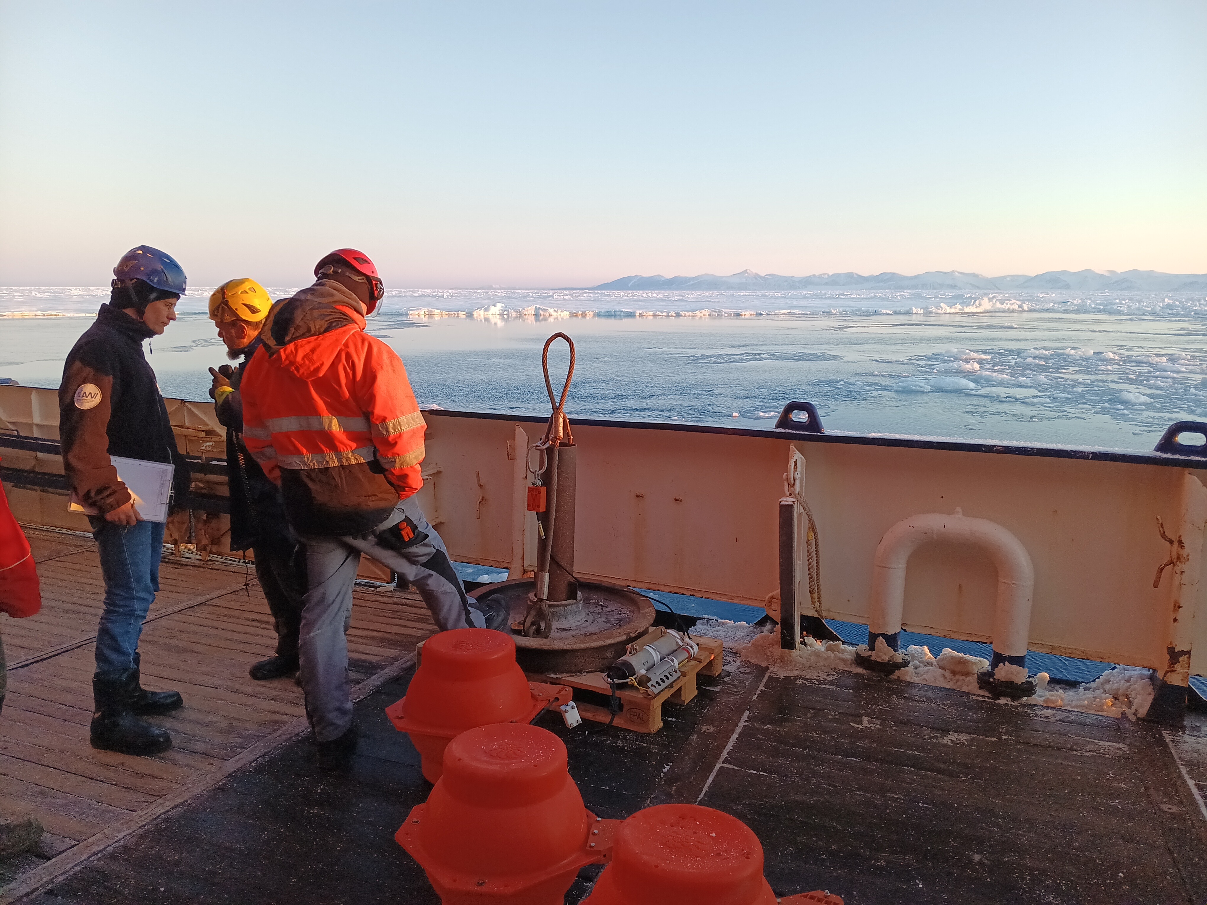
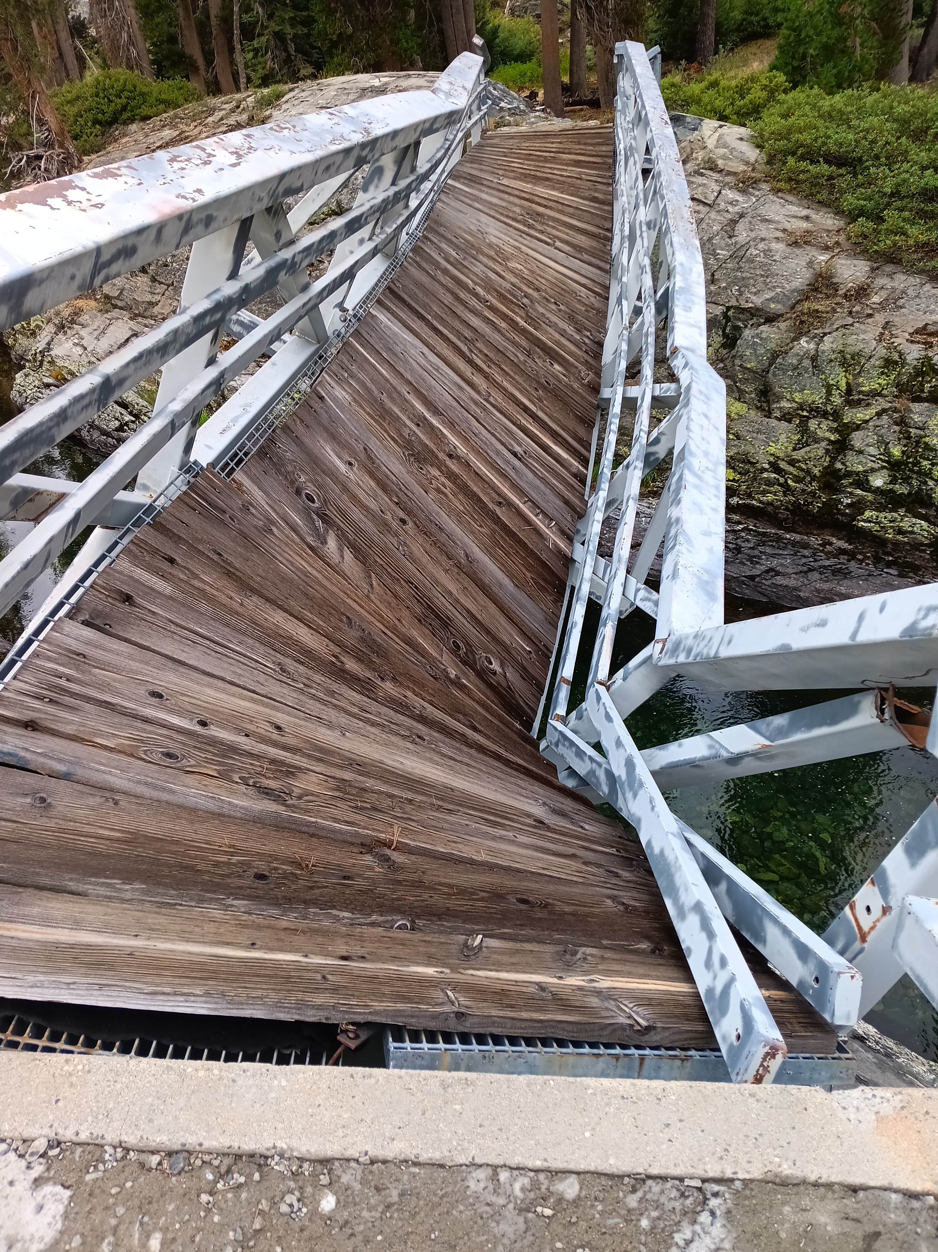
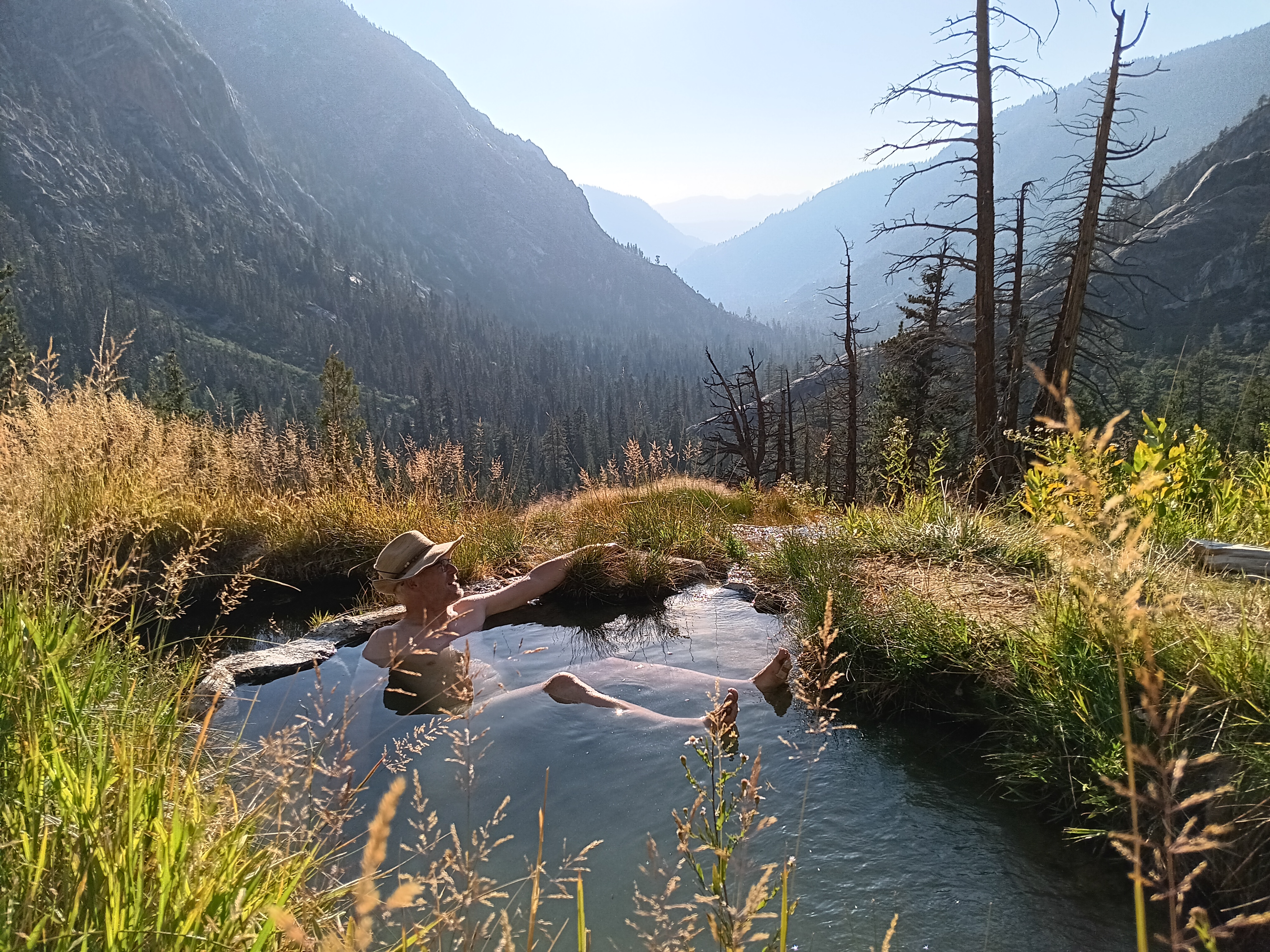
Pavla stopped her Suburu Outback on the side of the road in Tuoloume Meadows, Yosemite National Park to pick up a 63-year old hitchhiker who tried to reach his remote Parker/Mono trailhead. First, however, Pavla had to take a swim in the wild local river. Thus she provided the aging back-packer, that was me, with an expert lesson on what to do in California’s back-country when one sees a pristine lake or stream: undress and jump in. And so I did with some hesitation, admittedly, the water was cold after all. Jumping naked into a stream after an attractive woman who had just picked me up from the side of a road, I do not do that naturally, but Pavla taught me how to swim in places like these:

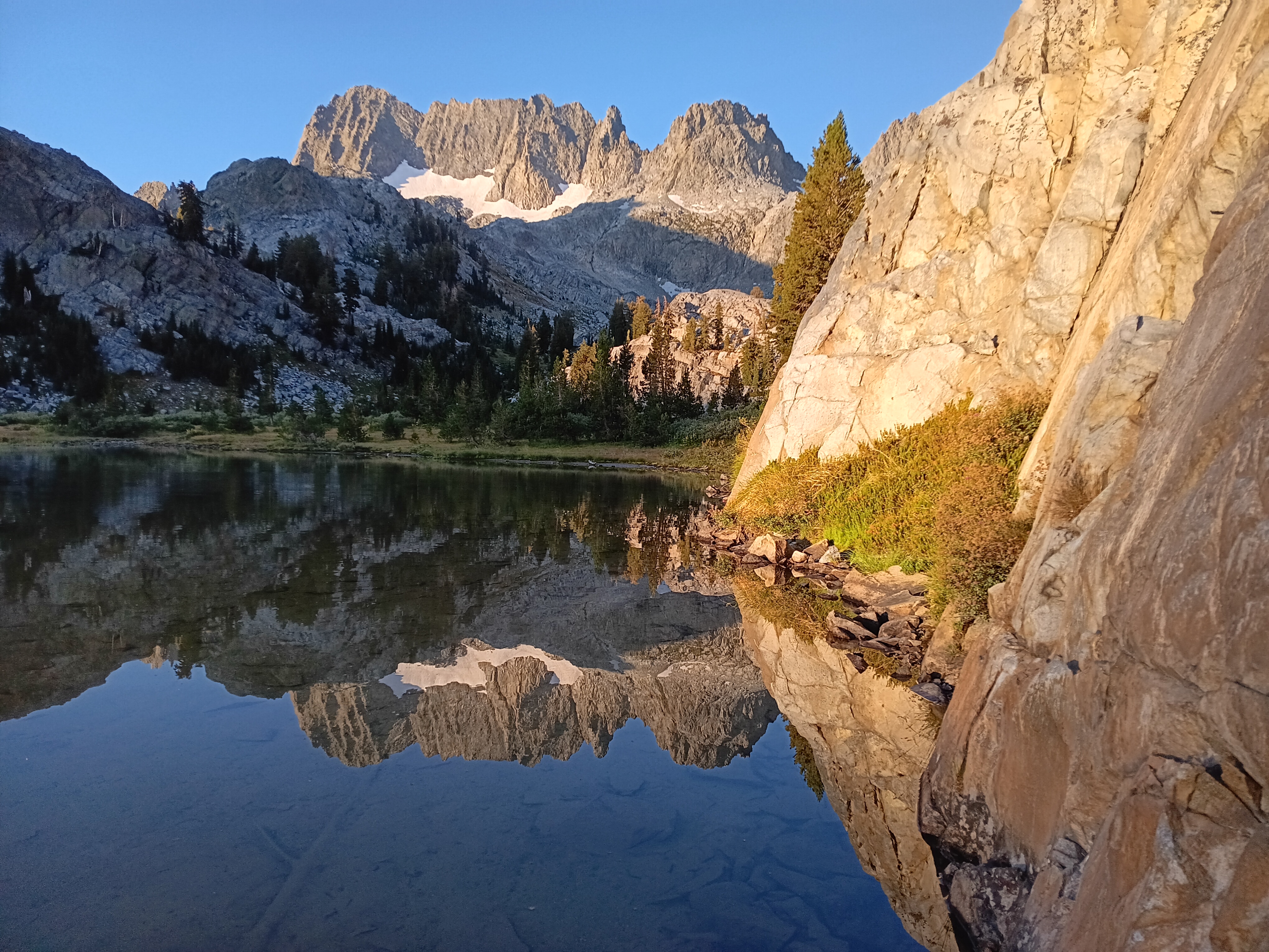
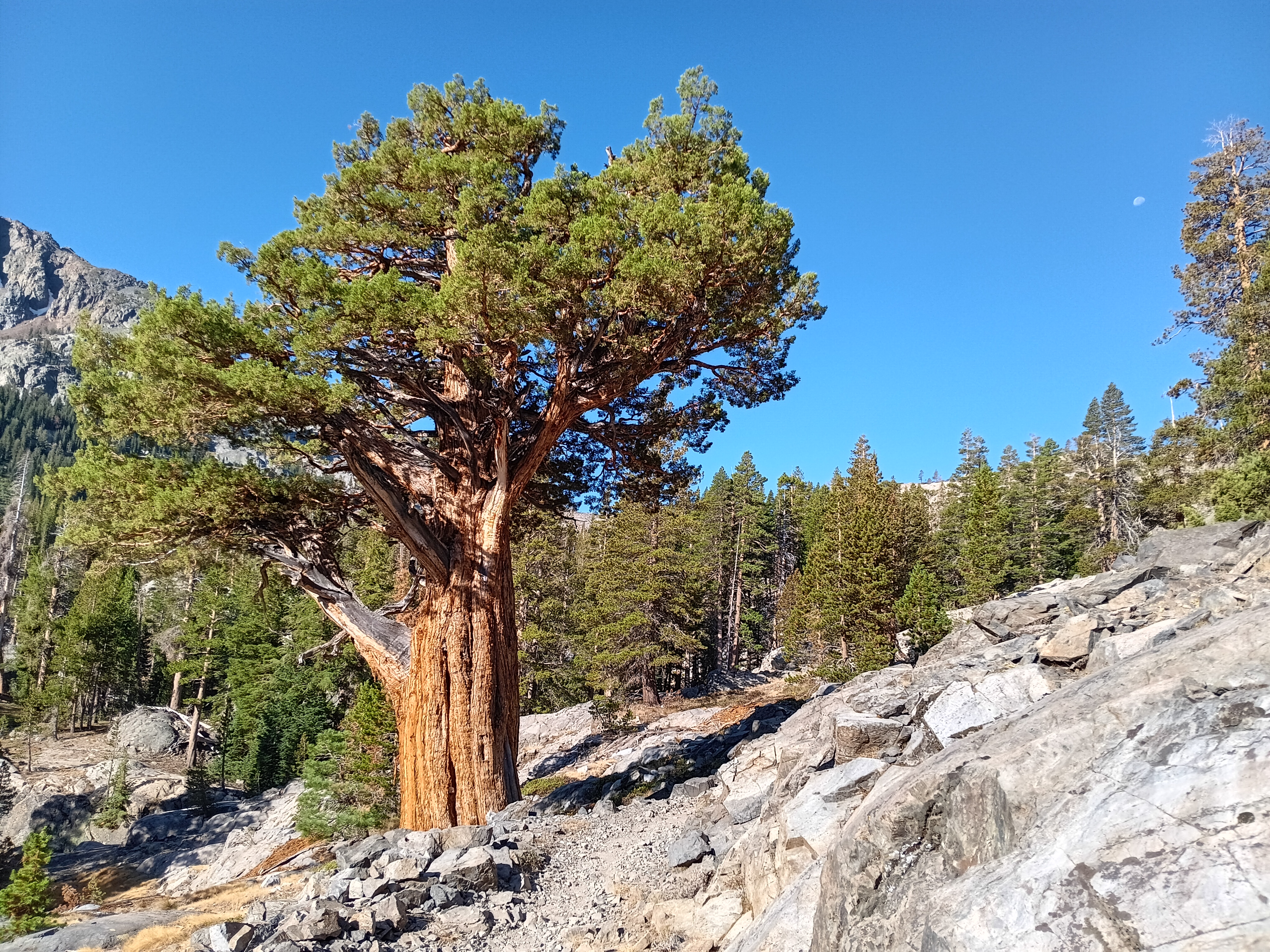
Minaret reflections in Ediza Lake (top left, Aug.-13), Western Cedar tree along the way (top right, Aug.-13), Rush Creek (bottom, Aug.-11), and Rosalie Lake (right center, Aug.-13).

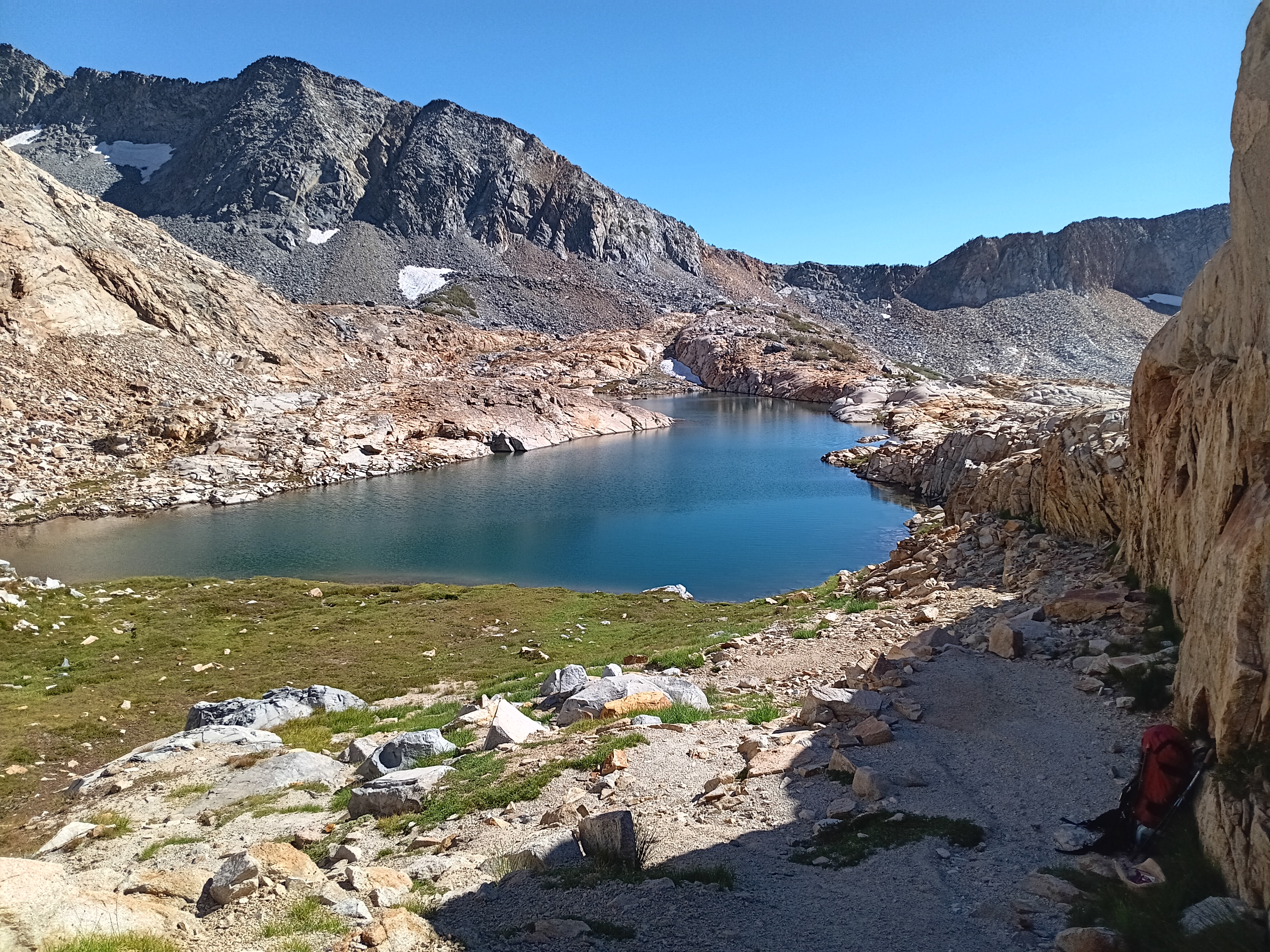
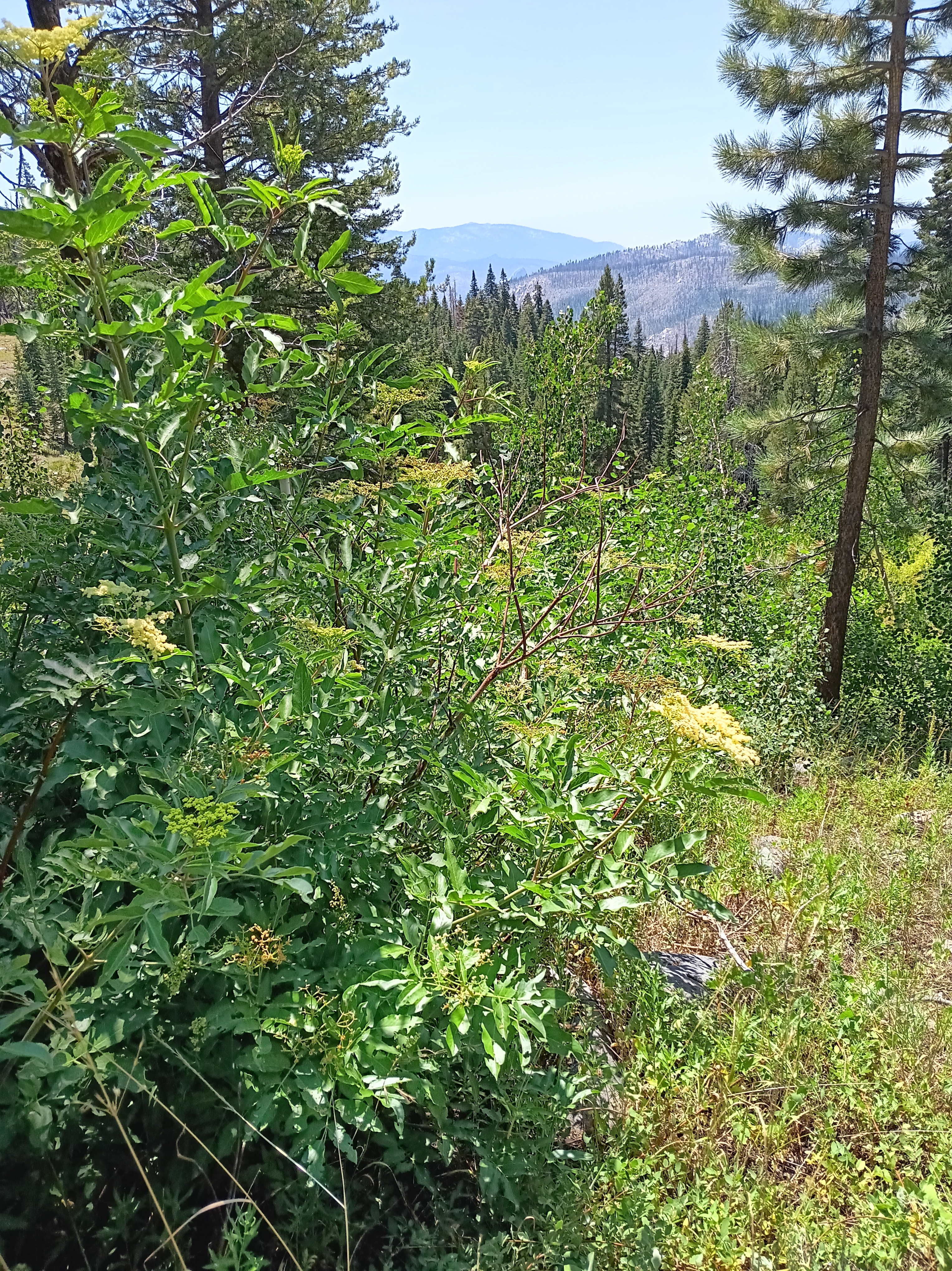
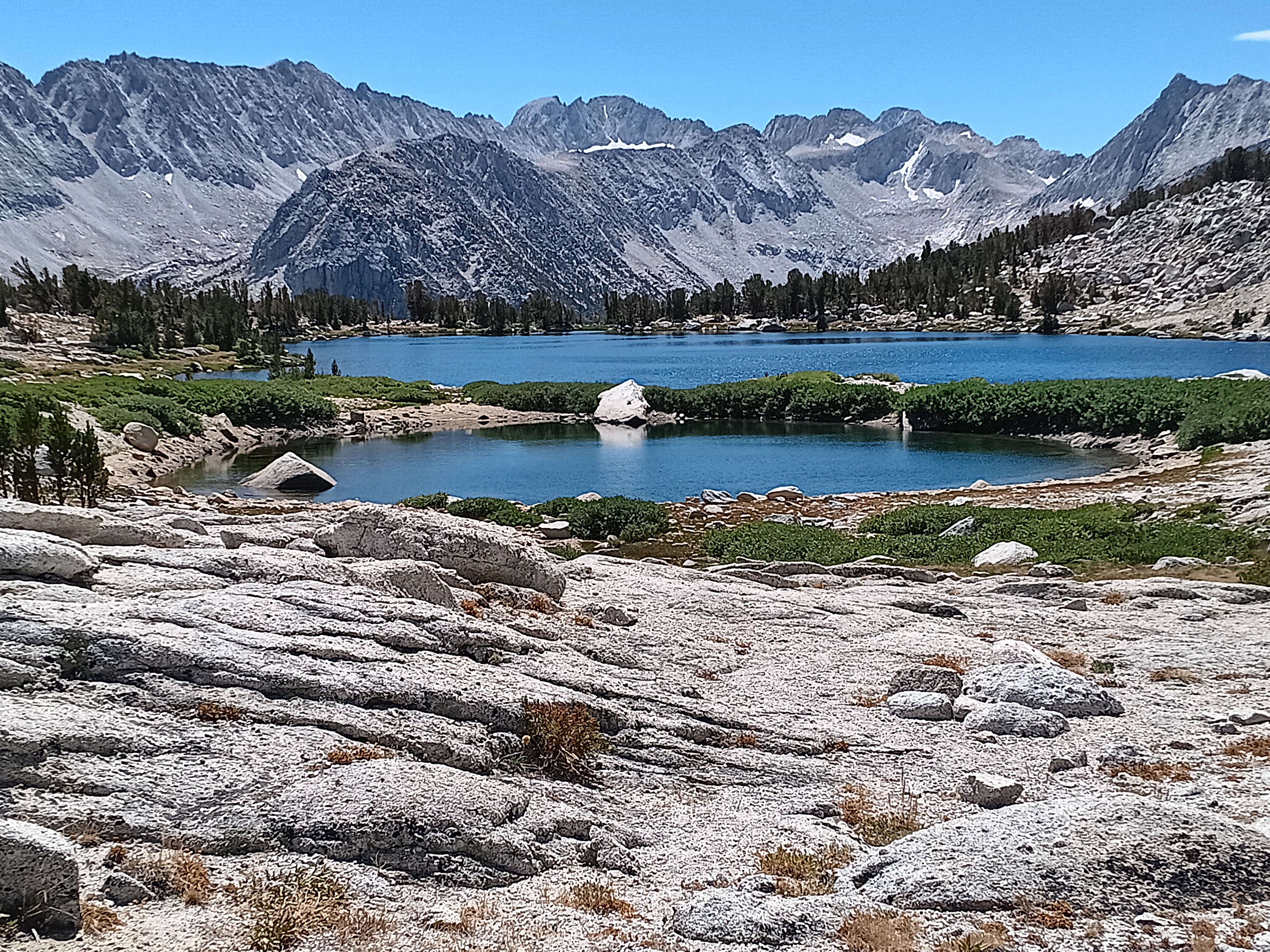
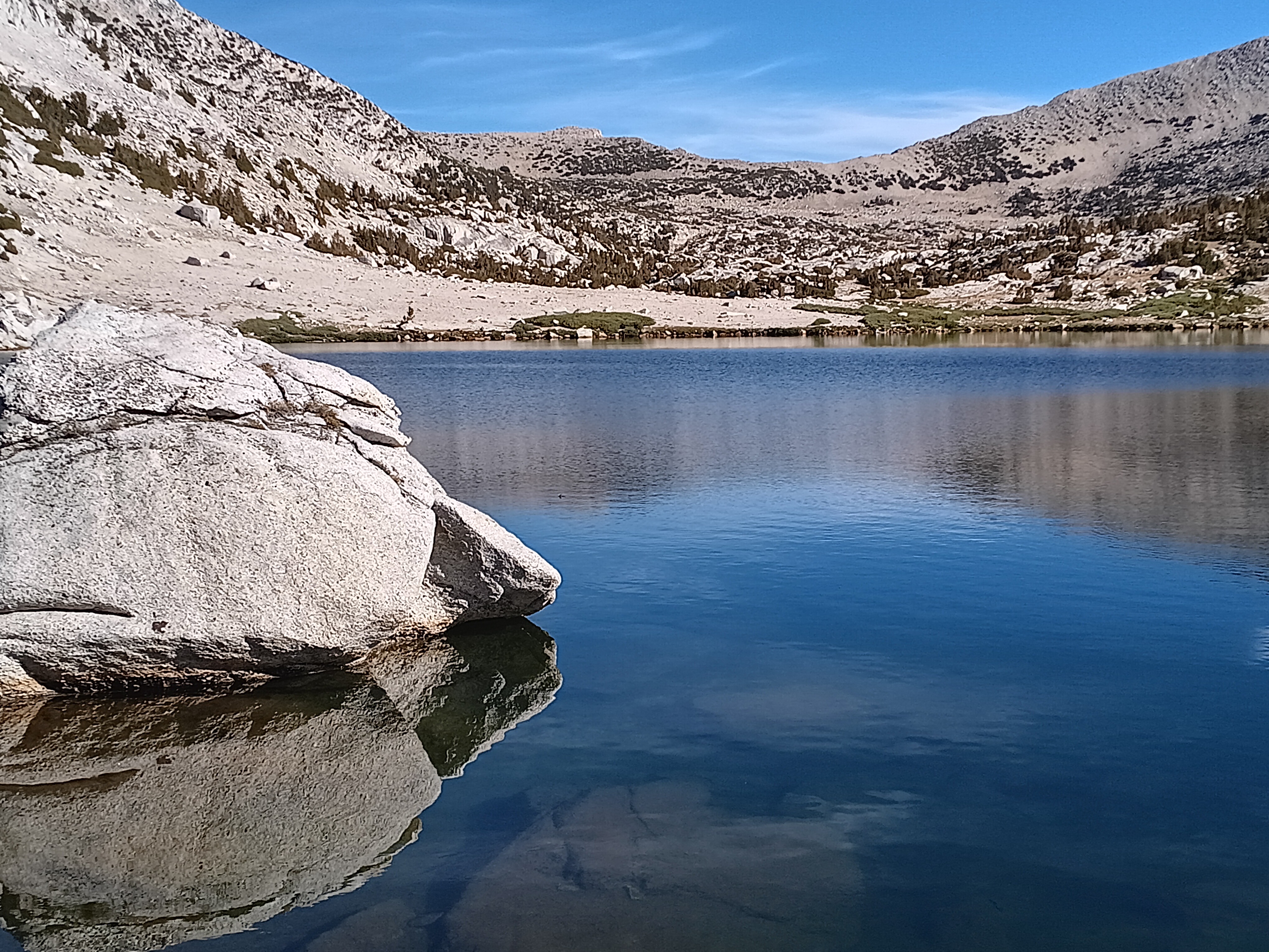
I swam the next 14 days in Rush Creek, Emerald Lake, Ediza Lake, Shadow Lake, Rosalie Lake, McCloud Lake, Duck Lake, Purple Lake, Lake Virginia, Big McGee Lake, Fourth Recess Lake, Pioneer Lake-10817, Pioneer Lake-10871, Pioneer Lake-11194, and lastly Trail Lake. And at each of these daily swims I was alone in or at the water. Only McCloud Lake I shared with two anglers early in the morning, but this lake was about 1/2 mile from the bus stop to the town of Mammoth Lakes, California, where I resupplied myself with food a week into my hike. Passing over Duck Pass the next day, I was now on my way towards Pioneer Basin which was the main goal of this years’ trip into mountains.

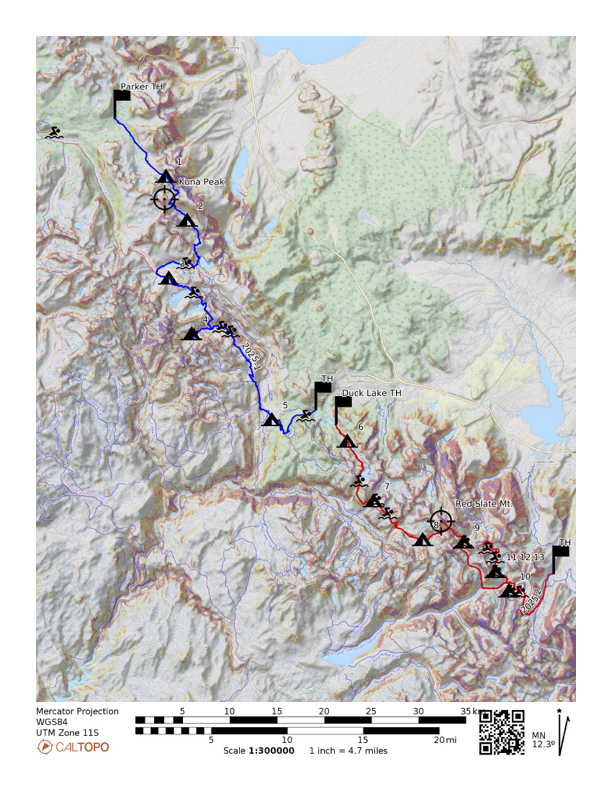
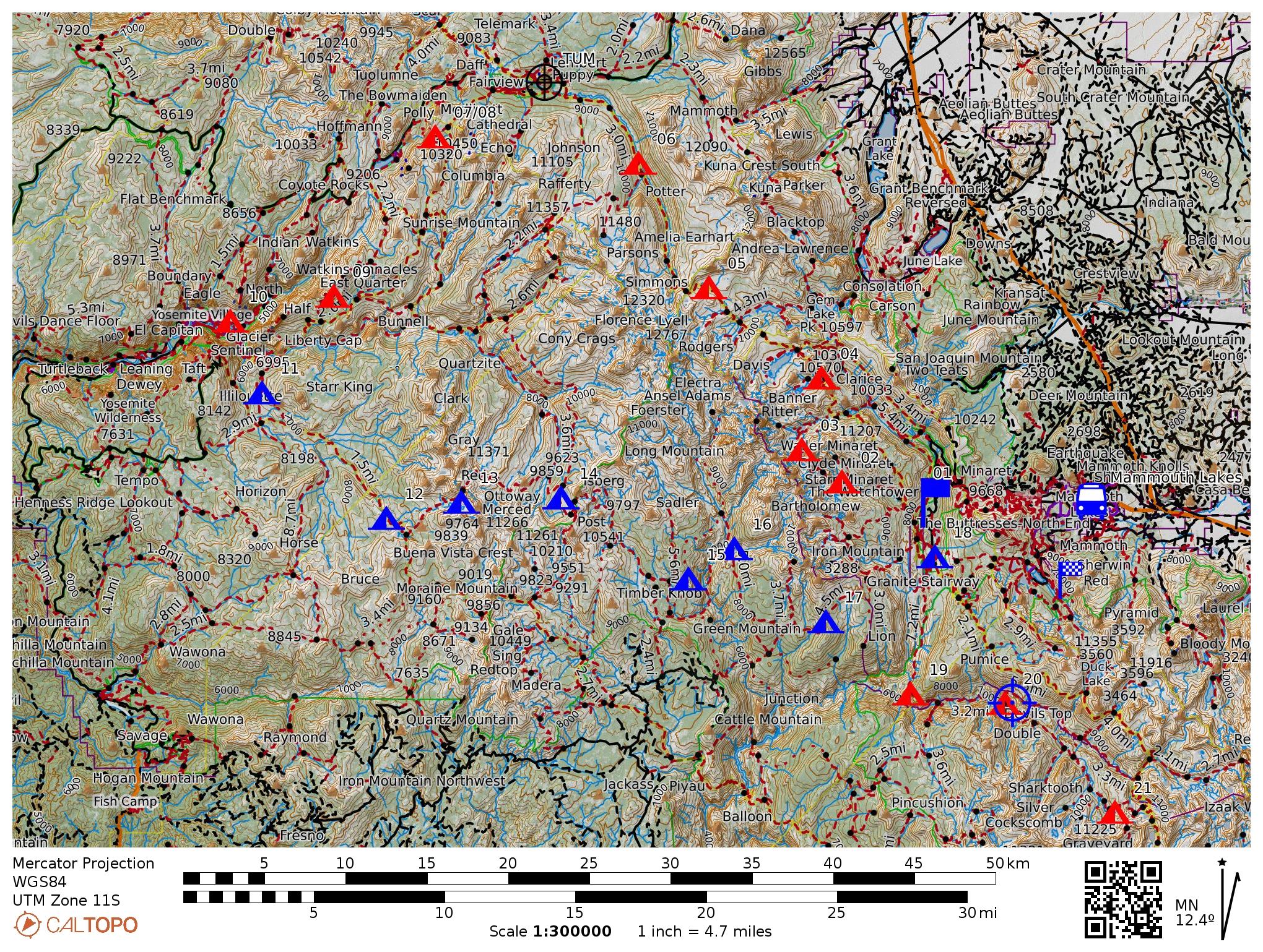
Tracks, camps, and swims during 2025 back-packing trip Aug. 9-22. Flags indicate trailheads with entry in Yosemite National Park in the north (blue track) and John Muir Wilderness in the south (red track). Crosshairs are at Kuna Mountain (13,008′ or 3965 m) in the north and Red Slate Mountain (13,135′ or 4002 m) in the south. Right panel is a close up of McGee Pass, Red Slate Mountain, Hopkins Pass, and Pioneer Basin.

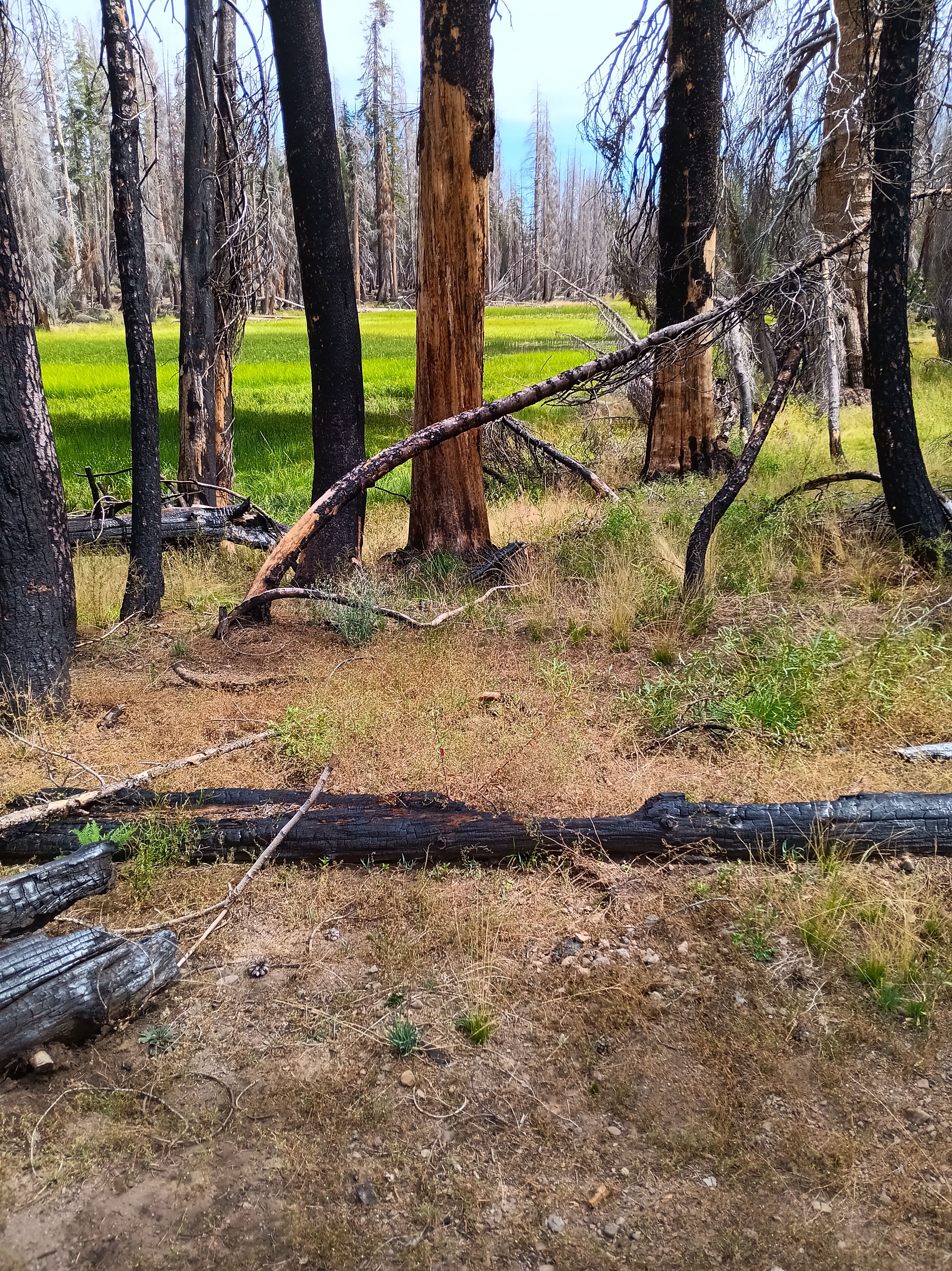
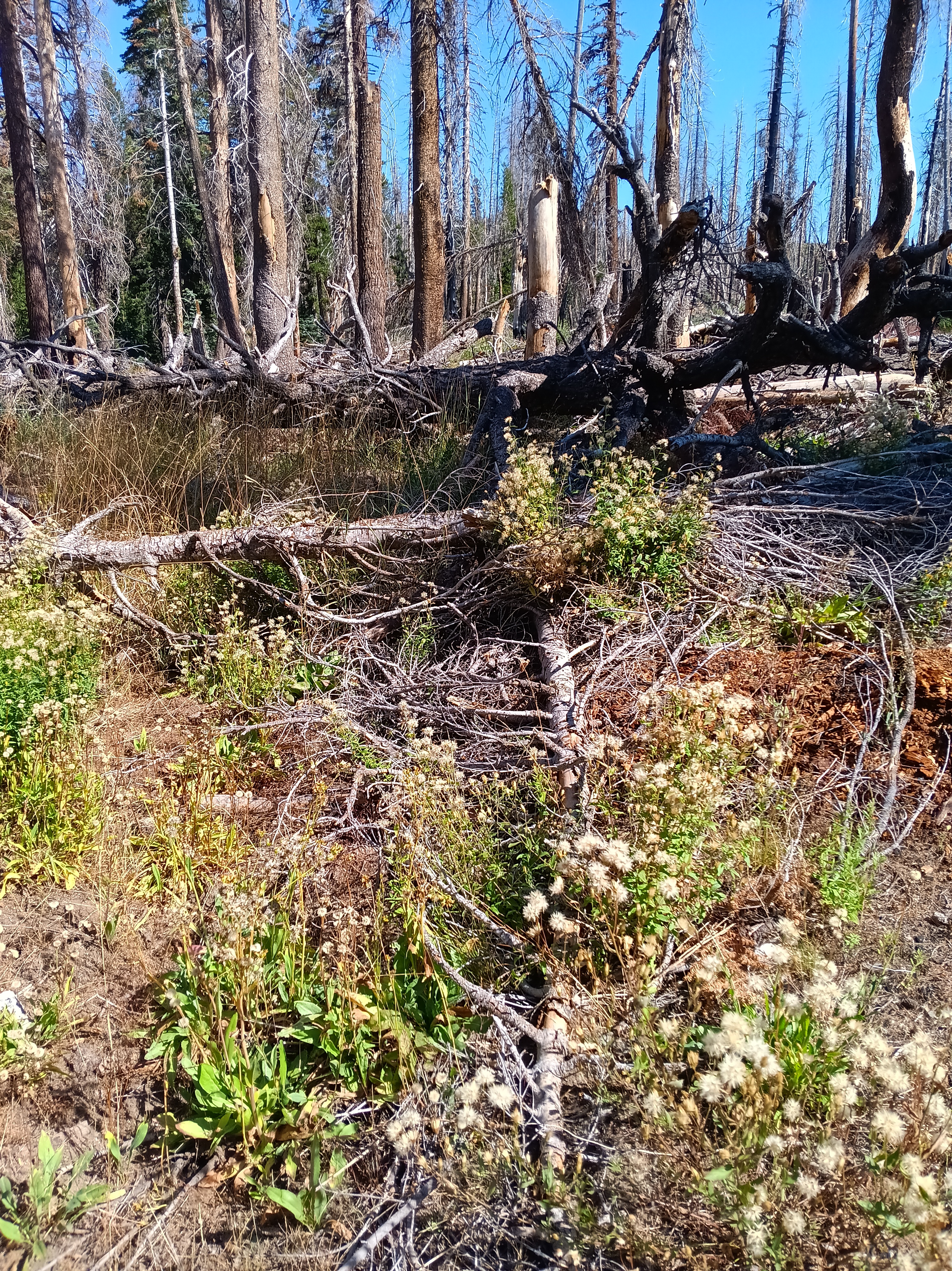
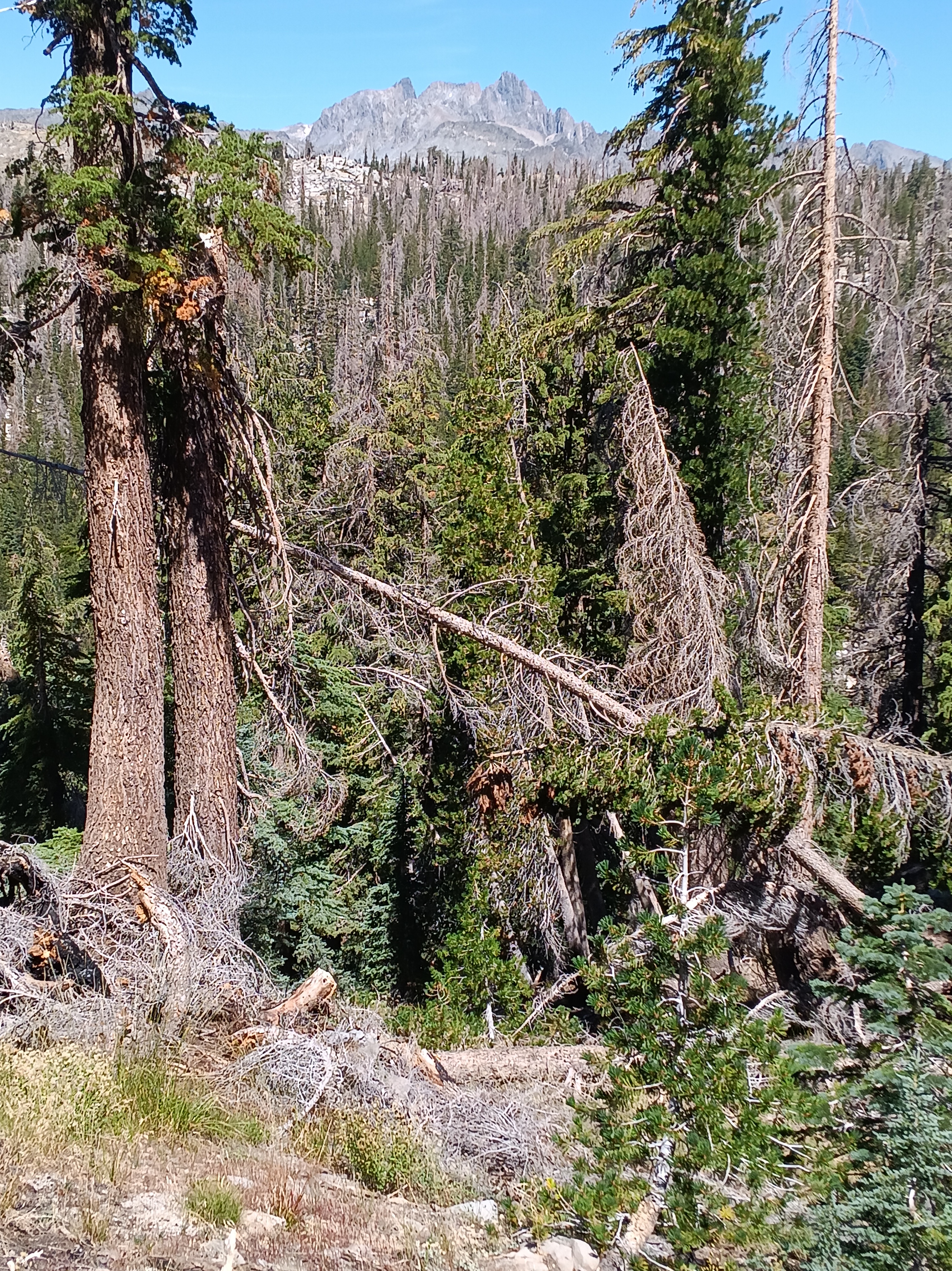
Pavla encouraged me to get into Pioneer Basin which she described as a wild, beautiful, and flatish place with many lakes and no trails. And so it was my home for 3 days and nights. The lack of trails scared me at first, because my 2024 California hike challenged me when my trail disappeared for 3 days in Ansel Adams Wilderness. The “trail” was there in theory, but it was overgrown by waist high brush, young trees, leave piles, and fallen trees after several forest fires raged through the area 10 or 20 years ago. This was at lower altitudes of 7,500′ (2300 m) and thus well below the treeline. In contrast, Pioneer Basin is above the treeline near 11,000′ (3300 m) and surrounded on 3 sides by high mountains to ease navigation. Nevertheless, it was tricky to reach from the north-west, because I had to cross two high passes only one of which had an established trail.

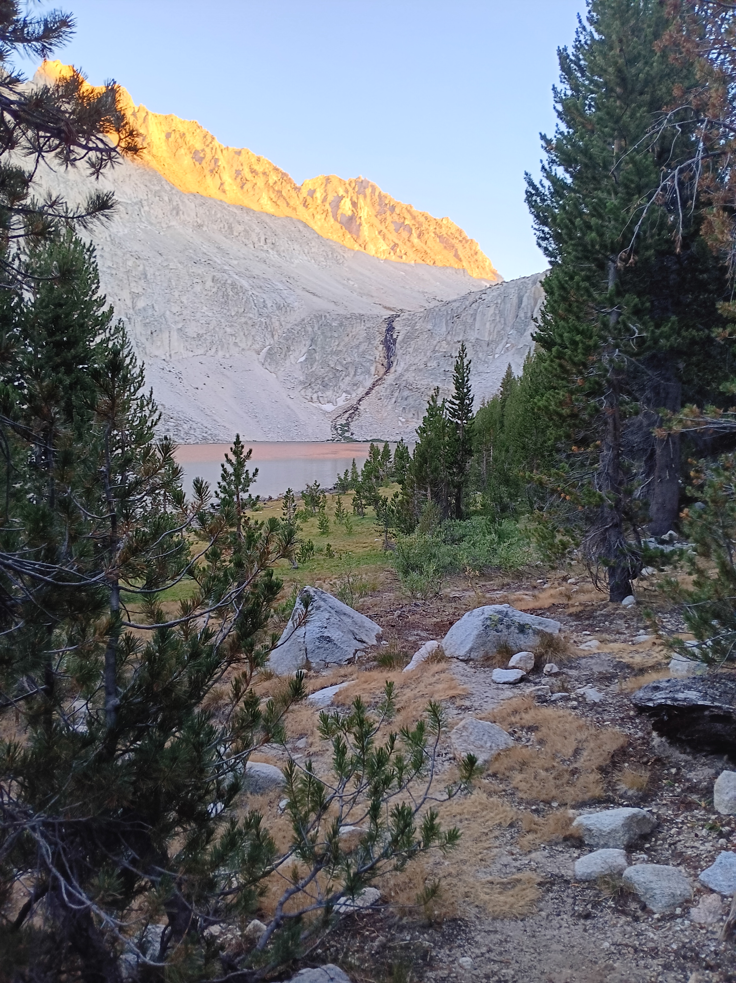
McGee Pass came first after hiking down to and then up Fish Creek to its origin below the snow fields of Red Slate Mountain. I hiked loosely with two parents my age and their grown two daughters and their dog. I had met them 3 days prior climbing up to Duck Lake and we kept meeting each other on the trail with few other people. We had lunch together atop McGee Pass at 11,900′ (3600 m) when I decided to climb the mountain following yet another tip of Pavla. Without my backpack the climb up Red Slate Mountain was at first delightful, but later became steep and strenuous. Much to my surprise, I suddenly had cell phone coverage near the top and I sent photos to my wife Dragonfly back home. It felt strange and funny to sit atop high mountains talking to Dragonfly who was walking below tall skyscrapers near Manhattan’s Fifth Avenue. She was not eager to talk, because she tried frantically to escape rain and traffic with a group of friends. Her husband, meanwhile, sits mellow atop the worlds with nearby clouds and far horizons as his only companions:

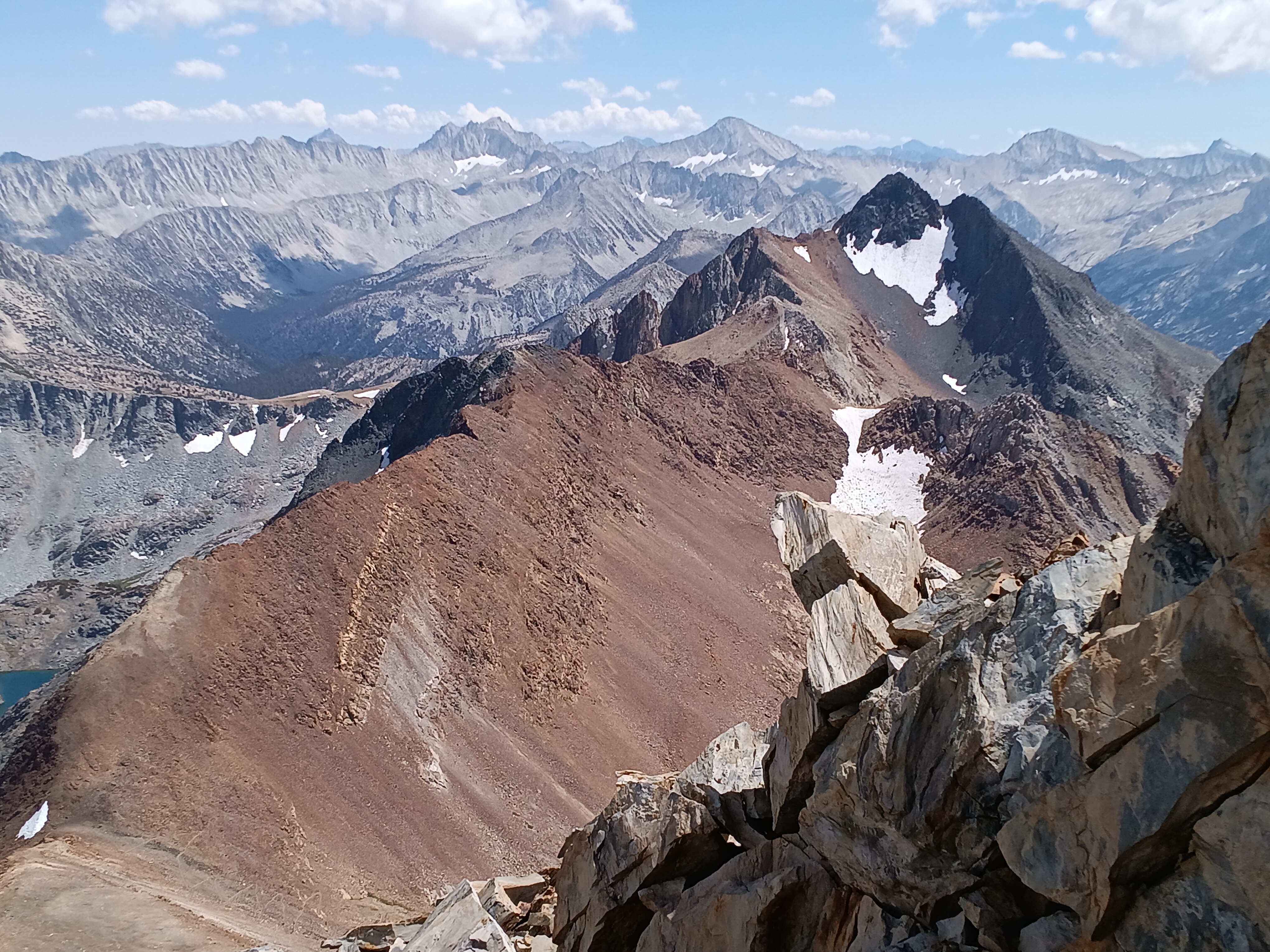
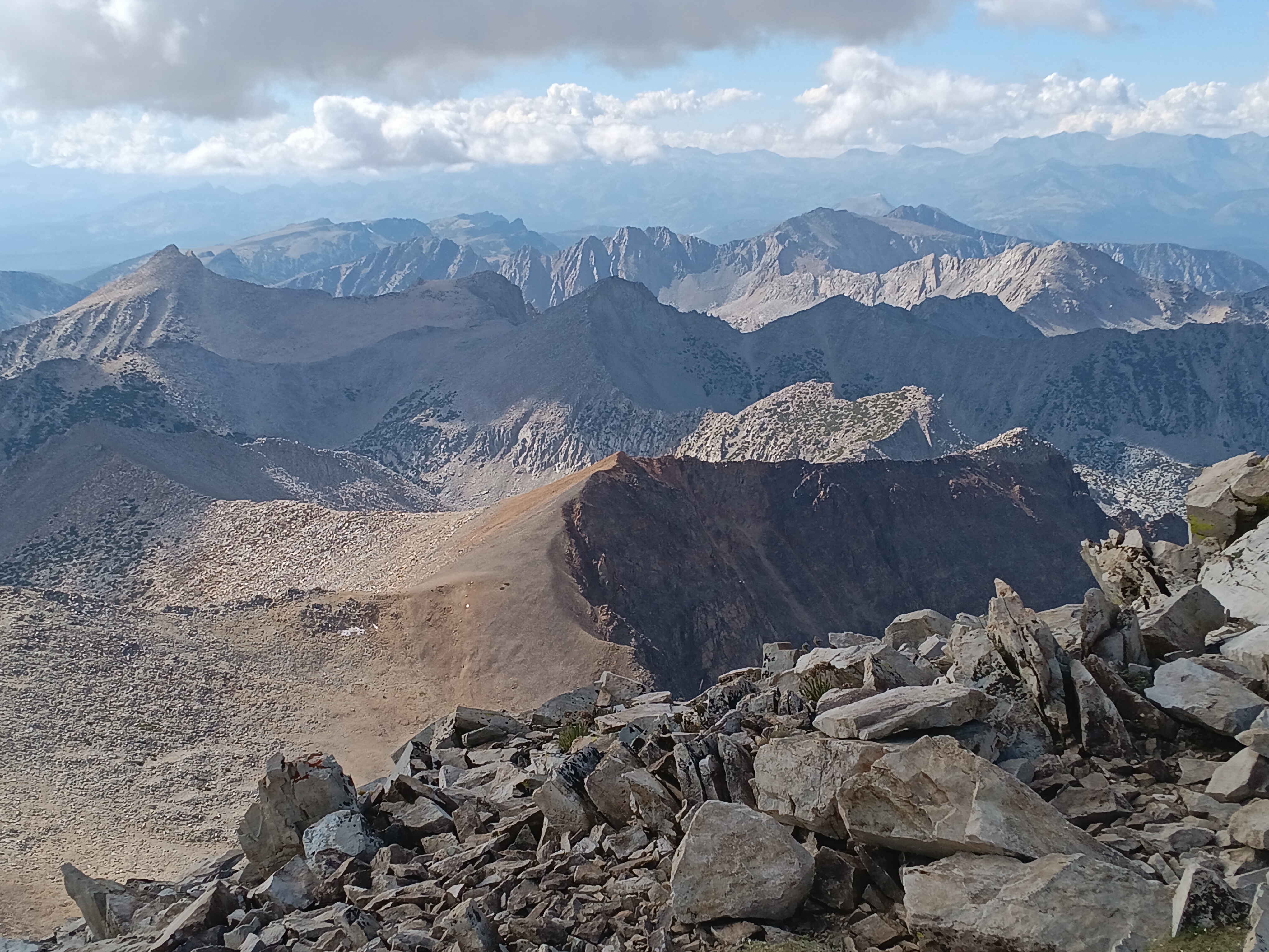
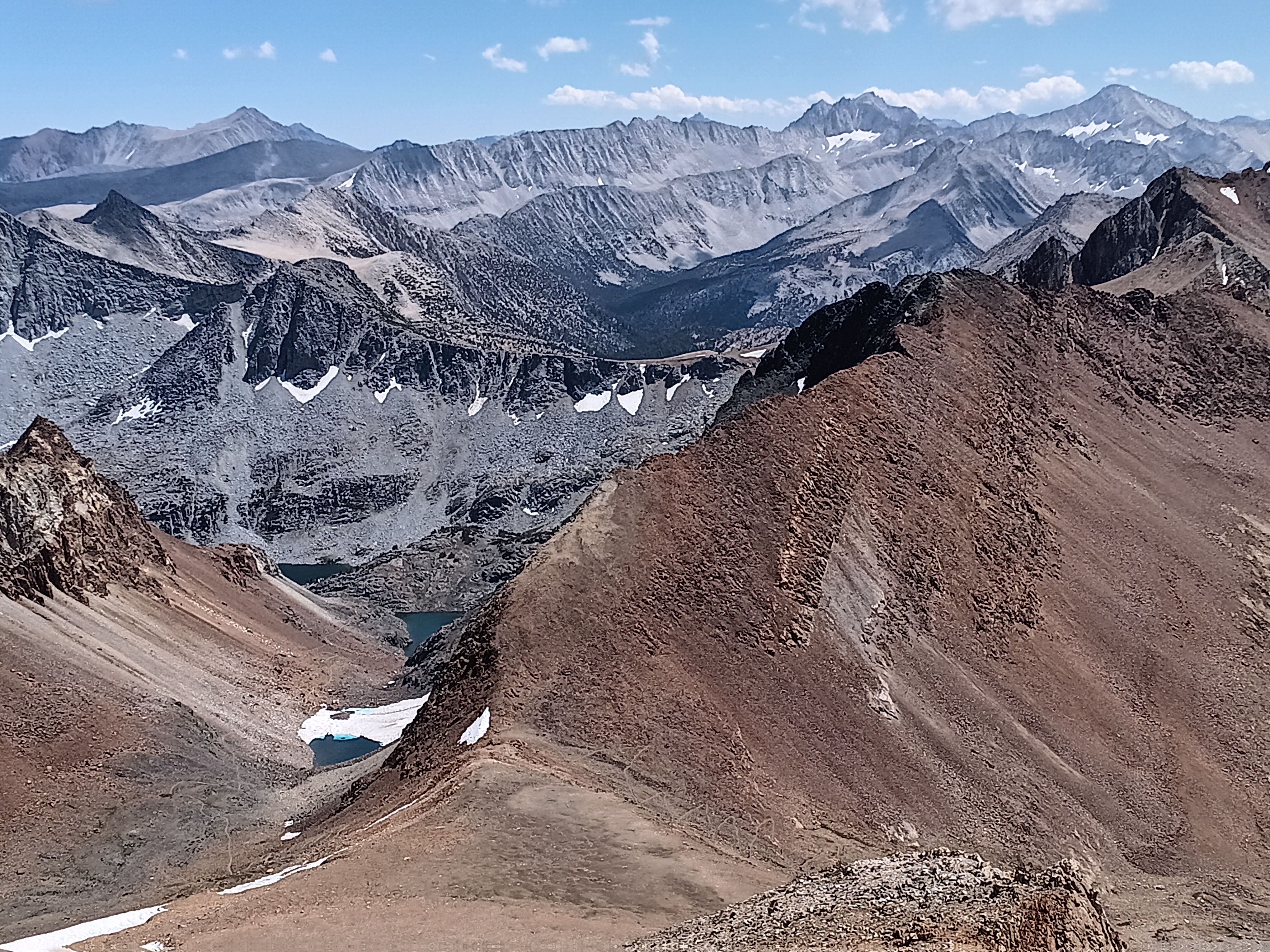
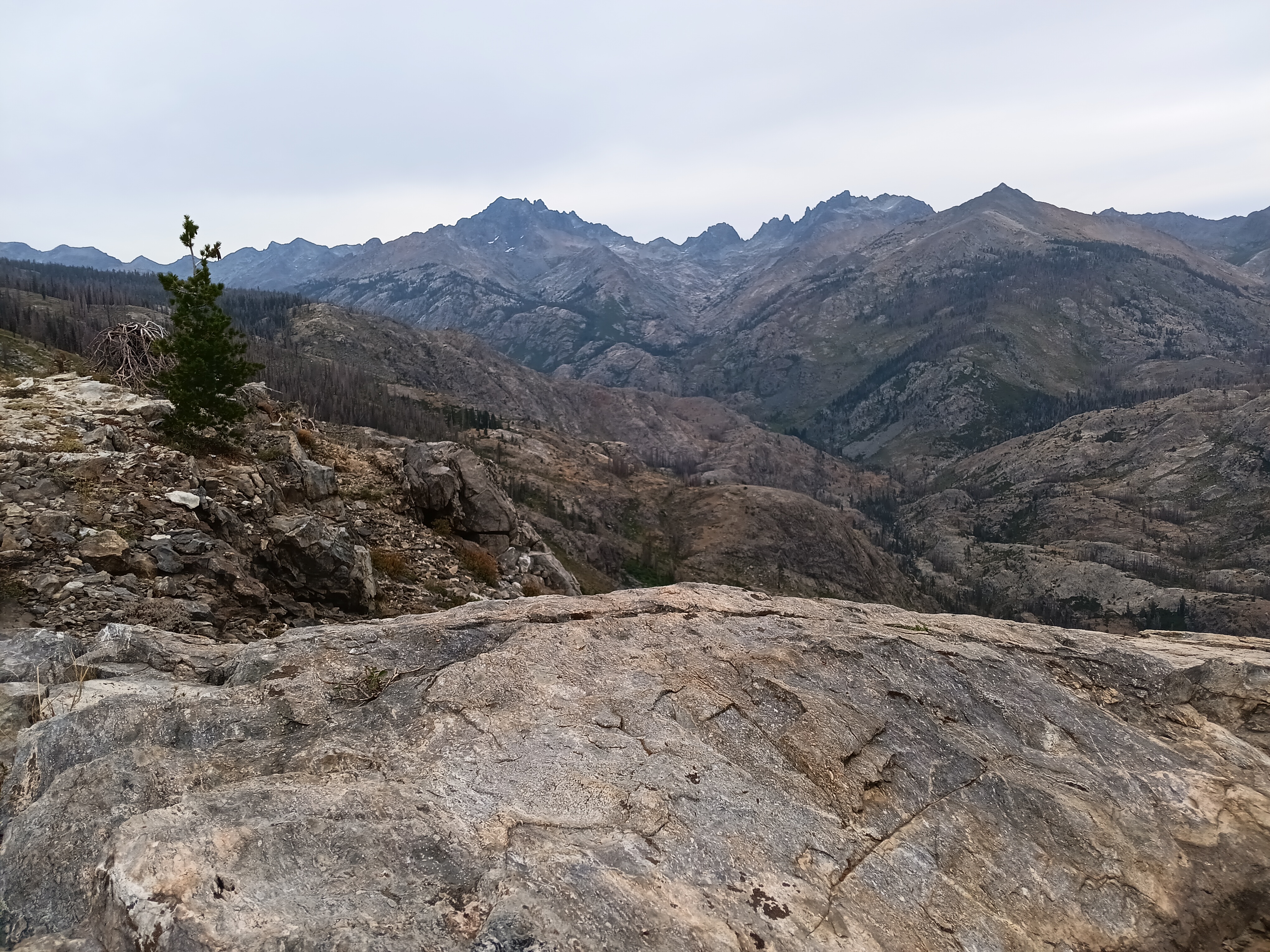
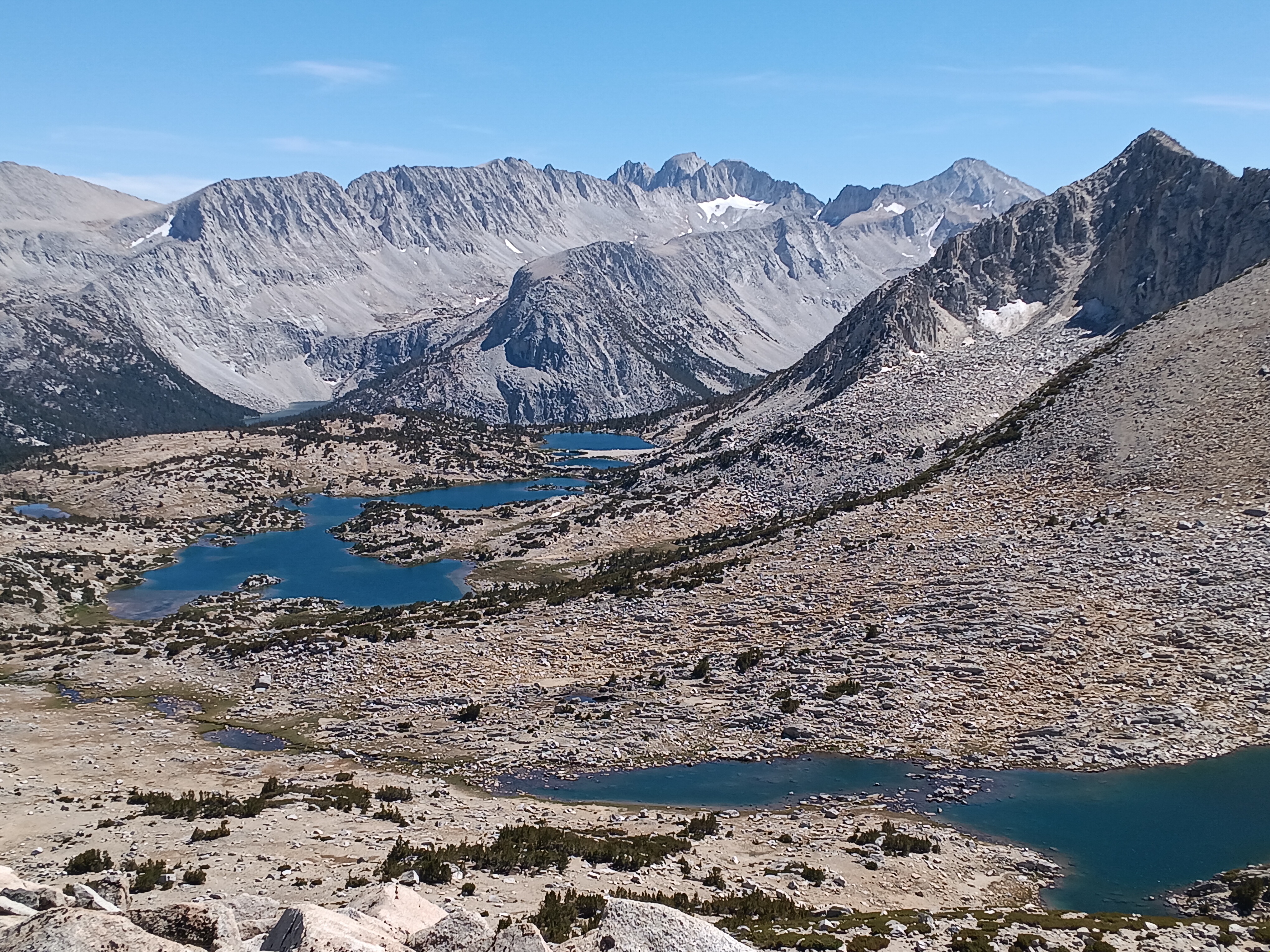
Lunch at McGee Pass (top left) and views from Red Slate Mountain towards Red and White Mountain (top right), towards north into Yosemite (center right), and towards south (bottom). The bottom photo shows three lakes with a faint path on the left and a zig-zag path up to McGee Pass on the right. The mountains in the far back are Mills, Abbott, and Dade Mountains that merge together at the end of the long ridge that bounds Fourth Recess. I crossed all these ranges the next 5 days to exit via Mono Pass to the east (left) of Fourth Recess. Hopkins Pass crosses the lower center ridge near a triangular snow patch. Pioneer Valley is to the left (outside frame) of the wooded Hopkins Valley. [Aug.-17, 2025.]

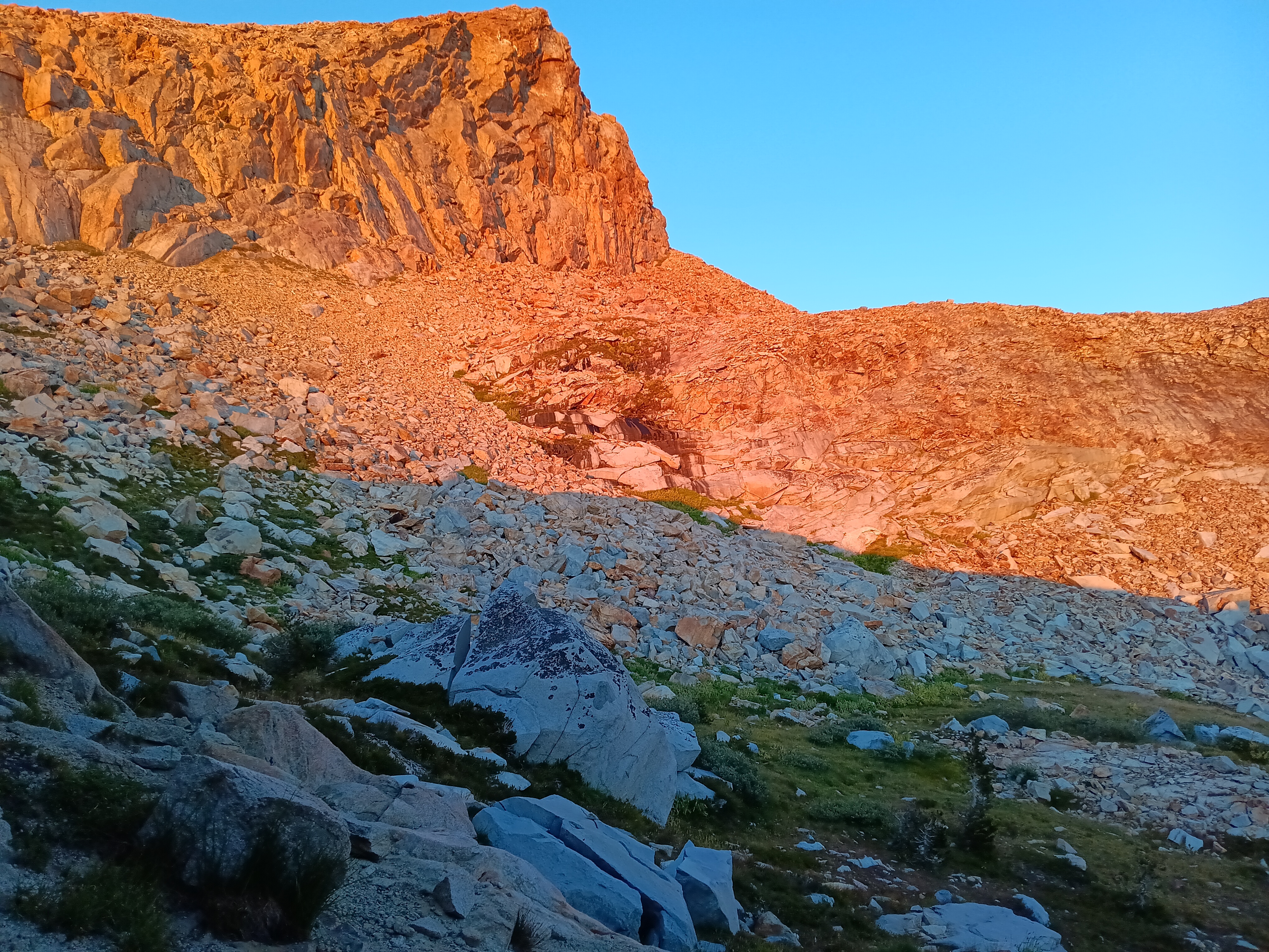
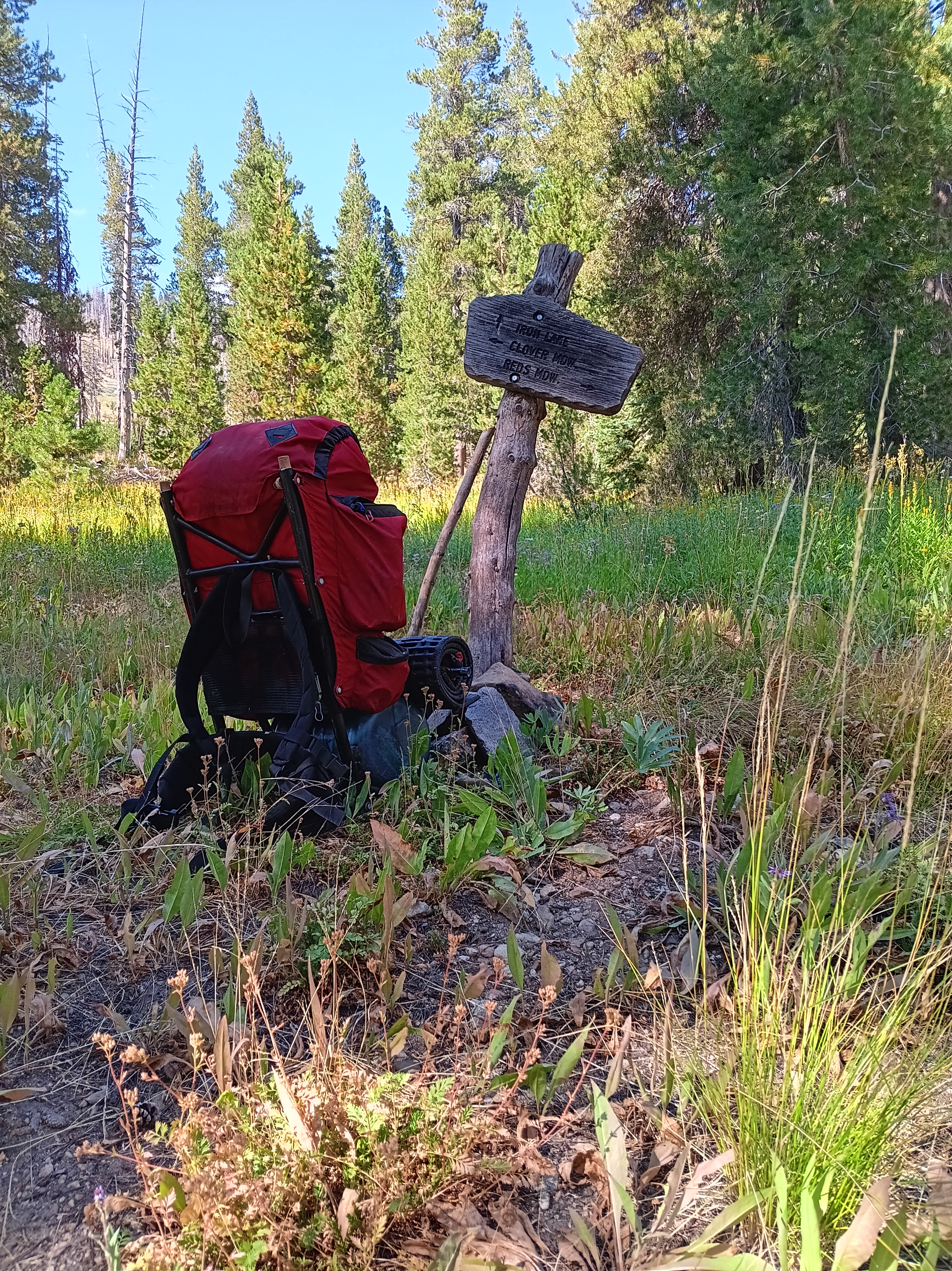
When I came down the mountain and reached my campsite at the lowest lake in the photo above (Big McGee Lake) it was 7 pm. I met my earlier hiking companions, told them about my adventures atop the mountain, and went for a swim just as the sun set for the day. I slept well that night, but got up early to climb over Hopkins Pass along a sketchy, barely existing path. Detailed descriptions of the route I found in Backpacking from McGee Creek to Pioneer Basin via Hopkins Pass by Inga Aksamit. She also moderates an outstanding Facebook group on the John Muir Trail that I used for my 2024 backpacking trip. Thanks to this guide the crossing of Hopkins Pass went well. It included an almost vertical scramble up a cliff on all fours to reach a tiny ice cap near the top.

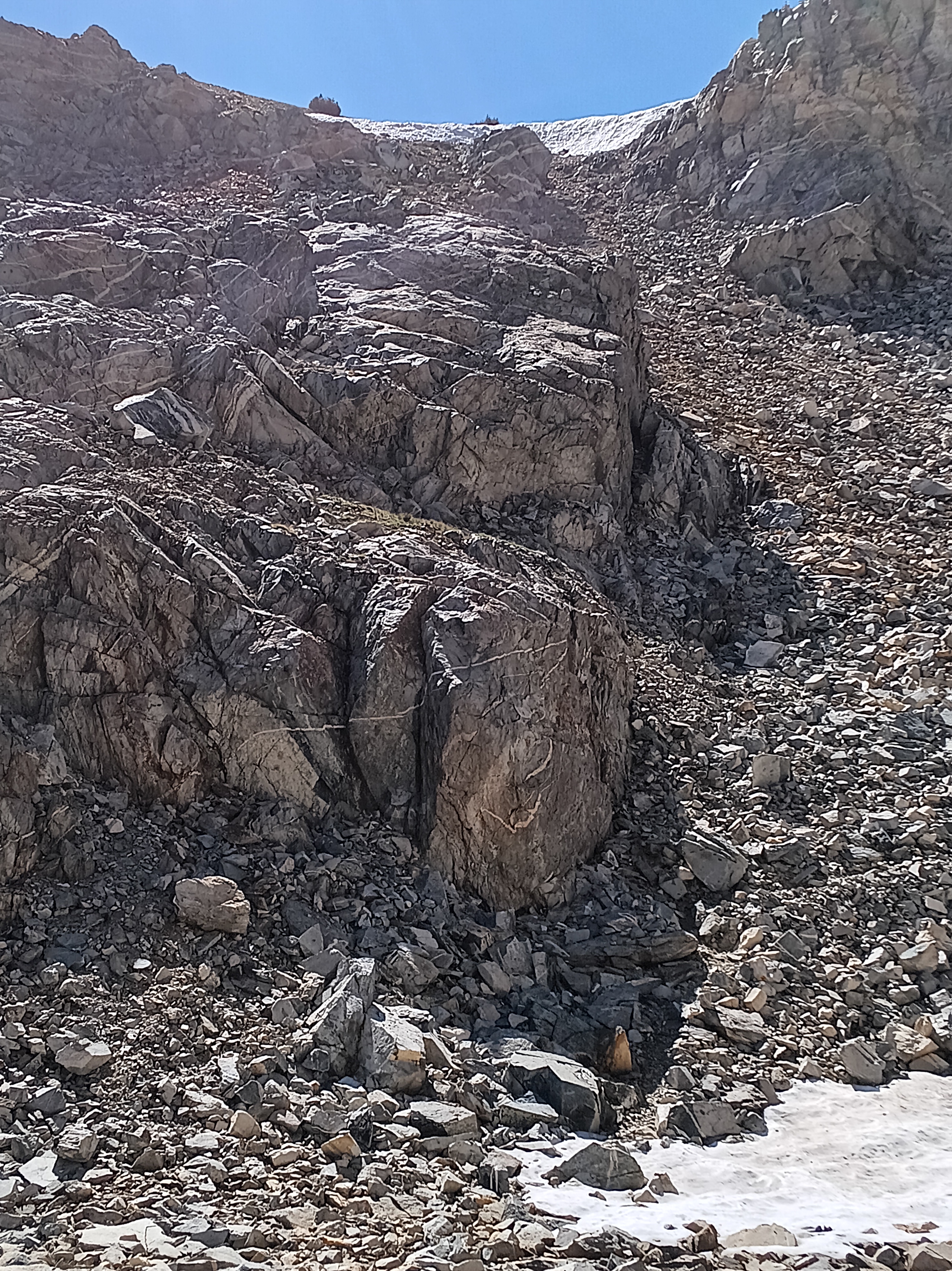
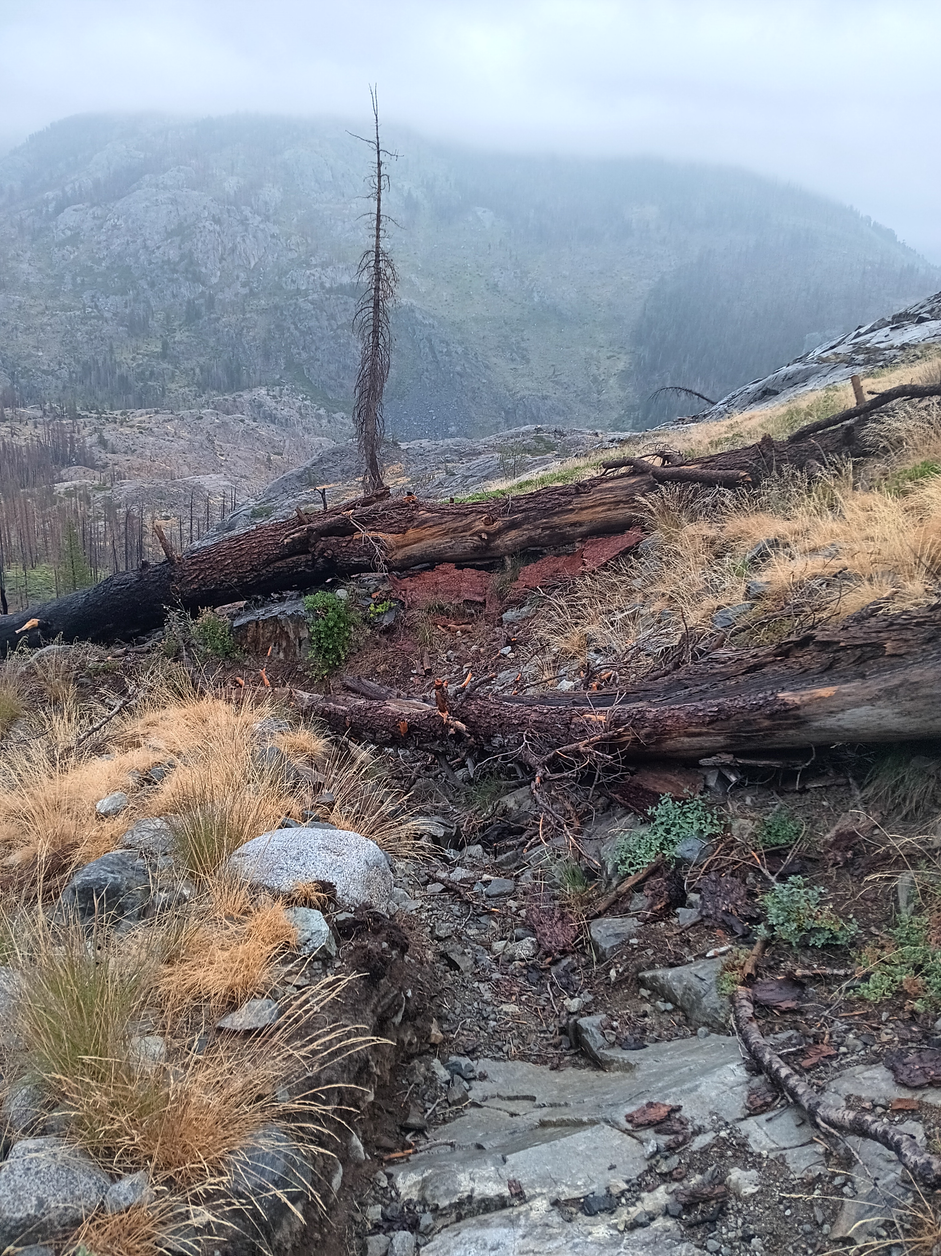
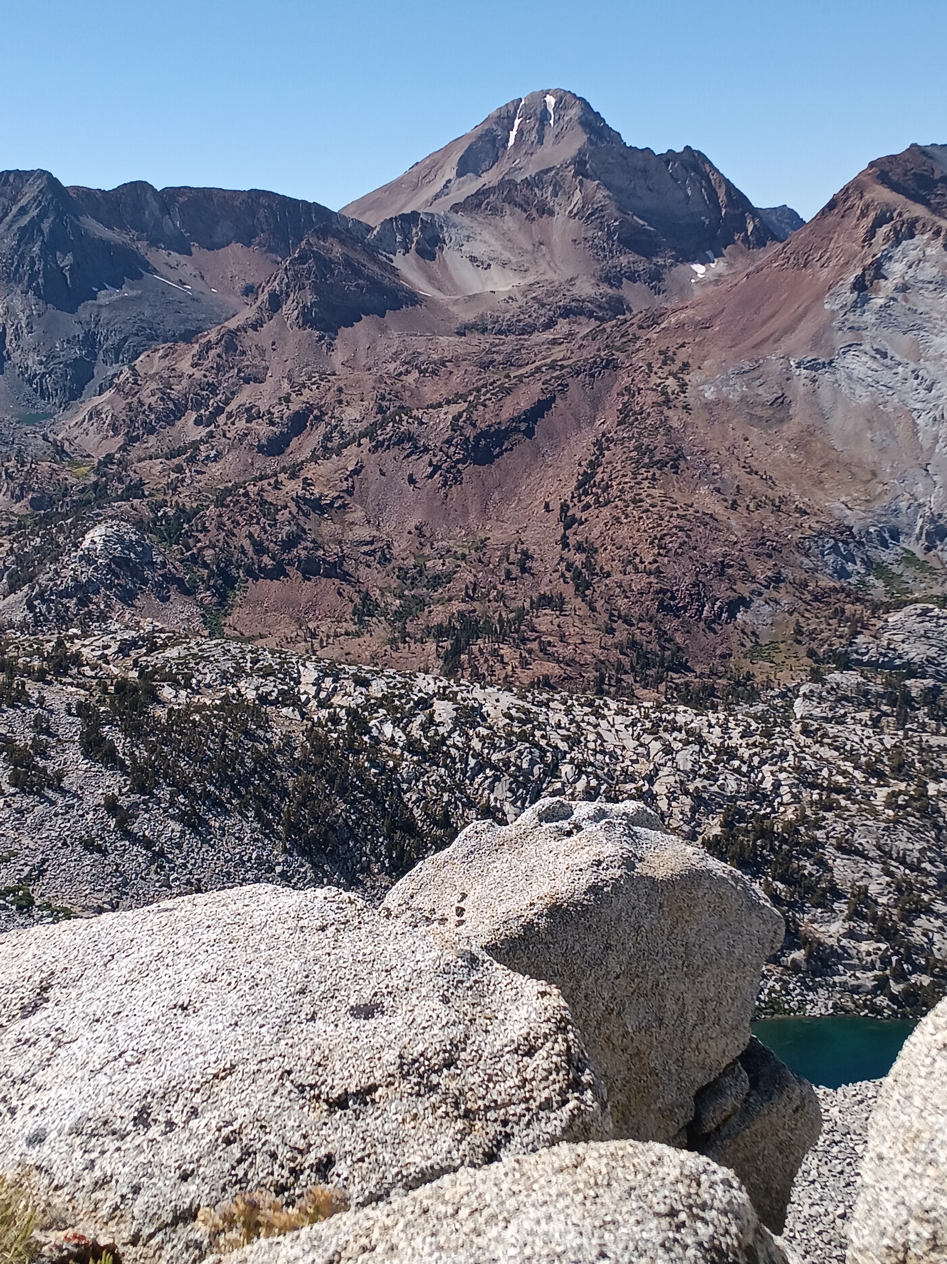
The last 400′ (120 m) of Hopkins Pass at 11,470′ (3500 m) up a bouldery cliff with a snow wedge above (left) along with views from the top such as Red and White Mountain (top right) and towards my campground at Bigh McGee Lake (bottom right). [Aug.-18, 2025.]

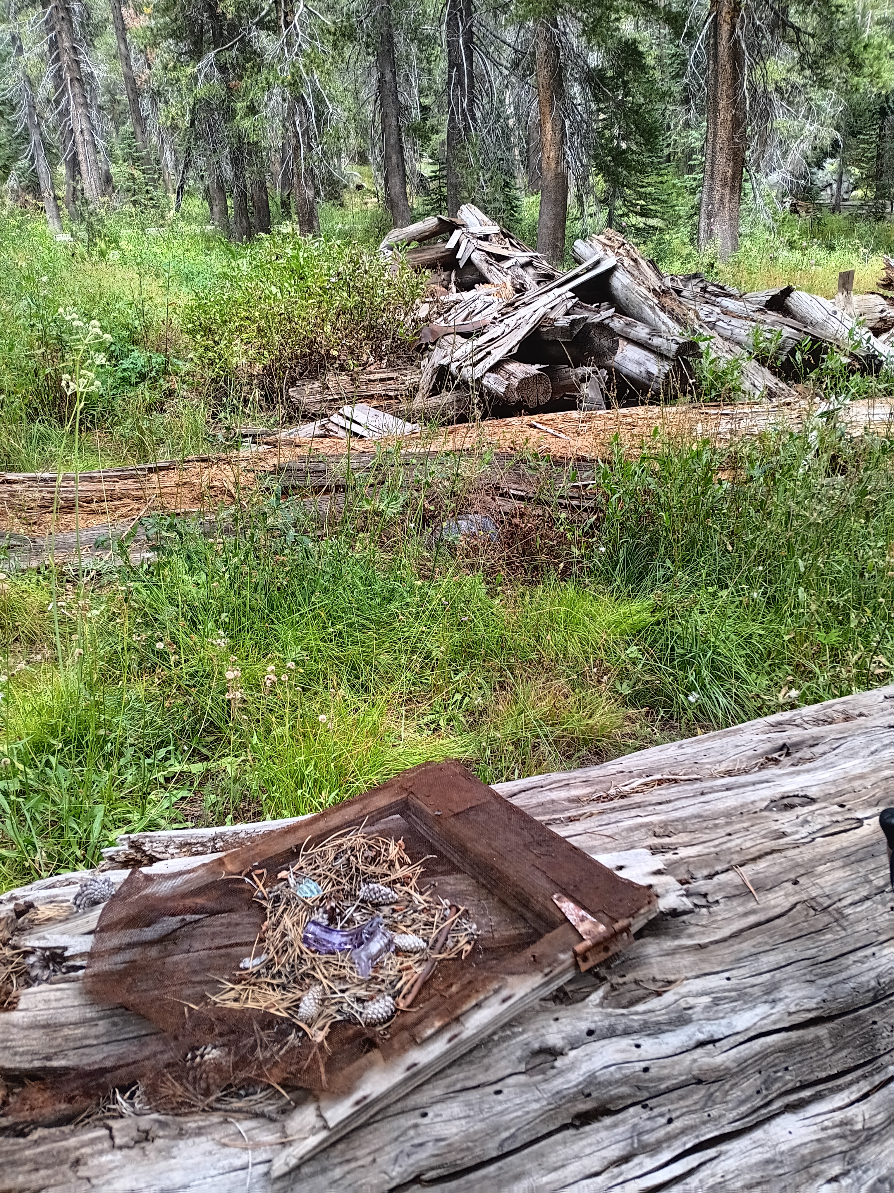
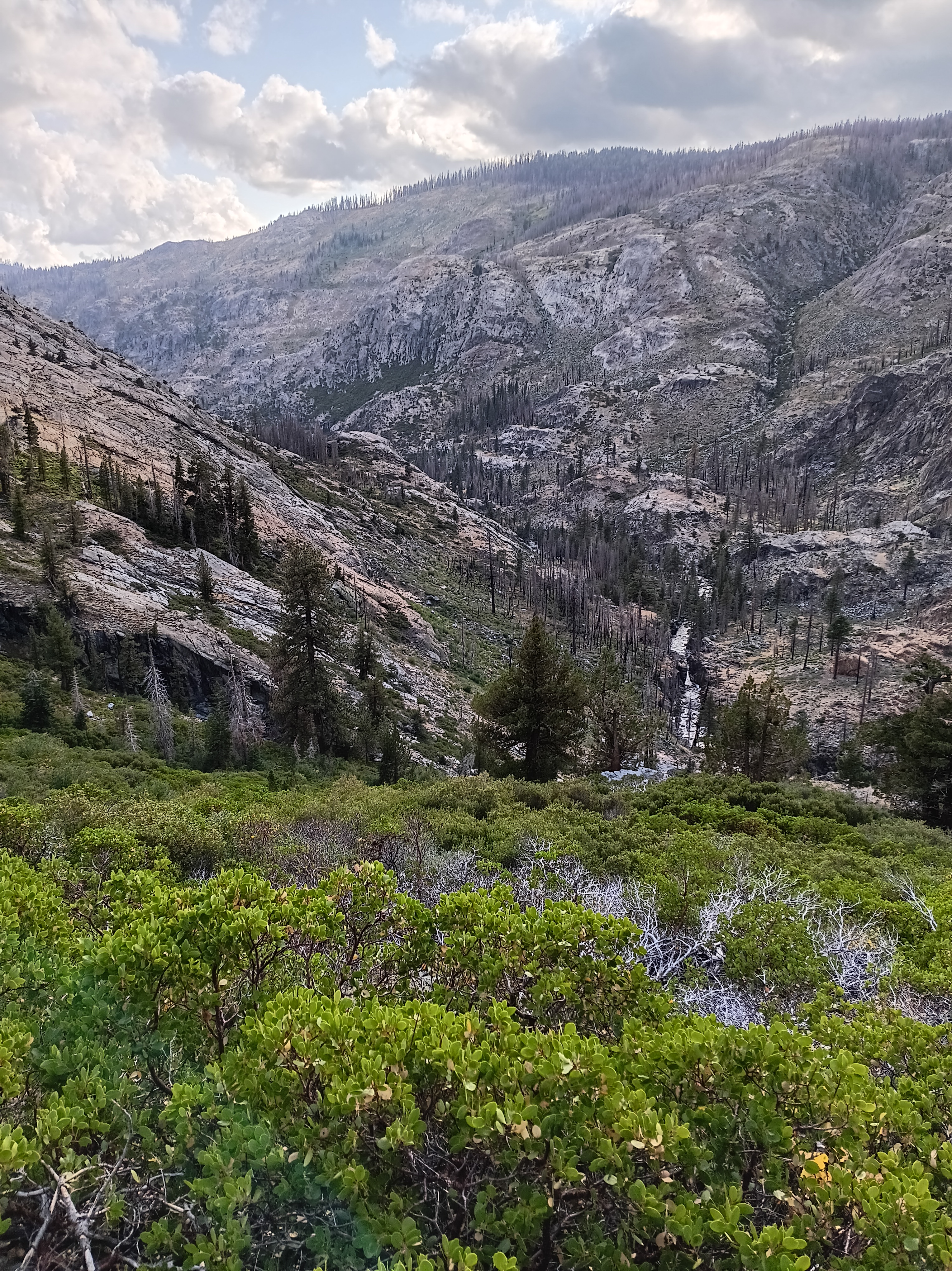
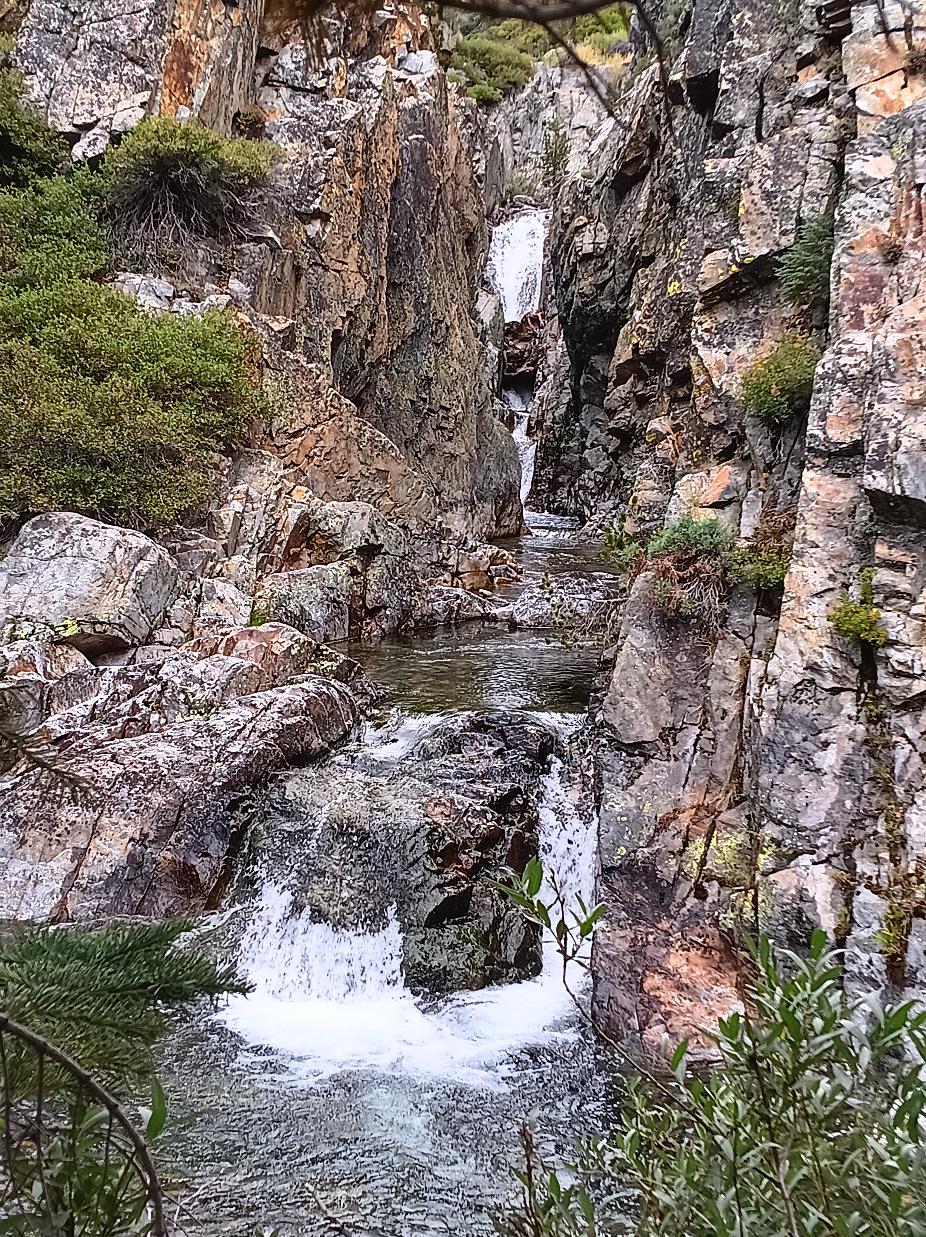
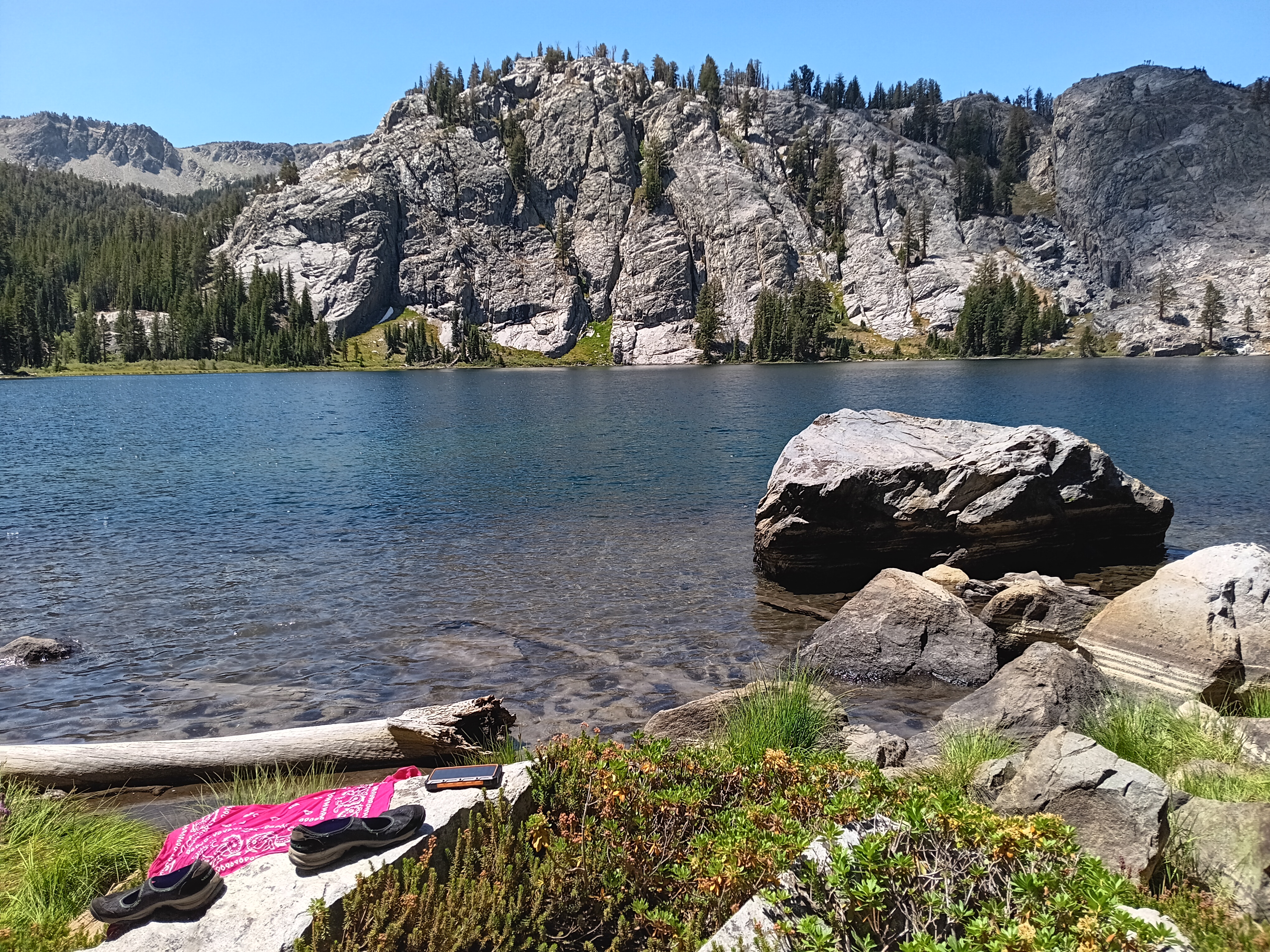
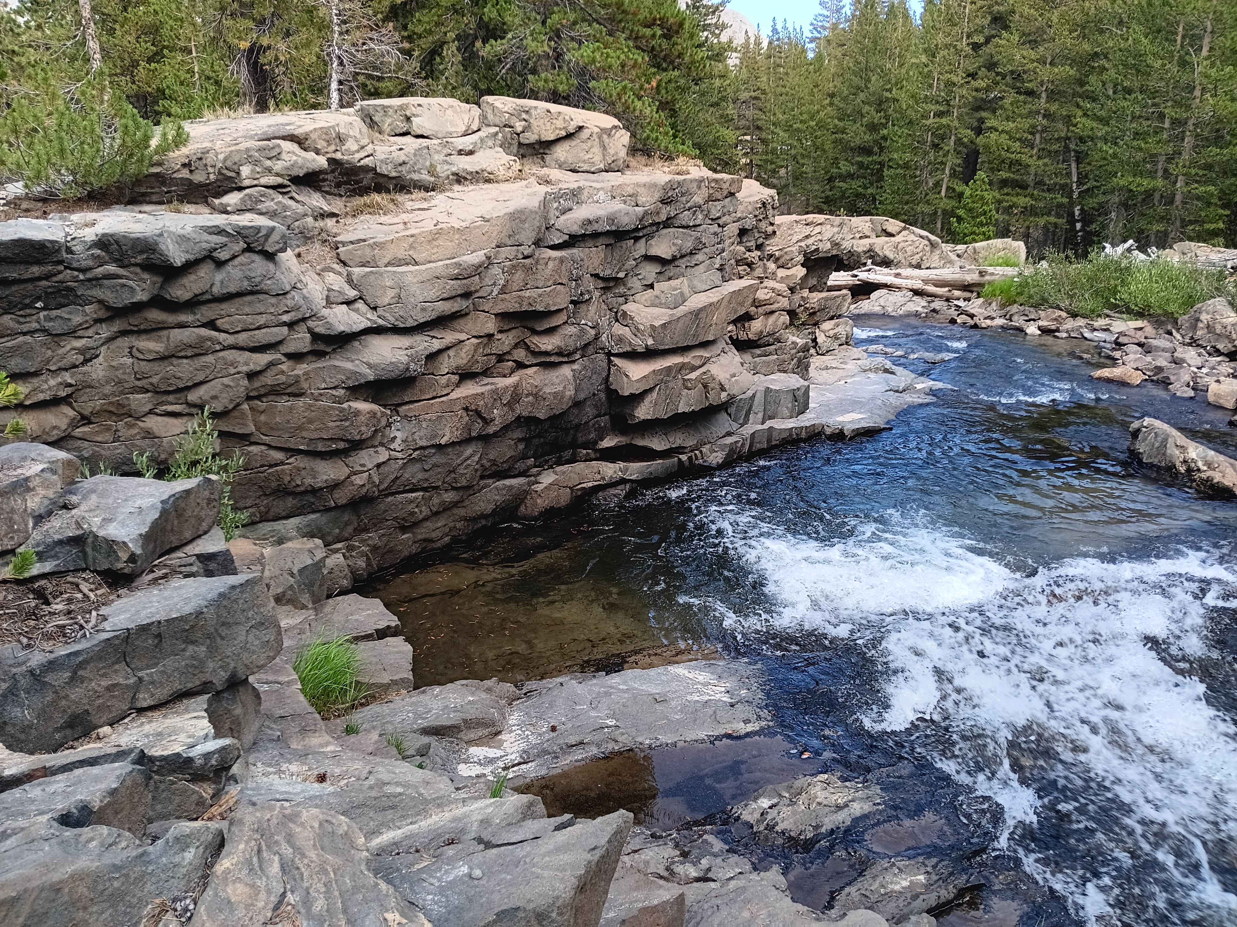
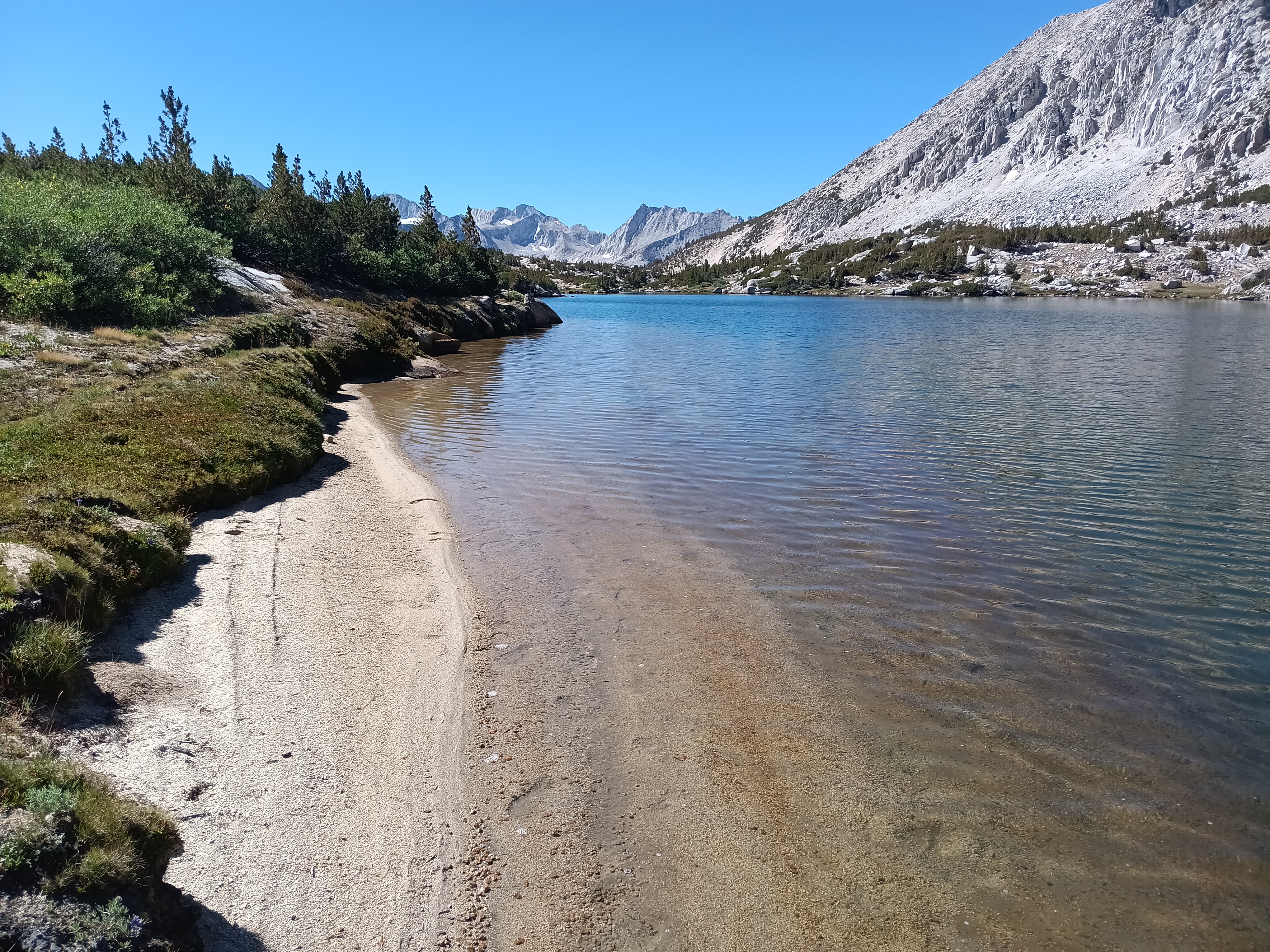
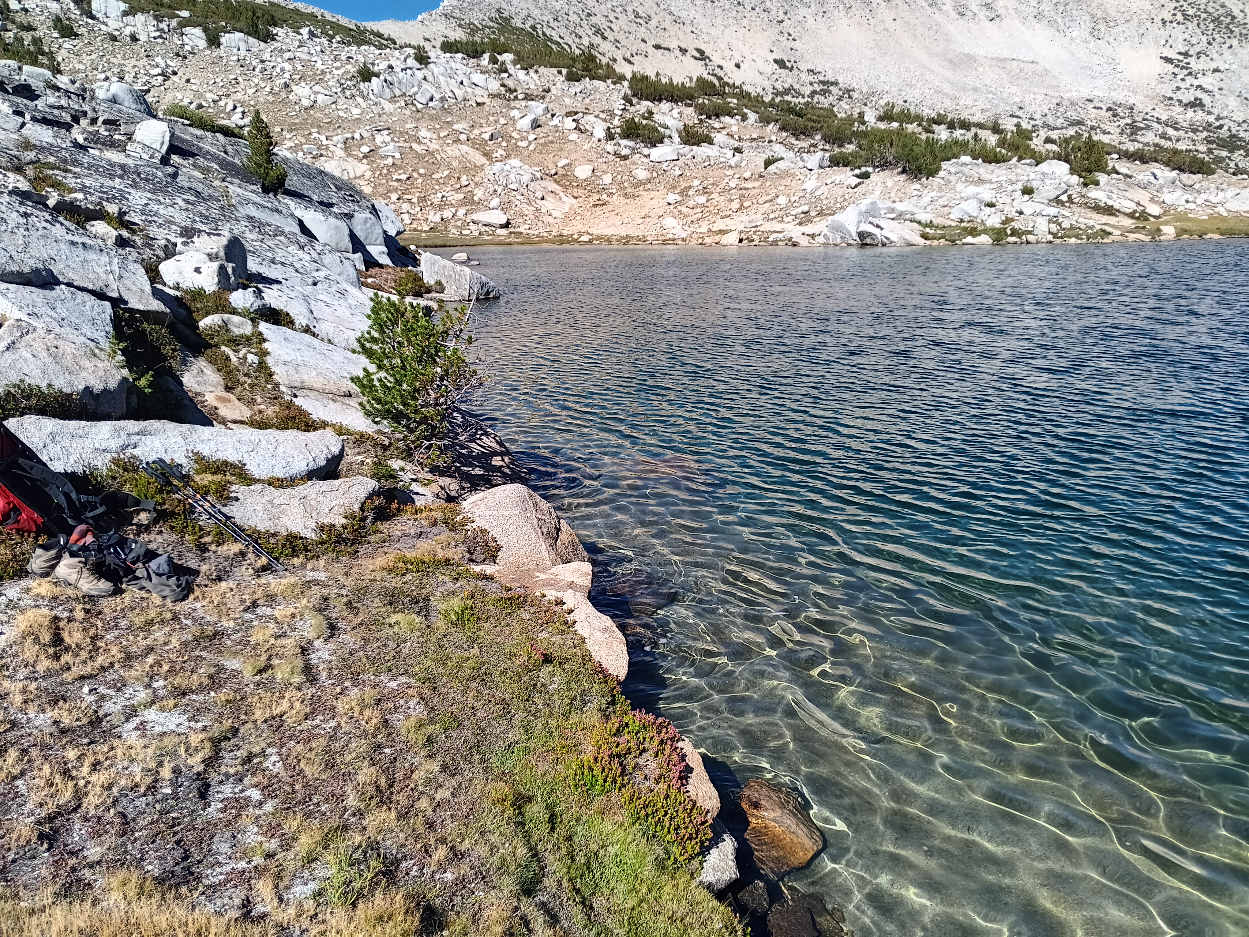
Heading down Hopkins Valley without a trail or difficulties, I reached Mono Creek at 9,300′ (2800 m) in the afternoon. I navigated an unexpected cliff above the treeline (easily done) and a massive pile of fallen trees (harder) that forced me to bush-wack for an hour. Escaping the mosquito infested Mono Valley, I camped a mile uphill at the georgeous Fourth Access Lake. It featured an outstanding and flat campground in the pines with views of lake, mountains, and waterfall; someone even had made a most comfortable bench out of wood. The lake was nearby and I had both an evening and morning swim before heading into Pioneer Basin. The Lake was also stoke full with trout:

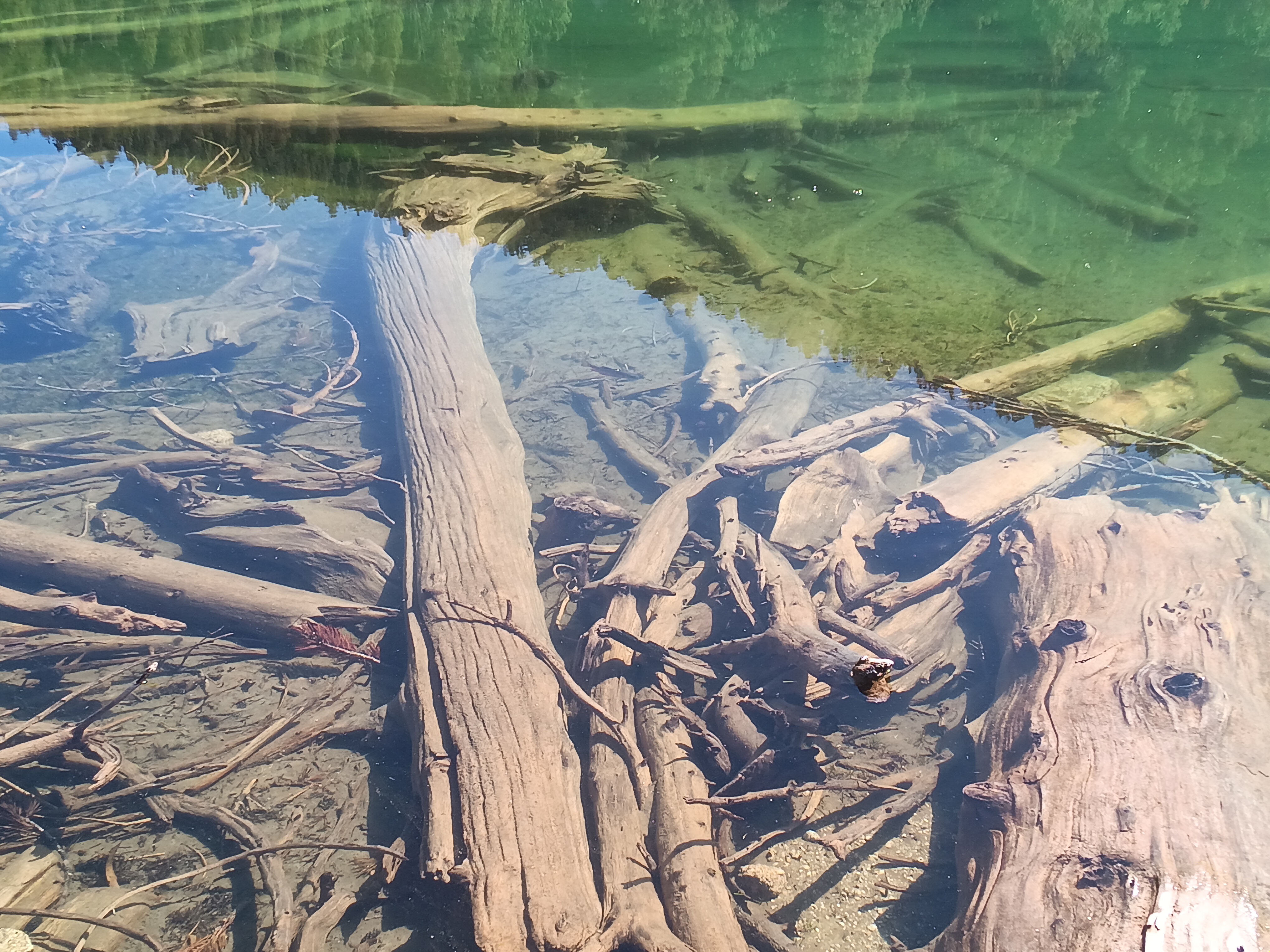
Campground at Fourth Recess Lake (top left), my swimming spot among the wooden logs and trout (bottom left), and the view from my camp (right panel). Two people camped on the other side of the lake. [Aug.-19, 2025.]

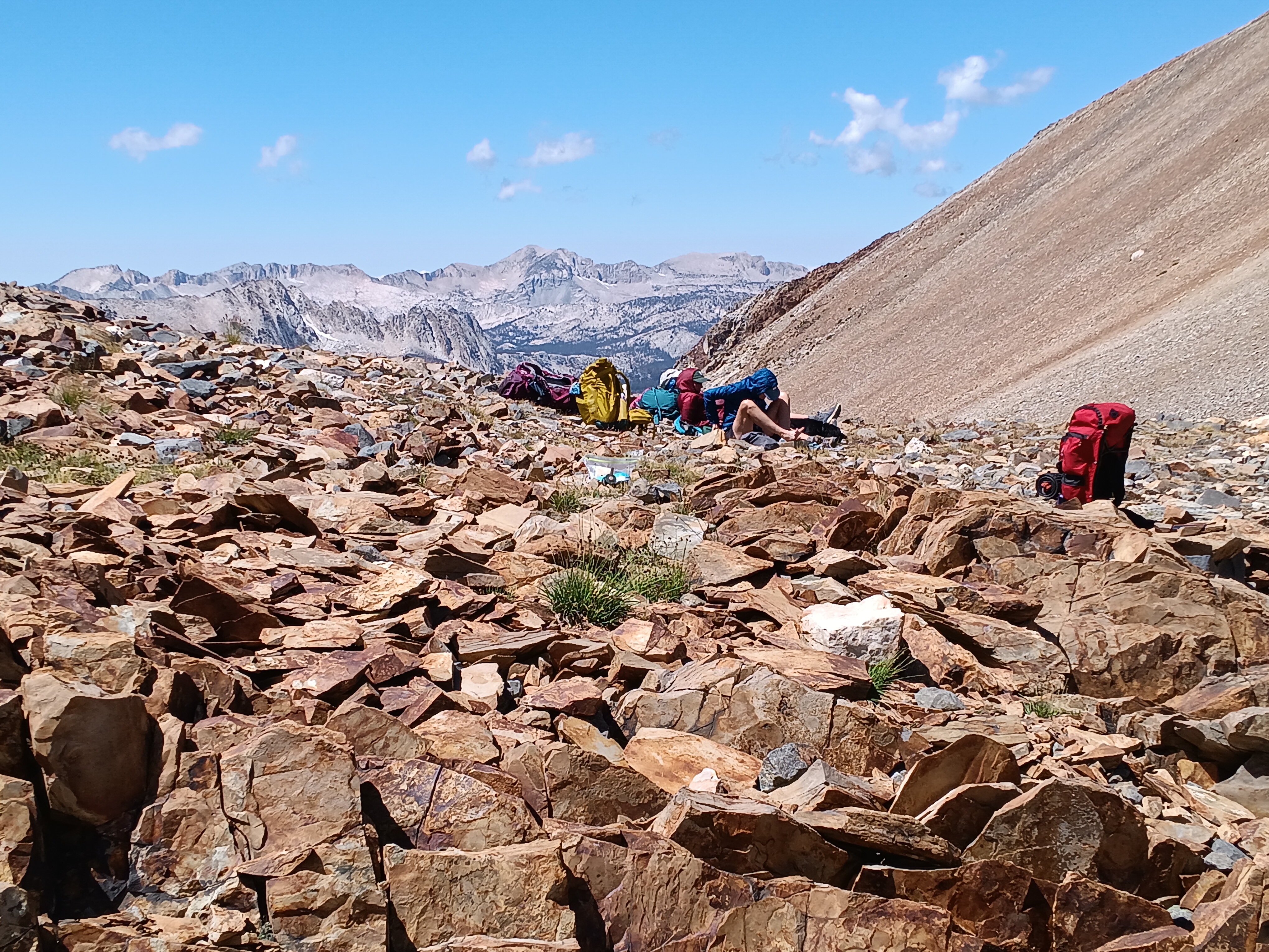
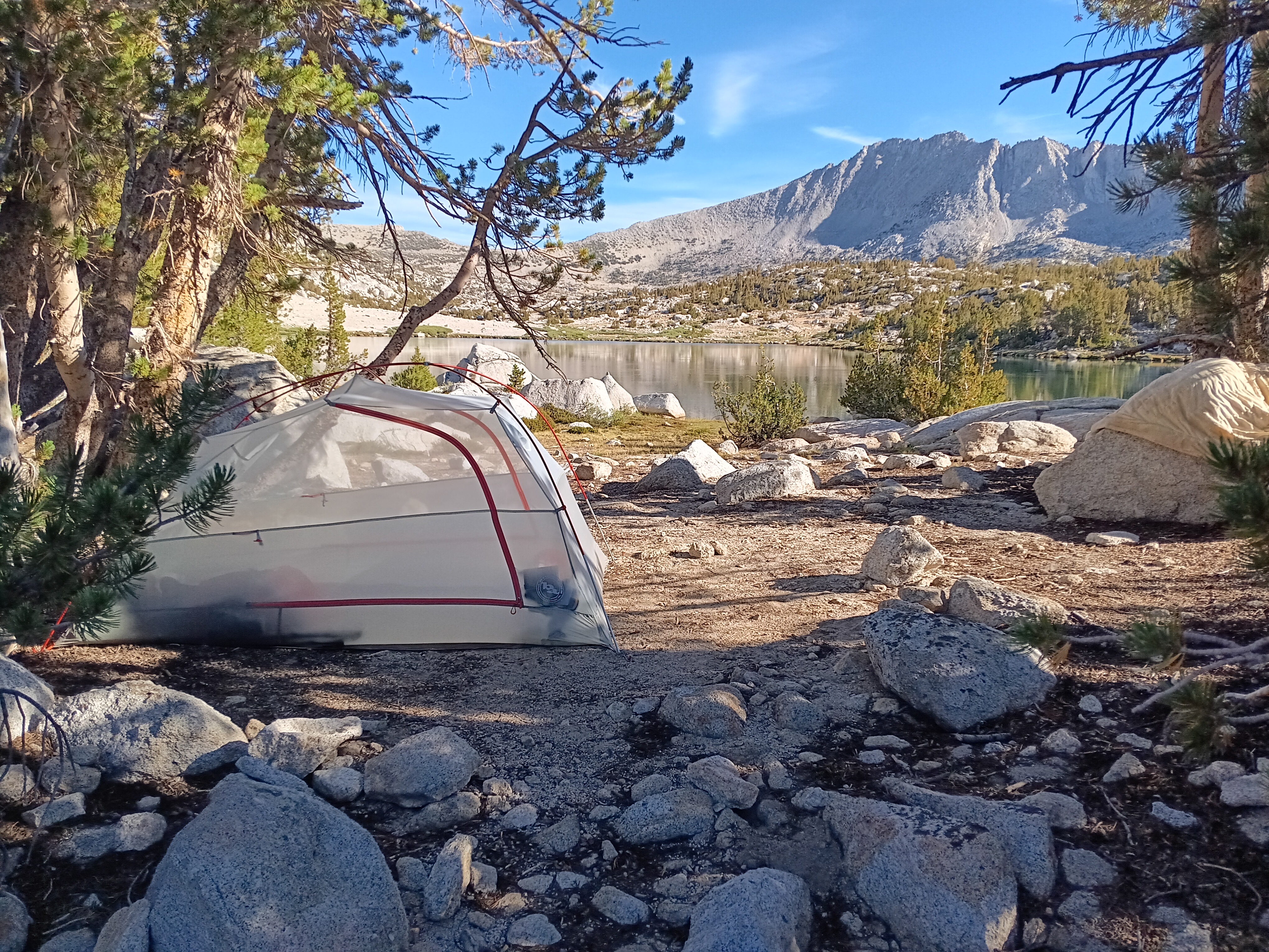
A short 3 hour walk the next morning got me to Pioneer Basin where I dropped my backpack at 11 am to spent the next 2 hours looking for a place to pitch my tent for the next 3 nights. It was surprisingly hard to find the right spot, but I found it after talking to a young man in his mid 30ies who had just “skied” down Hopkins Peak. Inspired by him, I did something similar the next day, but first he helped me find a good camping sites. I generally like to sleep under trees, pine trees in particular, and I was looking for a shady spot as it was warm and I intended to do some dozing after swimming in the nearby lake. Again, I had many trouts for watching and company, but back to the skiing I did the next day down the upper reaches at Pioneer Basin:

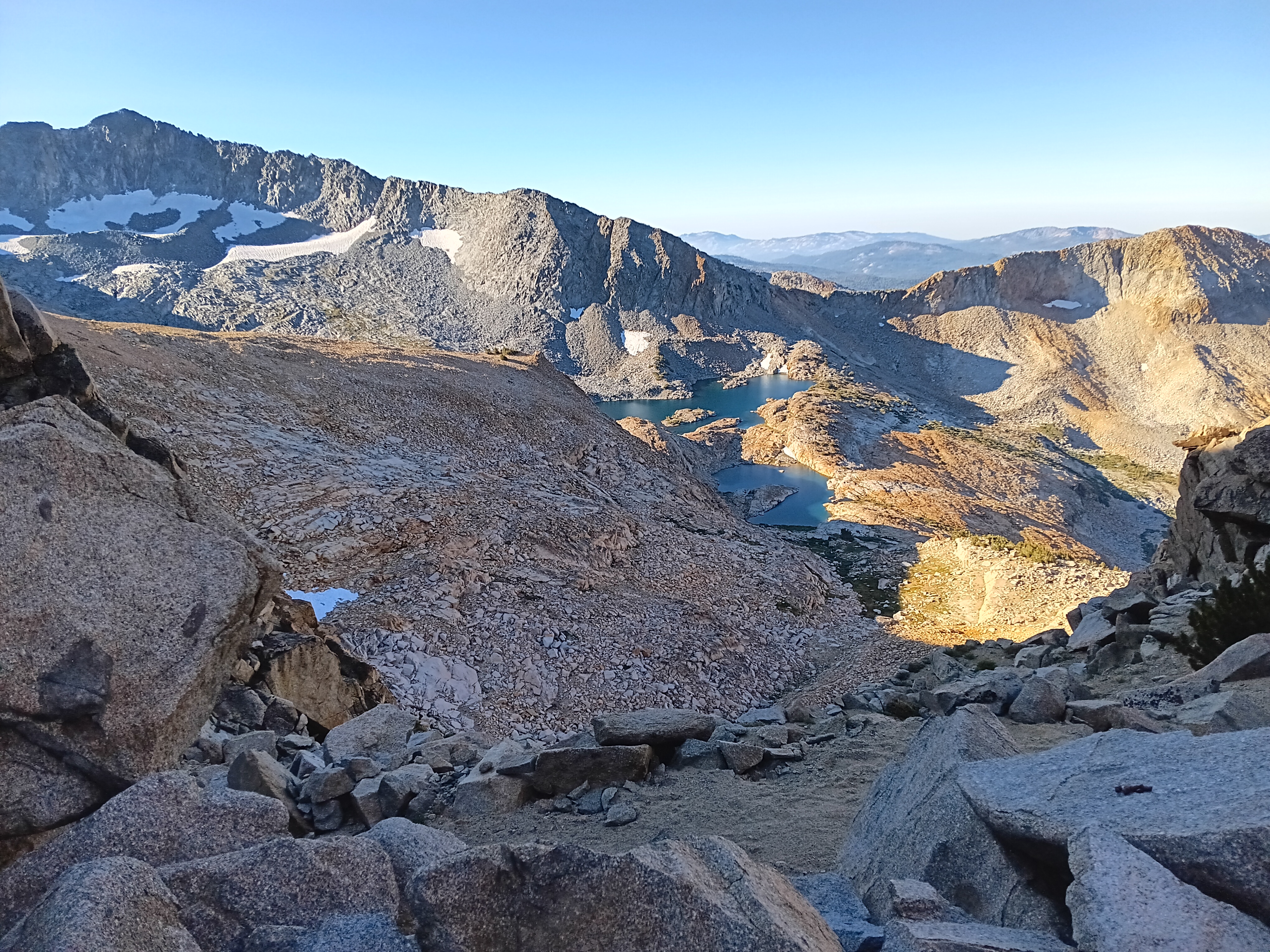
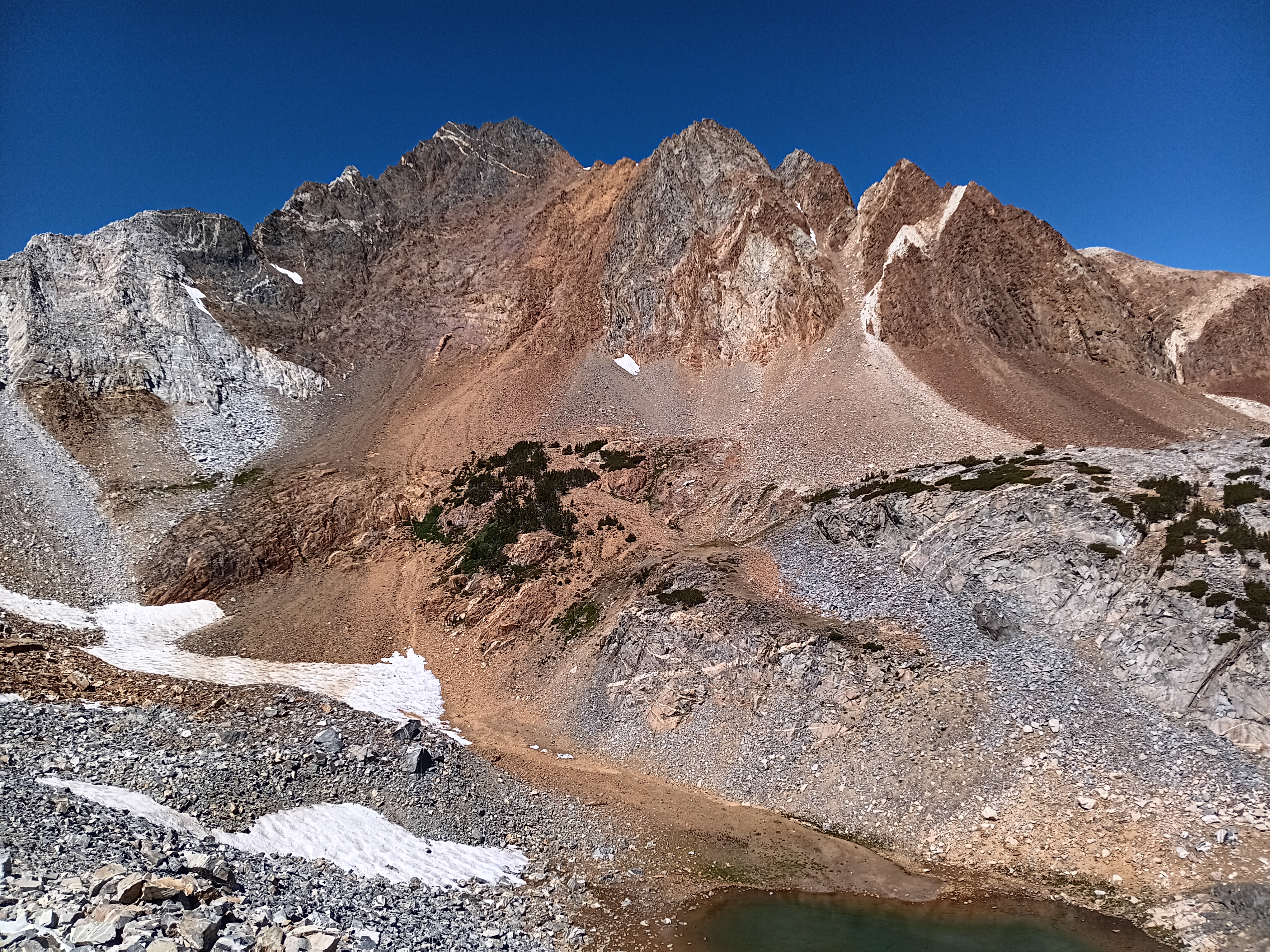
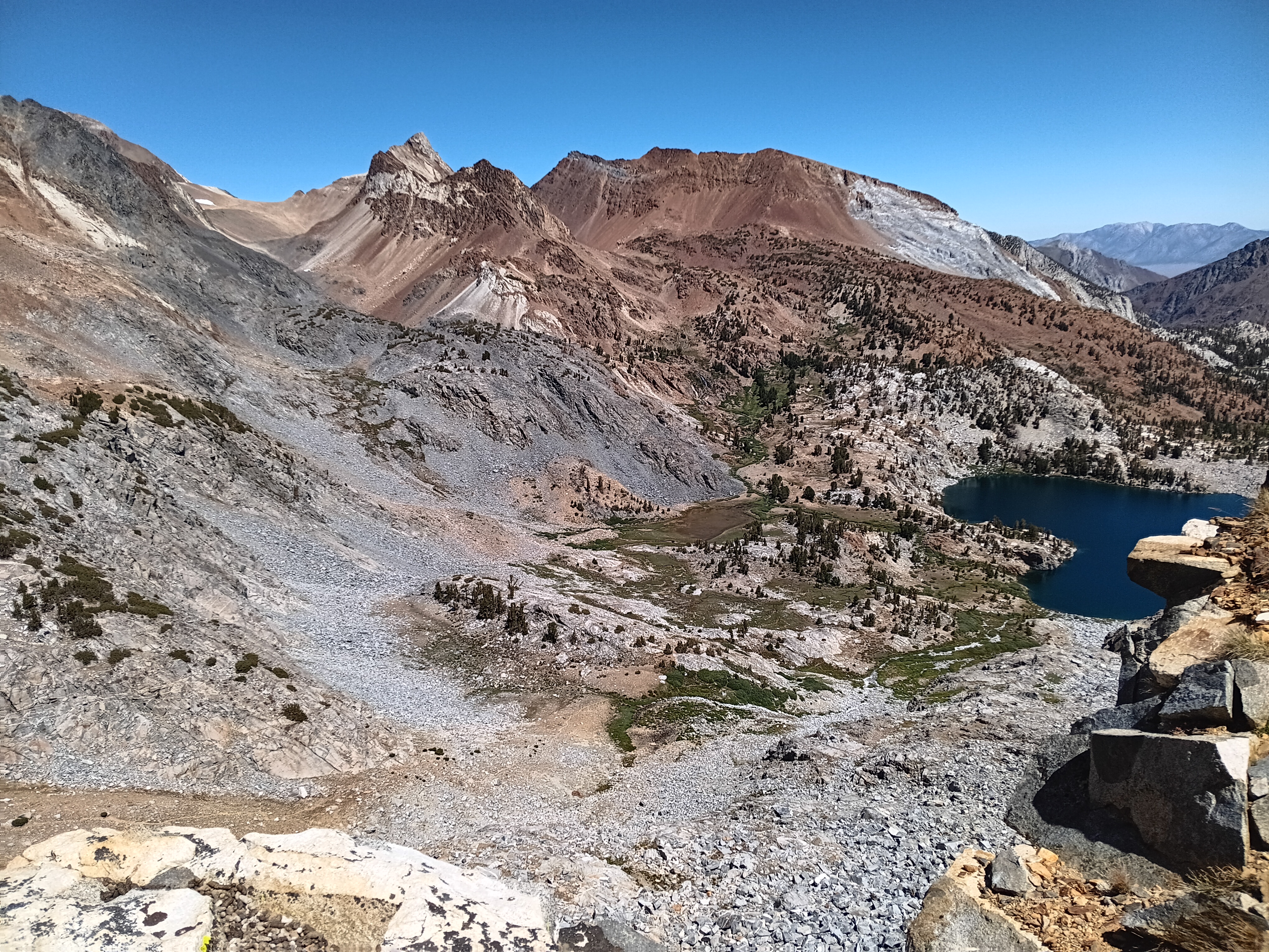
My camp in Pioneer Basin (top left) at the far end of the larger lake with the Fourth Acess Ridge in the background (center left). Fourth Access Valley becomes clearer at bottom left with the many lakes of Pioneer Basin in the foreground as seen from above Standford Col looking south. Looking north from the same location, I see Red Slate Mountain dominating the landscape (right panel). I had climbed it 3 days prior. [Aug.-20/21, 2025.]

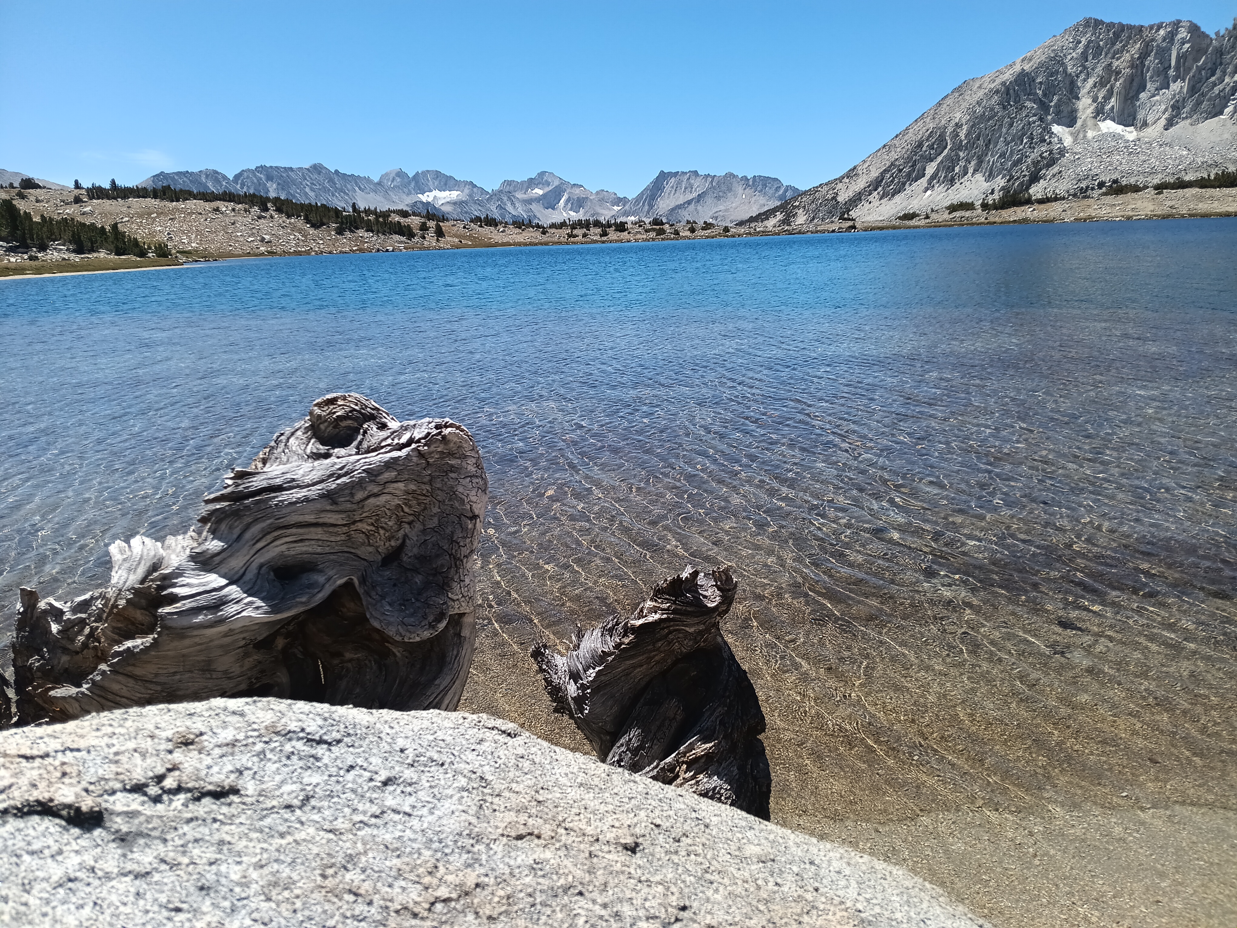
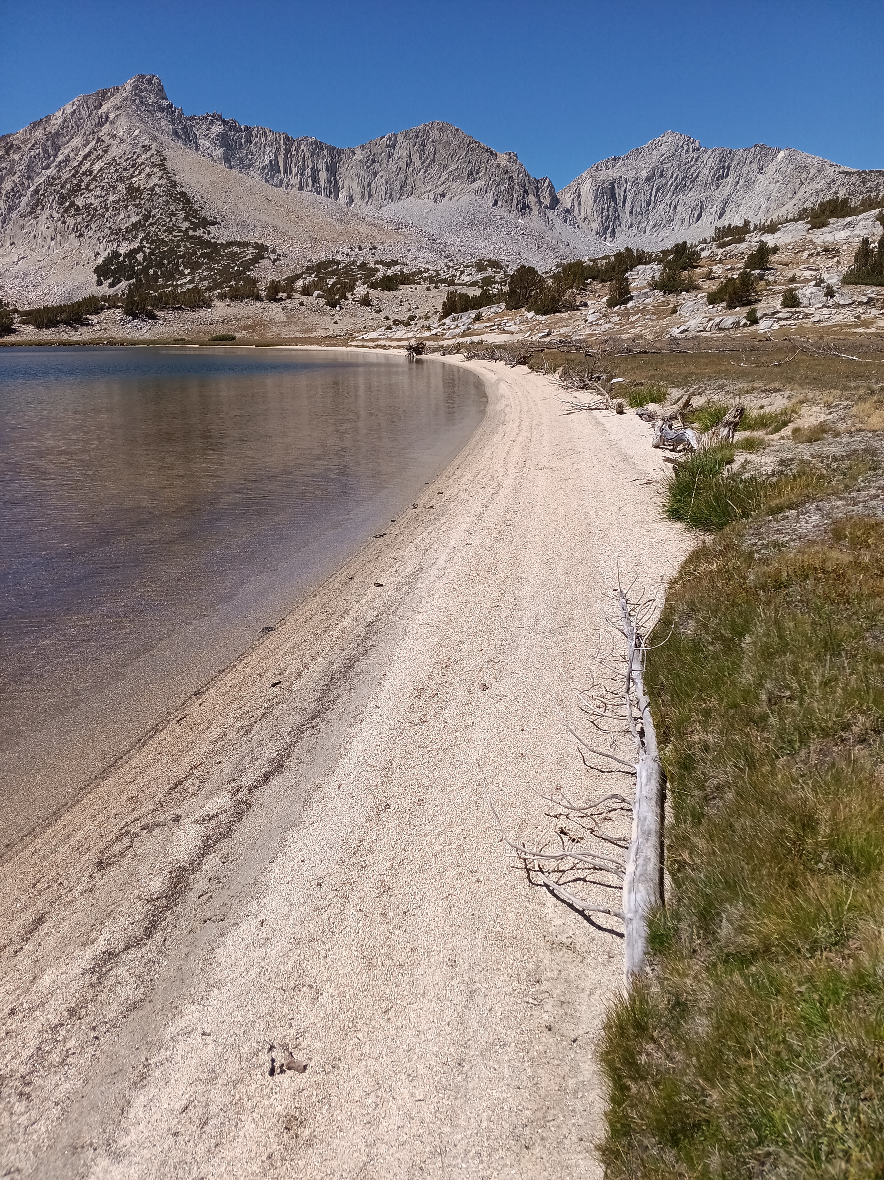
Most of the mountains surrounding Pioneer Basin are steep, very steep, but they tend to be a bit sandy, not quite, but the soil on the steep slope is free of bolders with alot of scree, smallish pebbles, really. It is almost impossible to gain traction hiking up such slopes, as one slides down and sinks in. In contrast, heading down such slopes, I found to be like skiing with the hiking poles to keep balance in a controlled slide. Just like skiing one sinks into the scree, slides down, and makes turns by setting poles and shifting balance. What takes 3-5 hours to climb up takes 15 minutes to slide down. Fun … the downhill part that is. So I hiked the basin, swam in 3 of the 7 lakes several times, and even had a lazy day doing nothing but watching the trout in the water, the birds in the sky, and the sun rise and fall. Heaven on earth that I shared with a total of 3 people in 3 days, that is, each person has 2 lakes for themselves every day. And the beaches of the lakes, too, were wild, sandy, and sunny:

Swimming the many lakes of the High Sierra Nevada, I felt fresh and clean and happy. Last year my wife Dragonfly told me to do this also and carry swim trunks, but for some reason I only swam once during the 36 days that I was hiking across mountains and past lakes in 2024. What made this year different was Pavla who picked me up at Tuoloume Meadows. She added to Dragonfly’s suggestions by forcefully setting an example for me. It thus seems that it takes a village to teach an old man new tricks. The swimming will stay with me as lake swimming added a new comfort to the adventure that is hiking for many days and weeks.

P.S.: My 14-day hike covered about 120 miles (190 km), so I comfortably saunter about 10 miles/day with about 40-45 lbs on my back. If pressed, such as by thunder and lightning and rain that hit me the last day at 12,000′ high Mono Pass, I got enough reserves to do an additional 5-7 miles at the end of the day to get down Mono Pass (top left) with Abbot and Dale Mountains in the dark clouds above Ruby Lake. No swimming there … this year.

Exploring Greenland’s Coastal Currents: A Journey of Discovery with Icebreaker Polarstern

Icebreaker Polarstern reached its home port of Bremerhaven in Germany just before Orkan “Joshua” hit northern Germany hard. The ship returned after 3 month at sea with 48 crew and 46 scientists working on ocean biology, chemistry, and physics. The 7-week expedition from Svalbard to Greenland and back to Germany culminated 3 years of planing and preparations led by the Alfred Wegener Institute (AWI). As one of 46 scientists I stepped onto the ship almost two months ago in Longyearbyen. We planned to explore what moves ice and fresh Arctic water into the Atlantic Ocean with sensors to probe the coastal circulation.  Analyzing these data, I will now live in Bremerhaven for a few months.

The map above shows where we went to the north of Greenland. I am coloring the coastal ocean shallower than 1000 m in light blue and the deeper ocean in dark blue. Our 2025 Polarstern data are the red symbols while yellow and blue symbols show data locations from 1964 ice island, 2007 icebreaker,  and 2013 helicopter surveys. This area contains the last and thickest sea ice of the Arctic Ocean and prior ocean observations originate from floating ice islands that both the Soviet Union and the U.S.A. used during the Cold War 1947-91 such as the Arlis-1964 track (yellow line). Helicopter surveys collected a few data in 2013 (blue symbols) while the Swedish icebreaker Oden collected data along two lines farther offshore (yellow symbols).

Now how does Greenland look from the ship? Well, there is always ice and it is always cold. The coldest days we had near the coast when the skies were clear. The coldest day we had -20 C, that is -4 F for my American friends, but most of the time we had clouds and storms with temperatures warmer at -12 C (10 F) with clouds and little visibility. It snowed alot and shoveling the ship’s deck was an almost daily chore. A relaxing “cruise” it was not. We worked sensors systems in the windy cold outside during all hours of the day and night. Pictures like the above were almost always taken during my 8 hours “off” that for me was from 08:00 to 16:00, because my shift was from 16:00 to 24:00. After a phone call to my wife after midnight and a peppermint tea to warm up, I slept from 01:00 to breakfast at 07:30. As almost all scientists aboard I shared my cabin with others, so there is not too much privacy. The photos below show my bunk bed (I slept atop), shared work spaces, and the rarely empty dining room. We often ate in shifts, too, because not all 50 people would fit the dining room in one sitting. So we often had 2 sittings. A comfortable living room was next door for desert, tea, coffee, games, and conversations.

Now what about science, you may ask. Here we made a major discovery, I felt. A mathematician used her craft to predict a coastal current to the north of Greenland that, I admit, made no sense to me as it contradicted 30+ years of training and intuition in which direction such currents would flow, that is, the coast should be on the right hand side looking in the direction of the flow. The curious thing was that to the north of Greenland it should go in the opposite direction, that is, with the coast on the left. In Claudia’s numerical computer model run for months on super computers, this current-in-the-wrong-direction was a both prominent and persistent feature. I always discarded it as an unrealistic feature of some computer code run amok. And yet, when we actually reach the coast of northern Greenland and I measure ocean currents from a ship sensor that runs 24/7 to tell me current speed and direction, here this weired or “wrong” current was. It screamed at me from the screen the moment I plotted the data and shared it with Claudia who was aboard with the comment: “Your model is right and my intuition was wrong. Your current is at the same location, the same speed, and in the same direction as your model said it would.” Furthermore, a distinct and separate way to estimate ocean currents from ocean temperature and salinity observations showed the exact same thing. That’s now two good complementary confirmation of the current that nobody has ever seen or measured … until now that we aboard Polarstern did so on Sept.-23, 2025:

The map on the left shows our study area to the north of North Greenland. On it in red are sticks whose length indicate the speed or strength of the ocean current (at 56 meters below the surface) while its orientation gives the direction of the current. The light blue is shallow and dark blue is deep water as before. The current is sluggish offshore with a weak component to the south. In contrast, closest to the coast of North Greenland we find long sticks that point to towards the left (west by north-west). This is Claudia’s Coastal Current.

The two plots on the left provide more detail, as it shows how the current varies with depth and distance from the coast along a line from the coast towards offshore. The bottom of the shallow ocean is the black line from 100-m to 350-m meter at a distance of 20-40 km from the coast. The top-left panel shows the current (in colors) across the section where blue colors indicate currents flow into the page while red colors indicate currents that flow out of the page towards us viewing it with the coast on the left. The bottom-left panel shows the velocity component along the section with a flow that is mostly onshore near the surface.

There is so much more to this story as well as additional stories, notice the red dots in the top-left panel between 150-m and 300-m depth that indicate a strong flow to the south and east, but I save this for later. I also do not wish to tell you about the two ocean sensors we quickly deployed at this location to stay there until we, perhaps, recover them with new data next year or the year there after. I do wish to close this essay, however, with the view of Greenland that we had where we discovered Claudia’s coastal current. Science is fun, exciting, and always surprises.

Yosemite and Ansel Adams Wilderness Camping: Tips on Permits and Trails near the JMT

Sleeping and camping in California’s Wilderness requires a permit. The most desired permit starts in Yosemite National Park to hike the 220 mile John Muir Trail (JMT) through Yosemite, Kings Canyon and Sequoia National Parks as well as Ansel Adams, John Muir, and Golden Trout Wilderness. This spectacular and scenic hike along the spine of the Sierra Nevada takes 3-4 weeks to complete without ever crossing a road or seeing a car. Chances to score a permit are slim (less than 1:10), so about 9 out of 10 applicants fail to win this “Golden Ticket” via a lottery. Last year I was one of the 9 and thus had to be creative, because I wanted to hike the JMT. Here is my “solution” from 2024:

My 2024 loop through Yosemite National Park. I acclimated at Mammouth Lakes (blue bus) for 2 days and took a city bus to my trailhead at Devils Postpile (blue flag). From there I hiked north to Yosemite Village via Donahue Pass along 8 campsites (red tents). This was my first permit. The second permit carried me from Yosemite Village via Red Peak Pass and Isberg Pass along another 8 campsites (blue tents) back to Mammouth Lakes. Subsequently, I continued walking on the same second permit south loosely following the John Muir Trail (JMT) and past it to Horseshoe Meadow near Lone Pine, CA.

My solution included two different, easy-to-get permits to loop counter-clockwise through Yosemite. Starting at Mammouth Lakes (Devils Postpile trailhead), I first headed north loosely following the JMT by crossing Donahue Pass (11,067′ or 3370m high) to reach Tuolumne Meadows (8,619′ or 2630 m low), Clouds Rest, and finally Yosemite Village. Resupplying there, I picked up my second permit, and hiked south back to Mammouth Lakes via Red Peak Pass in the Clarke Range. Back on the JMT at Devils Postpile 8 days later I slept at Reds Meadow (camp #18) to walk south for the next 18 days to complete my own JMT Plus.

The return loop through Yosemite added 82 miles, but these 82 miles required a different set of physical and mental skills, because away from the JMT both people and trails disappear intermittently for days which does not happen on the JMT. The gallery below shows my camp #9 above Half Dome (top left), myself on Clouds Rest (top center), and Cathedral Mountain seen from Lower Cathedral Lake (top right) either on or near the JMT. The larger bottom photo shows the Clarke Range in the distance that I crossed 5 days later. I took the photo above Clouds Rest before descending to Yosemite Village the next day.

The JMT is a shoulder-wide super-highway through the wilderness. The trails are always well maintained and one meets about 10 to 30 people every day from all over the world of all ages. Only on the last 5 miles past iconic Half Dome into Yosemite Village 100s or 1000s of people moved up and down the trails for the day. Sleeping at the backpacker’s campground in Yosemite Village (camp #10) for $8, I splurged on an awesome $40 breakfast at the majestic Ahwahnee Hotel. These are my priorities and I was back on serene trails turning right (west) near Nevada Falls to head up towards the Illilouette Valley. The last day hikers were a lovely couple from Lithuania with their two lively and happy children. Two hours later I reached the Illilouette watershed where I slept solidly on a thick and soft bed of pine needles (camp #11).

The next two days I only met one group of 2 hikers on my way to Merced Pass Lakes (camp #12) and nobody to Ottoway Lakes just below Red Peak Pass in the Clarke Range. My campsite #13 in the top-left photo below is the small flat area in the shade next to a 20 feet high block of granite. My view towards the west included Merced Peak at 11,726 feet (3574 m) and nearby patches of snow.

The photo above shows Merced Peak the tallest mountain of Yosemite’s Clarke Range. I crossed this range the next morning via 11,150′ (3400 m) high Red Peak Pass from where the photo above was taken at 8 am in the morning. The many switchbacks made this an easy hike both up and down into Merced Valley. Here I met, surprisingly, a group of 2 women from my home state of Delaware: we are a small and flat (<480′ or 140 m) state. Crossing the Merced River at 9,150′ (2790 m) elevation, I climbed up again towards Isberg Pass at 10,510′ (3200 m). The Delaware women told me that a snow storm was predicted the next day and stormy it was, indeed, at my campsite #14. Clouds and wind bursts rolled in and out over Isberg Pass all night and the next day. Without breakfast I left this unpleasantly cold and windy camp at 6:30 am to stay ahead of the snow storm trying to reach lower elevations. Easier said than done …

My old Tom Harrison paper map of Ansel Adams Wilderness showed a “maintained trail” for the next 16.6 miles to Hemlock Crossing (7555′ or 2300 m), a bridge across the North Fork of the San Joaquin River, and another 16.9 miles to Devils Postpile via Granite Stairway (9014′ or 2750 m). Such mileage usually takes me 2-3 days of comfortable walking, but this specific hike took me 4 long and exhausting days of navigation through dense brush and forest often without a trail. I gained a new respect for those who initially explored this wilderness 150 years ago without the contour maps, satellite navigation, text messaging, and SOS buttons that I had with me.

Almost immediately after crossing Isberg Pass, the trail disappeared. No problem here, because at ~11,000′ one is well above the tree line and thus sees clearly where one has to go. It is not hard to boulder over large rocks or walk on flat benches of granite or stroll down gently sloping dry stream beds. Furthermore, as soon as the trees reappeared near 9,500′ the trail reappears also. About half way between Isberg Pass and its trailhead near Clover Meadow Ranger Station I met the last group of people for the next 3 days. They were led by a “preacher” my age (63 years) without a backpack and four disciples ~20 years younger who carried heavy loads for their 4-5 day “revival” at Turner Lake in Yosemite. They were friendly, tried to convert me with good humor, and we talked for about 20-30 minutes about nature, god, and life as we know it, but then they headed up towards Isberg Pass and Yosemite while I headed down towards Bugg Meadow and Devils Postpile. All good.

Three hours later the trail almost disappears as I turn east at Detachment Meadow away from all trailheads. The trail becomes fainter with every mile, yet suddenly a posted junction sign points me towards Bugg Meadow and Hemlock Crossing. Good, this is my destination, but the trail immediately disappears. I pitched my tent (camp #15) near a fire-scarred rocky out-crop 2000 feet above the mighty valley the North Fork of the San Joaquin River just before it started to sleet. The next 3 days were the most difficult of my 35 days in the mountains:

All the above photos are on and along this disappeared “maintained” trail where most trees had burnt in many prior forest fires, the steel bridge over the San Joaquin River at Hemlock Crossing had washed out 2022, and snow, rain, and sleet drenched me. Not the best conditions to navigate by map, compass, and GPS altitude through chest-high, wet brush. Wilderness.

Wet, hungry, and discouraged I reached Hemlock Crossing at noon on Aug.-24, 2024 and discovered its badly damaged bridge. What to do? Rest, eat, and dry out before deciding. Feeling refreshed after a large, warm, hour-long lunch and dry clothes, I decided that the twisted bridge was unsafe to use, but that several logs downstream perhaps offered a better way across the swollen river. Strapping my backpack very tightly to my shoulders, I slid on all fours onto and along two large logs hugging them tightly. A climb over a smaller log lodged across the two larger logs was an added challenge (see photo below top left). This “bridge” was above a 20 feet waterfall downstream and a deep pool of water on the upstream side. I cried on the other side happy to be alive.

Furthermore, there was a trail on the eastern side of the San Joaquin heading both north towards Bench Canyon and Lake Catherine below Ritter and Banner Mountains and heading south towards Mammouth Lakes where I headed, but again I was soon on my own again without a trail. The path looks pretty clear on the map along a steeply sloping V-shaped valley near the 7,460′ contour, but where my boots hit the ground along this contour were just walls of brush, meadows, overgrown puddles of water, rocks, fallen logs. At one point I dropped my back-pack to move up the slope to 7,700′ to reconnoiter to find a path forward. There was none for 4 hours until I reached Iron Creek where I stayed for the night (Camp #16).

The sun emerged again the next day (Aug.-25), but the trail disappeared again within an hour from camp, but now I was in a dry forest that had not been burnt too badly and the map told me to go uphill. I did so for most of the day getting away from the treacherous San Joaquin River. Trouble awaited only in the meadows as here the terrain was wet, level, and overgrown with brush. My spirits lifted, however, when I noticed wild Elderberries. The photo above (bottom left) shows their blossoms, but later I found big, dark, black elderberries that I devoured after cooking them. The names of the meadows in the forest without a trail invoked emotions, too, such as “Naked Lady Meadow” followed by “Earthquake Meadow” followed by “Headquarters Meadow” followed by “Corral Meadow” followed by “Cargyle Meadow” before I reached a meadow without a name at the end of the day. These names tell me that people traveled and lived here in the past. There probably are stories that I do not yet know.

My senses sharpened during this day without a trail as I noticed more and more fallen tree logs that had a flat cut surface. At first I recorded each such sighting with its GPS position, but over time I could tell where they were. In the middle of these wild wanderings along a disappeared trail, I found this sign post (top left below) pointing out that this is the intersection of the trail to Mammouth Lakes to the right and Iron Mountain straight ahead. My navigation was good, but the so-called trail after this point was just one pile of wood after another pile of wood where I had to climb over, under, or walk around. Looking back, I find it amazing what one gets used to and how much punishment my then 62-year old body was able to take. After 10 miles of this I made camp at the unnamed meadow at 8,577′ (2610 m) below “Stairway Meadow,” “Granite Stairway,” and “Summit Meadow.” After that, a JMT-type trail emerged that led me down the mountain for 8 fast and furious miles downhill to Reds Meadow. Here civilization expressed itself in the form of a shower, beer, and double cheeseburger in that order. These last 8 miles passed faster than the prior 2 miles navigating wood piles:

Did my solution work? Yes it did for me in 2024, but it may not do so for everyone. During the 8-day return loop via the Clarke Range and North Fork of the San Joaquin River I met three other hiking groups: First 2 students from San Francisco, then the 2 women from Delaware, and finally the friendly “preacher” and his disciples. That was it in terms of people for 8 days. Along the way I learnt to read and interpret both the map and the landscape in front of me.

What served me well was to always listen to my body. I was NOT fighting to reach a destination. I walked only as long as it was fun (mostly) and always stopped for an hour or two when I felt like it. I took off my pack to investigate a pretty flower or a bee on it, watched a bird, or picked wild Elderberries, Red Currants, Rasberries, and even Blueberries. I made camp when I felt like, I was prepared to go home any day that was not fun, completion of the JMT or a certain section was not important. Some days I felt like walking 6-7 miles, but on other days it was 12 miles (to reach that cheeseburger at Red Meadow) or 17 miles (my last day on the trail to reach Lone Pine). It also made me enjoy the well maintained John Muir Trail the next 18 days.

Now, would I do this exact hike again? Probably not, but only now do I know how to read a map of what is out there. In the future I will focus on the many trails that intersect with JMT. That’s where you will find me. The JMT is the scenic highway that leads to all the others. Two days after my shower and cheeseburger at Reds Meadow, I found the Hot Springs of Fish Valley (camp #20). [Photo Credit to Justin from Bend, Oregon; he appeared out of nowhere from above, staged, and took the picture. I met him several times again the next 10 days, but that’s another story.]

Hot pool and spring in Fish Valley; view is to the west.

So, my next solution would be turn east at Toulumne Meadows and then turn south to cross Parker Pass (11,115′ or 3390 m), Koip Peak Pass (12,280′ or 3740 m), and Agnew Pass (9,900′ or 3320 m). Then follow the Pacific Crest Trail along the Middle Fork of the San Joaquin River back to Mammouth Lakes.