Nares Strait 2012: First Mooring Recovered

We have received word back from the intrepid Arctic explorers of some early success.  Here is Andreas Muenchow’s latest report:
“Recovered first mooring at 80.7 N and 67.7 W. Ice profiling sonar was hit by ice 100-m below surface, light damage on guard rail, but transducers look ok. Clear skies, light winds from the south, and air temperatures of 1.9 Celsius provided optimal condition. Never before did we recover a mooring this quickly: acoustic interrogation was less than 5 minutes, another 2 minutes after release command the mooring popped up in open water 300 feet from the ship, zodiak lassoed mooring, and 20 minutes later all was aboard. It does not get better than this … attention to detail by Dr. Melling’s mooring group (Joe, Ron, Dave, and Dave) in 2009 paid off.
Petermann Ice Island edged another 1 km towards Nares Strait. I saw at least 3 much smaller segments of likely Petermann Glacier pieces yesterday, all tiny, about the size of our ship. We are now also within helicopter range of Petermann Fjord, but we have 6 more moorings to go. Good start.”
by Andreas Muenchow, Aug.-6, 2012, 12:41UTC

Nares Strait 2012: Approaching Ocean Mooring Line in Kennedy Channel

by Andreas Muenchow, Aug.-5, 2012, 14:22 UTC

 From the southern entrance of Kennedy Channel at 80.03N and 67.25W we can see our mooring site about 45 nautical miles ahead, about 80 km. It will take us 8-9 hours to get there as the ship weaves its way through ice that covers about 50-80% of the surface. The farther north we get, the thicker and harder the ice. Air and ocean temperatures are lower, less ice melt has taken place, and we are closer to the source of this multi-year ice. The very clear skies, clean air, flat ocean, and rugged ice provide ideal conditions to fool the eyes and brain of even experienced sailors: mirages are everywhere as the light is reflected and refracted so many times that not all we see is what it is. Even renowned polar explorer Robert Peary saw land in the 1890ies where there was none, called it “Crocker Land” to honor one of his sponsors, and subsequent explorer toiled in vain to find it.

We are ready and eager to start work in earnest after 2 days of sailing. The recovery of the instruments anchored to the bottom of the ocean for the last 3 years has the highest priority. We need the instruments aboard to get to the data that describe ocean currents, temperature, salinity, and ice thickness at least every half hour continuously since August of 2009. Should the ice prevent us to reach every site, we are prepared to service the automated weather stations, like the one at Hans Island. Dr. Jeremy Wilkinson is hosting the data here in real time. Hans Island is a short distance north of our mooring line. Tonight we will start to measure ocean temperatures, salinity, and densities with depth at 5-7 stations running along a section from Ellesmere Island in the west towards Greenland in the east. The term “night” has no meaning, however, as the sun is always brighter than it is in my garden in Delaware because there is no shade and ice and water reflect all light along multiple pathways.

 At 6 am this morning I saw a ship-sized piece of ice from Petermann Glacier in the distance. It had the undulating surface that is typical of Petermann as well as dirt from rock. Nevertheless, do not know where the Manhattan-sized Petermann Ice Island PII-2012 is right now or if it has left the fjord. Internet access is severely limited for scientists and crew alike. So you, my dear readers, probably know more than anyone aboard this ship where PII-2012 is from browsing NASA’s MODIS archives, if the area is cloud-free.

 The helicopter left the ship half an hour ago with the ice observer and two scientists aboard (Allison Einolf and Dr. Renske Gelderloos) to reconnoiter local ice conditions up to Hans Island 60 miles ahead. While a prudent mariner in these icy waters will always inspect ice conditions ahead via helicopter to extend the 3-12 mile radar range, the helicopter is also an expensive resource at $1,800 per hour. For example, with the currently clear skies overhead NASA’s MODIS provides 250-m resolution bands that are good for ice navigation in Nares Strait, if they were available. RadarSat is even better, but even RadarSat is received aboard the ship only at downgraded resolution to reduce data transmission rates and costs.

 Addendum: The helicopter returned safely with images and videos of ice conditions in Kennedy Channel. Also, as of 2 minutes ago: “In theory we do know where PII-2012 is as this morning’s RadarSat image include Petermann Fjord,” said Ice Service’s Specialist Erin Clark before heading off for lunch after getting off the helicopter.

Nares Strait 2012: Cruise blog

As the Nares Strait 2012 Team begin their journey out of internet access range, Professor Muenchow would like to mention that University of Oxford’s Dr. Helen Johnson has a Cruise blog with posts about the trip.  Here are the links to her latest three posts:

“The reality of Arctic research”
“Excitement on joining the ship”
“Preparations for the science ahead”

More soon!

Nares Strait 2012: From Thule towards Smith Sound

The CCGS Henry Larsen lifted anchor about 6 hours ago sailing north towards Nares Strait and Petermann Glacier. Air temperatures in port were a balmy 10.5 C this morning, but now have dropped to 6.3 C this evening at sea. We are steaming at almost 9 kts with clear skies overhead most of the day. We hit a fog bank or two and I mistook the blowing fog horn for a fire alarm.

The day was largely spent with setting up gear, re-arranging lab spaces indoors and deck spaces outdoors. The usual drills and introductions to emergency procedures (fire, abandon ship, helicopter) to a few hours, too. Access to the internet is severly limited: it takes about 1 second to send and receive 64 bytes from the ship to either Delaware, England, or California. About 20-40 of these “pings” fail, meaning that actual data transmission and receive rates are even slower.

There are faster connections aboard, but those are limited to the ice observer who receives severely downgraded RadarSat imagery for ice navigation that will guide ship and helicopter for visual observations on where to go and what ice to avoid. Petermann Ice Island apparently moved another 4 km and has its tip now sticking almost into Nares Strait perhaps touching coast near Offley Island at the north-eastern side of Petermann Fjord. That image is 24 hours old, we may receive a new one over night.

Local time (same as Montreal or New York) in 9pm and the sun is still about 30 degrees above the horizon, no darkness all night. Greenland and its ice cap are visible in the distance, about 30 miles to my right. A few icebergs are scattered loosely here and there. We are 48 people aboard … more laters.

Nares Strait 2012: Grounded in St. John’s, Cod, and Crossing of Lines

Hurry-up and wait: The rushed 5 am arrival at St. John’s airport this morning turned into a six-hour wait and a canceled departure for Thule, Greenland. Crew, officers, and scientists are all grounded and spend an extra night waiting. There is lots of talk about screeching-in and uncertainty if membership in the “Order of the Blue Noses” or the “Order of the Gold Dragons” substitutes the more mundane “screeching-in.” Let me explain:

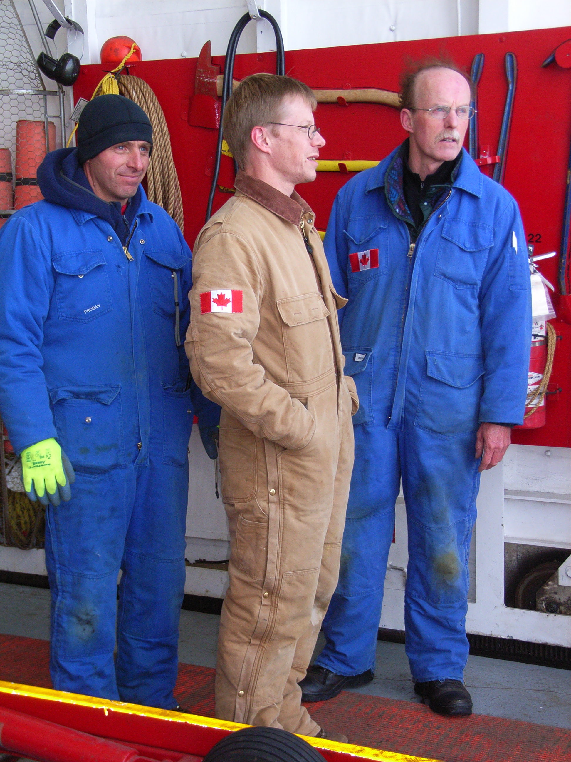
Canadian authorities aboard CCGS Henry Larsen.

The CCGS Henry Larsen originates from St. John’s and most of its officers and crew are local to the town, island, and icy waters offshore where cod once ruled supreme until mis-managed industrial-scale offshore trawling almost wiped the cod out and destroyed much of the local economy that was based on cod for centuries.

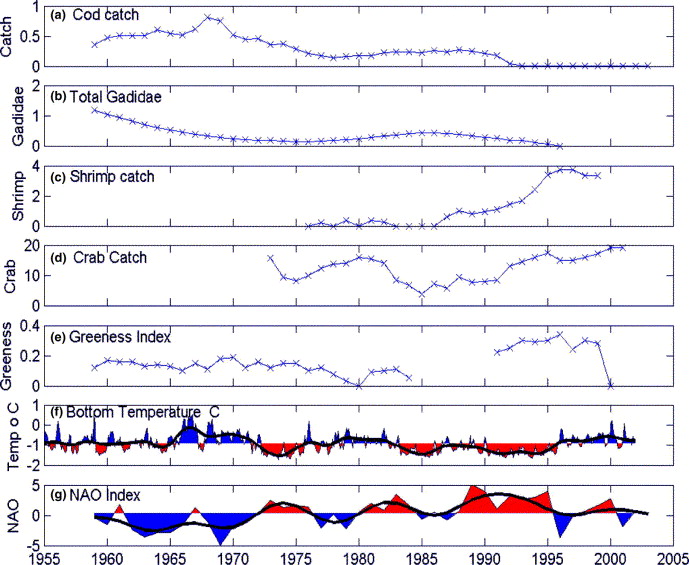
Time series of (a) catch of cod (in 106 tonnes) over the Newfoundland and Labrador shelf (b) the total abundance of Gadidae over the southern Newfoundland shelf (c) the catch of shrimp and (d) crab over the Newfoundland and Labrador shelf (e) the greenness index from the Continuous Plankton Recorder (CPR) over the southern Newfoundland Shelf (f) bottom temperature from inshore on the southern Newfoundland shelf and (g) the North Atlantic Oscillation (NAO) index. The heavy solid lines in panels (f) and (g) represent low-pass filtered smoothed curves of the plotted data. [From DeYoung et al, 2004: Detecting regime shifts in the ocean, Prog. Oceanogr., 60, 143-164.]

The CCGS Henry Larsen has two crew who rotate on and off the ship every 4-8 weeks. Over the years I have met many crew who hailed from families who had worked the cod on smaller, inshore boats. They are superb and experienced sailors who know how to handle and run ships and all attached to it in harsh and icy waters. But how does this relate to screech and cod? Let me digress a moment by comparing US and Canadian Coast Guards:

The U.S. Coast Guard’s ice breaker operates 24-hours/day under military rules without alcohol or overtime to be had. In contrast, the civilian Canadian Coast Guard operates less hours at full strength with some alcohol and some overtime served in moderation. The cultures aboard US and Canadian vessels differ: US ships are permanently in training with young crew on 6-month deployments moving to a new assignment each year, while Canadian ships are working with an older, more experienced, and steady crews. The Canadian crews do the same amount of work in 12-18 instead 24 hours with 1/3 the staff. Ironically, US ships have more “unclassified” electronic capabilities with many more advanced sensor systems. Both ships also have “classified” sensors and missions that I know nothing about, but I digress. Cod and screech are potentially aboard Canadian ships operating out of Newfoundland only.

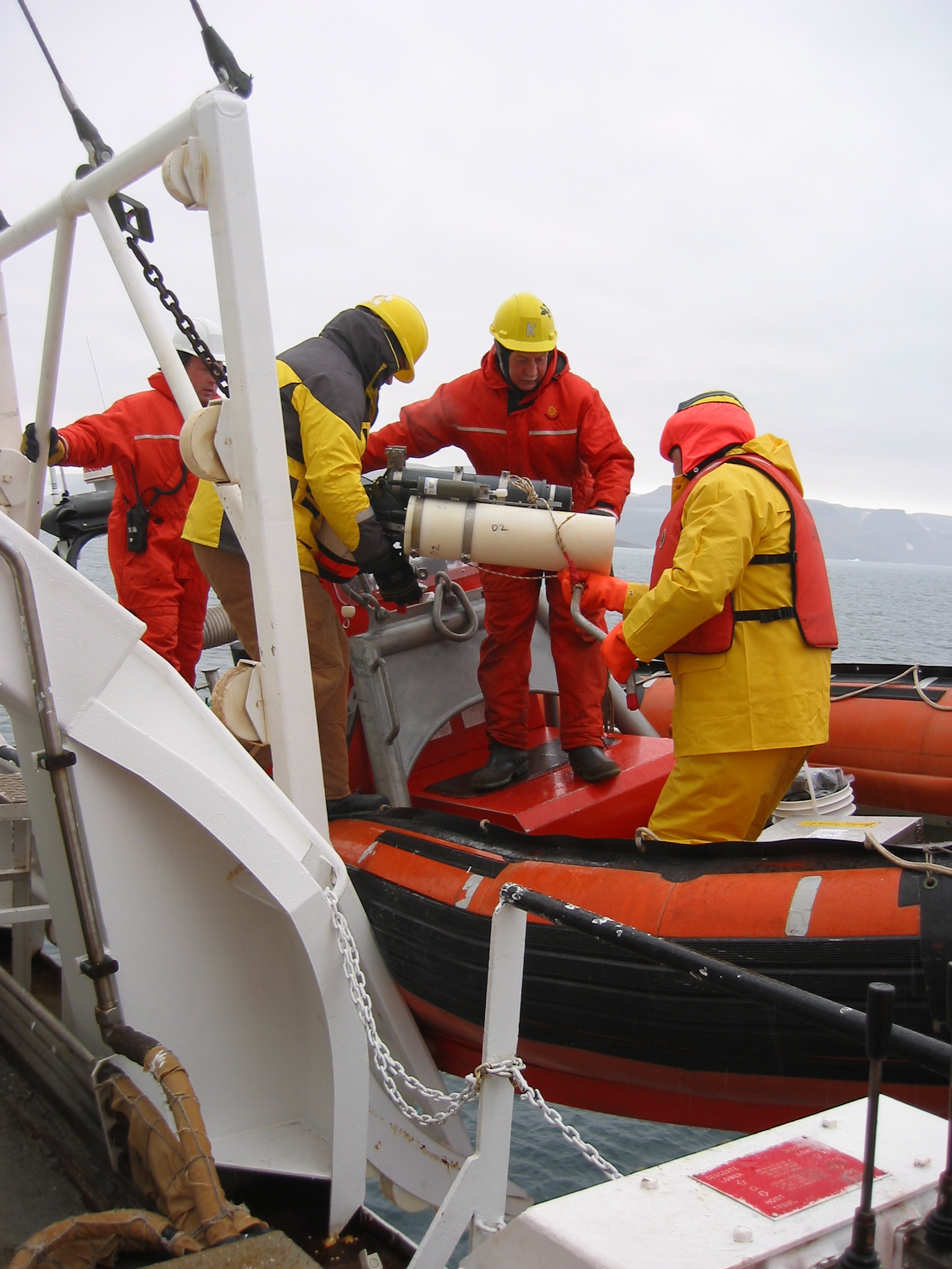
CCGS Henry Larsen crew at work: Deployment of a tide gauge (subsurface pressure sensor) in Alexandra Fjord. This is one of the instruments we will recover from Nares Strait that was deployed in 2009.

Our small motley crew of eight scientists this year consists of 4 Canadians from British Columbia, 3 Americans from Delaware, and 1 Dutch from England. Yesterday night we all converged at a fine restaurant on Ducksworth Street in downtown St. John’s, Newfoundland. A dispute is still raging among us on what is valid proof of earlier”screeching-in?” I learnt the hard way, that “laminated certificates” are invalid, but what about “un-laminated certificates?” The former are easily obtained in the vibrant port city of St. John’s with its many bars and pubs. The “un-laminated certificates” may be valid, if signed and authenticated by an officer of the CCGS Henry Larsen aboard said ship, but enforcement has been selective.

There are also arguments, that a crossing of the Arctic Circle (certified by a Commanding Officer of a Canadian Coast Guard ship) or the crossing of the International Dateline north of the Arctic Circle (certified by a Commanding Officer the CCGS Henry Larsen) may supersede the more common “screeching-in” ceremonies and certificates. I am the main person making these arguments facing authorities with powers that exceed mine by far.

Our failure to leave for Thule, Greenland today may give some of us a chance to get potentially needed “screeching-in” certificates, but I very much doubt that these “laminated certificates” carry much weight. Time will tell. It will also tell if we get to Thule tomorrow. Hurry-up and wait.