
Retreating from Fort Conger, the U.S. Army lost 68% of its men to death by starvation and drowning. They were delivered to the northern shores of Ellesmere Island within sight of northern Greenland by the SS Proteus on August 12, 1881 and were left with ample food and fuel to survive and explore comfortably for a years or so.
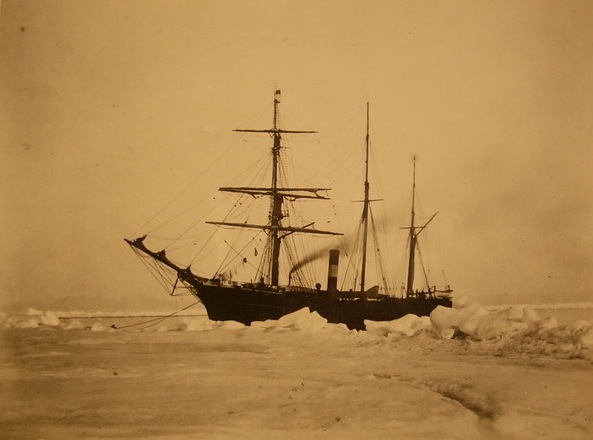
Seal Steamer (SS) Proteus that delivered men and supplies to establish Fort Conger; she was sunk by ice trying to deliver supplies to Fort Conger in 1883.
They built a large house from pre-fabricated sections within days and quickly settled into a routine of scientific observations and explorations by man-hauling sleds. A ship with new supplies was scheduled for the next year, but it sank trying to penetrate the ice. A second ship sent in 1883 also failed to reach them, again on account of heavy ice conditions. When a third ship reached them in 1884 all but 8 of 25 men were dead. About 120 years later we had similar trouble to reach Fort Conger to recover a tide gauge, but after trying five times, we finally got there to tell a happier tale.

Detailed map of Fort Conger and its environ from an original 1875 drawing. The “x” marks the location on the ~30 m deep ocean bottom where we deployed a tide gauge in August 2003.
In 2003, just offshore from Fort Conger we deployed a small tide gauge in Discovery Harbor to measure the rise and fall of sea level along these ice-infested shores. Our plan was to recover it in 2005, but then our field camp was blown away by hurricane strength winds (another story). In 2006 we failed to recover the instrument as our ice breaker could not get there. In 2007 we failed again even though a helicopter got us to the beach, we talked to the sensor package via a hydrophone, but we could not recover it because of ice. In 2009 we failed yet again, you perhaps get the drift here by now, even though a zodiac with grappling hooks was near the mooring. It was only in 2012, amazingly, that an expert group of hardy fishermen from St. Johns, Newfoundland hooked the elusive instrument and fished it out of the water [photo credit goes to Derek Stone of the Canadian Coast Guard]
-
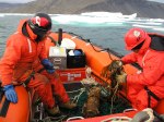
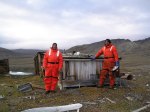
- Recovered Discovery Harbor tide gauge
-
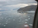
- Fort Conger and Discovery Harbor
-
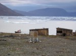
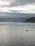
- Beach of Fort Conger at low tide
-
- Fort Conger rebuilt 1900 by Peary
after the CCGS Henry Larsen dispatched its helicopter for a brief flight to inspect the ice [photo credit goes to the author of these lines]
-
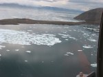
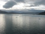
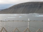
- Discovery Harbor off Fort Conger
-
- Spit of Discovery Harbor
-
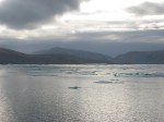
- Spit with lady Franklin Bay
-
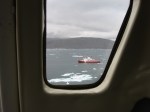
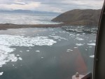
- Icebreaker near Fort Conger
while the author anxiously searches the coast for the zodiac with the successful fishermen [photo credit to author]
-
- Discovery Harbor, spit to left
-
- Fort Conger behind dark headland
-
- Spit protecting Discovery Harbor
-
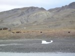
- Hill east of Discovery Harbor
The instrument was still recording data after all those years at the bottom of the ocean. For the entire period from 2003 through 2012 the computers inside the white tube dutifully sampled ocean temperature and pressure every three hours. The sensors cared little about the biology growing and living on it, ice did not touch them, and they had plenty of battery to work without complaint as they were never starved of food. These data are the only long-term observations of bottom pressure along with 3 other such moorings that we recovered more readily. They show strong tides under the ice as well as an intriguing 13-day oscillation all along Nares Strait that I presently cannot explain.
Discoveries are still to be made … such as explaining the data from Discovery Harbor outside Fort Conger which show both regular tides and not-so-regular changes in sea level under ice-covered Nares Strait in the high Arctic.
Addendum Oct.-26, 2013: See more historical detail in today’s blog post at Crocker Land: Tides of the Arctic.
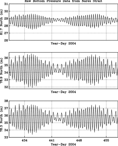
Sea level changes in meters for 28 days at Discovery Harbor or Fort Conger, Canada near 81.7 N latitude (top), Alexandra Fjord, Canada near 78.9 N latiude (middle), and Foulke Fjord, Greenland near 78.3 N latitude (bottom).


Amazing, and fascinating. You might be interested in this new virtual reconstruction of Fort Conger:
http://archive.cyark.org/fort-conger-intro
(I have no connection with the work). I’d love to talk with you about the way tidal data from Fort Conger, among other places, was used to support the idea of the existence of Crocker Land in 1910 – I’ll be writing about it on our blog, and linking to this post of course.
Genny LeMoine
Thank you for sharing the excellent link … that I also highlighted a little.
Addendum: More historical detail on tides in a brief blog-post by the above commenter entitled “Tides of the Arctic” that I will respond to with another essay on the subject here .. stay tuned 😉
Hello would you mind letting me know which web host you’re using?
I’ve loaded your blog in 3 different web browsers
and I must say this blog loads a lot faster then most.
Can you suggest a good hosting provider at a fair price? Cheers, I appreciate it!
I think all I did is to have this hosted by word-press directly for a $99/year suscription to get rid of the advertisements. Maybe there were other benefits associated with this suscription that I am ignorant with.
Hello! I’ve been following your web site for a long time now and finally got the courage to go ahead
and give you a shout out from New Caney Tx! Just wanted to tell you keep up the good work!
Pingback: Heartbeat of Ocean and Air of Greenland | Icy Seas
Pingback: Tribal Interactions and Arctic Research | Icy Seas
Pingback: Ghosts of Discovery Harbor: Digging for Data | Icy Seas