
The Grand Canyon of Arizona stands tall in the mind as the Colorado River carved itself into 6000 feet of rock. A similar canyon has been discovered in northern Greenland near Petermann Gletscher. The canyon without a name is buried under 6000 feet of ice, but its size and scale “… are comparable with parts of the Grand Canyon in the United States in terms of width and length and, in its deepest region, are about half of the Grand Canyon’s depth.” These are the words of its discoverers led by Dr. Jonathan Bamber published today in Science magazine.
![Grand Canyon of the Colorado River in Arizona. [From Intinarist.com]](https://icyseas.org/wp-content/uploads/2013/08/grandcanyon1331071283.jpg)
Grand Canyon of the Colorado River in Arizona. [From Itinerarist.com]
-
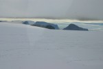
- Plateau above Petermann Gletscher in 2012. View is towards the south-east.
-
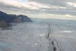
- Floating Petermann Gletscher looking upstream towards the Greenland Ice Sheet in the background.
-
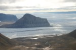
- Sigurd Berg Glacier discharging into Petermann Gletscher in 2012.
About 10 years ago the lead-author from Bristol University in England published data of bedrock elevation. It shows the topography of Greenland if one takes away all ice in an instant to see what lies below. This 10-year old map is coarse, there is only one datum about every 5 km and you will have to squint hard to see the canyon. In contrast, the new maps published today for the area of Petermann Gletscher show more detail as much better surveys were done the last few years. No more squinting … we now know that the blue colors (below sea-level) at Petermann connect to the interior ice sheet’s blue:

Greenland’s bed-rock elevation from Bamber et al. (2003) digital elevation model based on remotely sensed surveys of the 1970ies and 1990ies gridded at 5 km resolution.
The British, Canadian, and Italian scientists used radars flown on NASA’s plane to “see” through the ice. The bedrock under the ice gives a hard return or echo. It works much like an echo-sounder on a ship that indicates the invisible bottom of the ocean below. The canyon near Petermann Fjord provides a potential pathway of meltwater that drains from the interior ice sheet towards Petermann Fjord. The canyon almost reaches Greenland’s Summit Station where a web-cam shows how flat and desolate the interior of Greenland looks now. The deepest points of the ~ 10 km wide canyon are about 280-450 meters below current sea-level:
![Canyon with no name of the Petermann Gletscher drainage basin in North Greenland. [From Bamber et al. (2013)]](https://icyseas.org/wp-content/uploads/2013/08/bamber2013fig2.png)
Canyon with no name of the Petermann Gletscher drainage basin in North Greenland. [From Bamber et al. (2013)]
Now why is this important? First, it shows how little we know of our own planet when Grand-Canyon style features are discovered as we speak. This should encourage students to get into science, mathematics, or engineering to become future discoverers. Second, this canyon potentially connects the interior ice-sheet, its plumbing, and melt water to Petermann Fjord. It offers new ways to think on how Petermann-like glaciers fit into the climate system: The fastest-flowing of Greenland’s glaciers, Jacobshavn Isbrae, has such a canyon and it accelerated after it lost its ice-shelf the last few decades thus pushing much ice from land into the ocean which raises sea-level. And third, this canyon and the freshwater it delivers to the ocean below Petermann may create the channels under the floating ice-shelf of Petermann Glacier where the bedrock, the ice, and the ocean meet. This explanation differs from an alternate one, that is, the ocean enhances ice-shelf melting in the form of sub-glacial channels. Either ways, it is fun and exciting to report discoveries, but even more so to make them on your own. Lets get started.
ADDENDUM: Excellent reporting of this story by NPR which includes a NASA video as well as this awesome graphic (video flies through it, more here ):
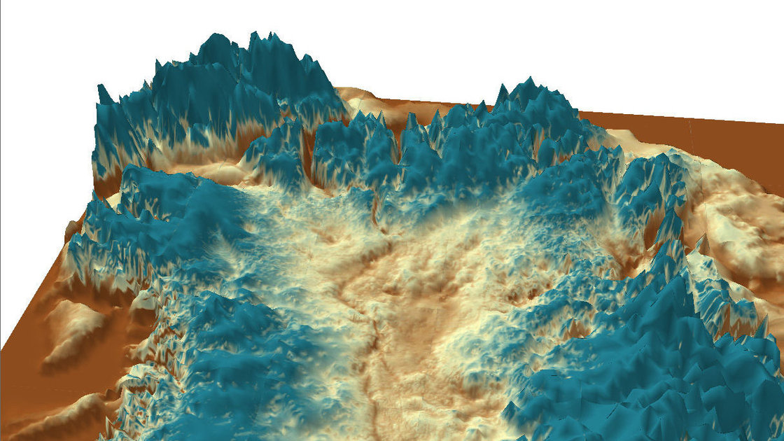
Courtesy of J. Bamber, University of Bristol
Bamber, J.L., M.J. Siegert, J.A. Griggs, S.J. Marshall, and G. Spada (2013). Paleofluvial mega-canyon Beneath the Central Greenland ice sheet Science, 341, 997-999 DOI: 10.1126/science.1239794


It will be interesting to see that map/data from Jøkelbugt and Dove Bugt?
Those regions are included in the above map. Furthermore, the data are public and can be accessed at the University of Kansas at https://data.cresis.ku.edu/data/rds/ with substantial support from the U.S. National Science Foundation.
Yes also note it is turquoise blue in Storstrømmen and L. Ibstrup area, in the map From Bamber et al. (2013).
Pingback: NASA video of Petermann megacanyon | Allison E. Einolf
Reblogged this on Spirit In Action.