
Leaving all land behind when FS Polarstern sailed for Greenland almost 2
weeks ago, we saw land again for a few hours last Sunday. A small
ice-capped island called Isle de France was ahead of us. Solid ice was to
the west, open water to the east, and Greenland proper appeared just
faintly above the western horizon. We arrived at 5 am in the morning, but
the northern summer light changes more with the clouds, absent this day,
than it does as day becomes night. We are more than 1000 km to the north
of the Arctic Circle and about half-way between Bremerhaven and the North
Pole.
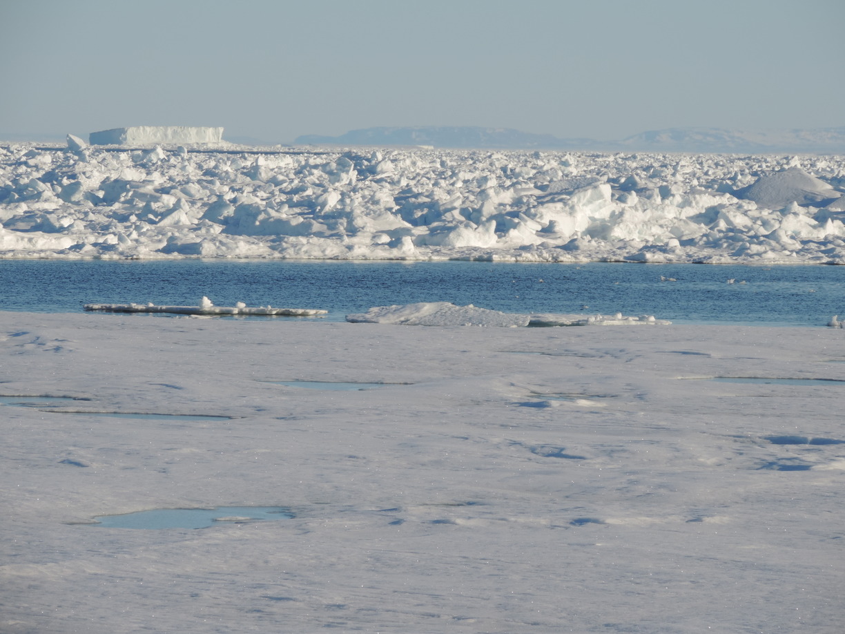

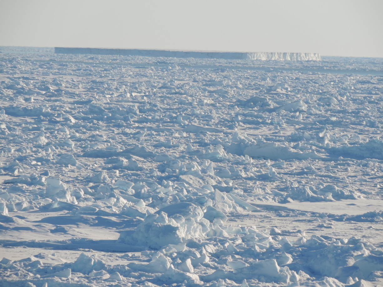
Waiting for the mooring work to begin, we sailed along a row of large
and grounded tabular icebergs and ice islands that appeared strung out
like pearls on a line where the ocean’s water was about 100 meters deep.
Sea- and ice-scape looked the same eons ago when massive ice-sheets
covered much of northern Europe and North-America before people invented
agriculture and turned from nomadic hunters and gatherers to settled
farmers and peasants. And while everyone awake admired Greenland’s beauty
and serenity that Sunday morning, I had only one thought: Here go my
moorings.
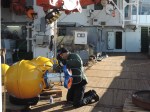
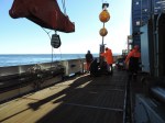
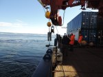
The ship paused for a few hours to wait for me and Jonathan to ready
instruments that we needed to placed on the ocean floor. They are
designed to measure ocean currents for the next 2-3 years and will give
us better ideas on how ocean heat and currents melt
Greenland’s glaciers from below. We already had deployed four such
instruments the day before out of sight of land and icebergs. Now we were off Isle de France to complete our shelf mooring program with 3
instruments placed across the south-western slope of Norske Ore Trough.
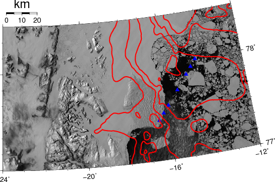
This ‘trough” is really a broad and deep submarine valley that connects
the deep Fram Strait 150 km to the east to Greenland’s largest glaciers
100 km in the West and North. The valley may act as a pathway, so we
think, to move warm ocean waters from Fram Strait near the bottom across
the broad and confused continental shelf of Greenland. It is coastal oceanography that we do, but the heat that our coastal flows
transport towards the glaciers does impact a changing climate that
changes land, sea, and icescape both here around Greenland and
elsewhere as ocean sea level rises when ice on land becomes ice on water
and eventually water in the ocean.
As fast-flowing floating glaciers disappear, such as Zachariae Isstrom did
the last 10 years, the ice-sheet behind them on land often accelerates and
thins because ice-shelves attached to glaciers act a little like a cork
does to a bottle of Champagne. The bubbly inside exerts a high pressure
against the cork separating the Champagne from the lower pressure outside,
especially if shaken. If you loose the cork or remove it explosively, then
the bubbly will spill out quickly. The friction of an ice-shelf may have
retarded the advancement of the ice-sheet behind in a subtle balance of
forces. Now, as the ice shelf is removed, a new
balance of forces will have to establish itself. The transition from one
to another stable state usually occurs via accelerations: The glacier
speeds up, stretches, and as it stretches, it thins and may allow the sea
water to advance deeper shoreward to melt more ice that was before not
in contact with the ocean. It is a positive feedback and the potential
exists, that the glacier keeps retreating faster as a result. Both
Jacobshavn Glacier in South-West Greenland and Pine Island Glacier in
Antarctica do this now.
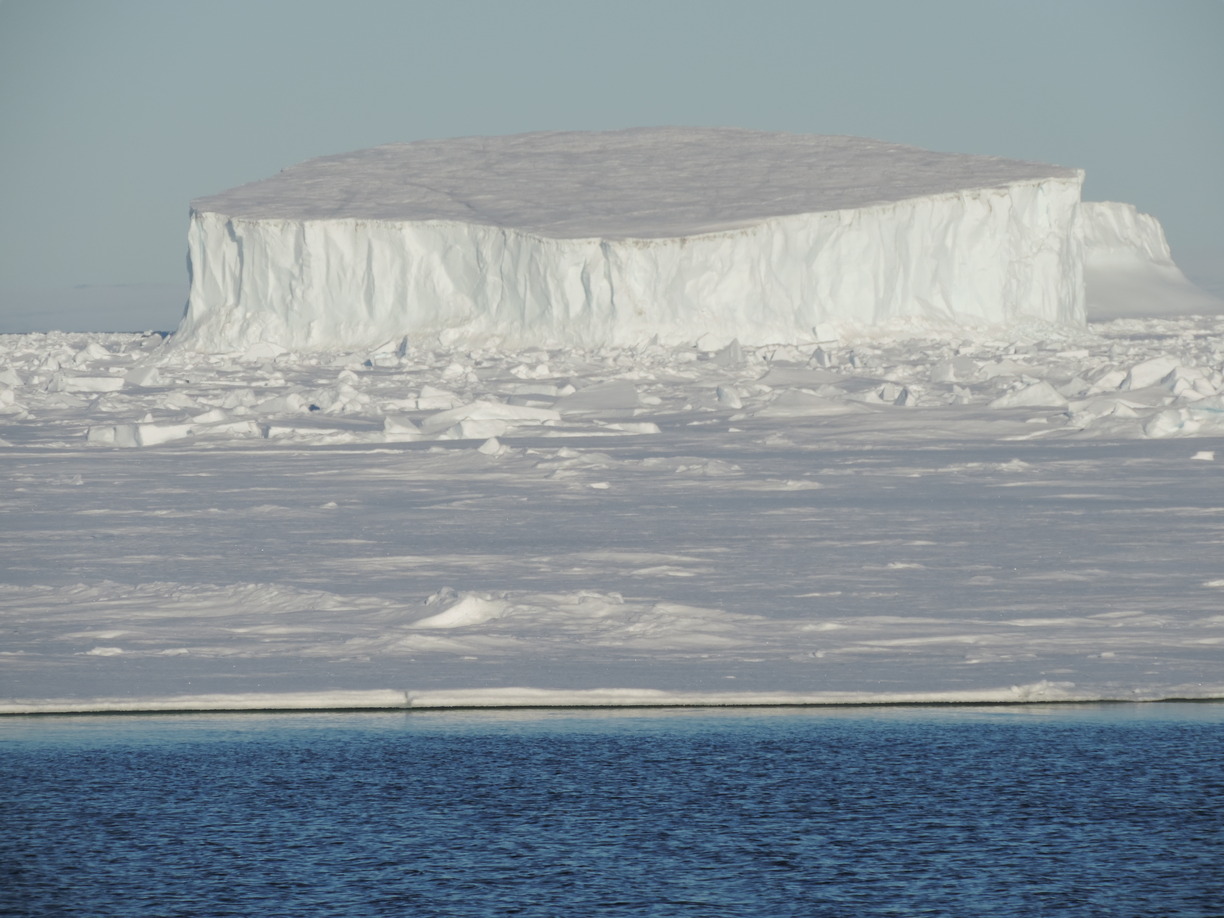
But I digress and want to return to Isle de France with its pearl string
of tabular icebergs within about 5 km off our first moorings. At 170
meters below the surface a strike by one of these stunning mountains and
islands of hard ice will perhaps wipe out a mooring, but perhaps the
goddess of the sea will steer the perhaps 50,000 year old towers of ice into shallow
water where they will ground for a few years. Either way, I will be
watching these icy islands from afar for the next few years in what
becomes a most exciting and pleasurable puzzle with many pieces. Some may
fit and some may be missing. Perhaps the best we can hope for is
a sketch or an outline. Control of nature is vanity, we are merely
temporary sailors on a mighty ocean with ice that will last longer than
either us or whatever sensor we may place in her ways.
posted by Pat Ryan for Andreas Muenchow


Pingback: Coastal Oceanography off North-East Greenland | Icy Seas
Pingback: Northern Winds and Currents off North-East Greenland | Icy Seas
Pingback: Germany 1985 to 2018 | Icy Seas