Category Archives: Ice Cover

Nares Strait 2012 Ice Arch Collapsing (Updated 6/30)

UPDATE-2 6/30:

June-30, 2012 MODIS-Terra view of the collapsing Nares Strait ice arch. The separation occured at the location where the hairline fracture developed 3 days ago. The collapse is propagating upstream to the north as the buttressing support on the western anchor point near Bache Peninsula and Pim Island was removed.

UPDATE-1 6/29:

June-29, 2012 MODIS-Terra view of the collapsing Nares Strait ice arch. The separation occured at the location where the hairline fracture developed 2 days ago.

The most relevant weather information is from Hans Island near 81 N latitude.

ORIGINAL Post (6/28/2012):
The collapse of the ice-arch in southern Nares Strait began June-27, 2012 with development of a small hairline fracture along the western side of the strait off Ellesmere Island, Canada. The fracture connects an isolated area of open water off Bache Peninsula, Canada at 79 N latitude. The front between land-fast ice in the north and the open water in the south has moved slightly southward. It has also lost a visible larger piece of ice that before anchored the bridge at its western connection to land. This motion will open the hairline fracture more, accelerating the collapse of the ice-arch. The missing support of the ice-arch on its western side will collapse the entire ice-arch and the previously land-fast ice of Nares Strait will stream rapidly to the south, I predict, before this weekend.

Updates (including an animation) will be posted daily at http://muenchow.cms.udel.edu/Nares2012/Kane/.

Ice-bridge at southern Nares Strait June-26, 2012 23:30 UTC from MODIS-Terra. There are no hairline fractures yet along the Ellesmere Island side near 79 N latitude. Greenland is on the right (east), Canada on left (west).

Ice-Bridge at southern Nares Strait on June-27, 2012 17:40 UTC from MODIS-Terra. Notice the crack and hairline fractures in the ice along the Ellesmere Island coast near 79 N latitude and 75 W longitude.

This collapse happens each year in the summer, though the timing varies from April for weak and July for strong arches. The arch in 2012 lasted longer than the one in 2011. No or only weak ice-arches formed at this site in 2007, 2008, and 2009, e.g., http://muenchow.cms.udel.edu/MODIS/.

EDIT-1: Same imagery, same gridding, but more focus and detail

MODIS-Terra June-26, 2012 prior to collapse.

MODIS-Terra June-27, 2012 at the onset of collapse. Note the change near the Canada at 79 N latitude where open waters meets the sea ice.

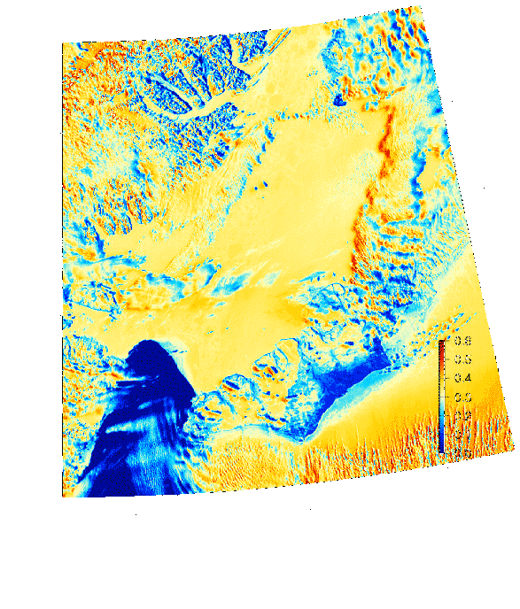
EDIT-2: The moorings we try to recover this summer are to the north of Kane Basin and to the south where Petermann Fjord enters Nares Strait. This map shows it (also notice how badly the coastline of Greenland is surveyed):

June-10, 2012 MODIS-Terra image showing location of moored array that was deployed in Aug. 2009 to be recovered in Aug. 2012.

Greenland’s Warming, Melting, and Sliding to Sea

Greenland is warming, Greenland’s warming is melting its ice, and Greenland melting ice is raising global sea level. All true, but it all has happened before during the last 100 years or so. Our technology to extract small signals buried deep in noise from both our backyard and remote Greenland is unprecedented. This skill should not fool us, that the large changes that we see in Greenland and elsewhere have not happened before. They have, but memory is a fickle thing, as “new” is exciting, while “old” is often forgotten and considered unimportant. Those who live in the past are doomed to miss the present, those who ignore the past, are doomed to repeat it. We need to learn from the past, live in the present, and prepare for the future.

Preparing for an expedition to Nares Strait between northern Greenland and Canada in about 5 weeks, I am exploring temperature data from land, satellites, and ocean sensors to get a feel for what has changed. I started with data from weather stations such as the U.S. Air Force Base Thule , Canada’s former spy station Alert, and Denmark’s Station Nord about 700-1000 miles from the North Pole. So, it is cold up there:

Annual cycle of air temperature (bottom panel) from south to north at Thule (red), Grise Fjord (green), Alert (blue), and Cap Morris Jesup. Data years (top panel) for each year day are degrees of freedom. For each place two temperature curves indicate upper and lower limits of the climatological mean temperature for that day at 95\% confidence.

Well, we knew that, but the real question is: Has anything changed? Has Global Warming reached Greenland? The plot above does not tell, but this one does:

Annual averages and trends of air temperature anomalies for the 1987-2010 period for (top to bottom) Station Nord (Greenland), Alert (Canada), Grise Fjord (Canada), and Thule (Greenland). Scales are identical. The trends are fitted to daily, not annual data. The annual averages are shown for display purposes only.

To some it screams: “Warming, melting, Greenland is surging to sea.” [It is, but it did so before.]

There is lots of fancy signal processing that goes into this (see Tamino or a class I teach) to make a firm statement:

The air around northern Greenland and Ellesmere Island has warmed by about 0.11 +/- 0.025 degrees Celsius per year since 1987. North-west Greenland and north-east Canada are warming more than five times faster than the rest of the world.

This must be huge (yes, it is), it must have an effect on the Greenland ice sheet (yes, it does), and this must raise sea level (yes, perhaps 10 cm or 3 inches in 100 years, Moon et al., 2012).

Now where is the catch?

The catch is that my records all start in 1987, because that is the period for which I have actual measurements from all those stations. My satellite record is even shorter: it starts in 2000, but with lots of work can be extended back to 1978. And my ocean record is shorter yet: it starts in 2003. There just are no other hard data available from north-west Greenland.

So, does this mean we are stuck with the gloom and doom of a short record?

No, but we have to leave the comforts of hard, modern data with which to do solid science. People have to stick out their necks a little by making larger scale interferences. Based on the 1987-2010 results shown above, I can now say that trends and year-to-year variations are all similar in Alert, Thule, Kap Morris Jesup, etc., etc., so I will use the 60 year Thule record to make statements that somewhat represent all of Nares Strait. I could also start looking for softer and older data. With soft data I mean sketchy ship logs kept by whalers, tense expedition reports of starving explorers (Lauge Koch, Knud Rasmussen, Peter Freuchen), and imperial expeditions (George Nares, Adolphus Greely).

Further south there are a few ports where government or trading authorities started records early. The current capital of Greenland, Nuuk (formerly Godthab) is such a place. The Nuuk record starts 1881. And what I find is that the current warming in Greenland has happened just as dramatic as it does now in the 1920ies and 1930ies [well, except for the 2010 spike, but that story is still ongoing]:

Data from Nuuk, southern Greenland, where the temperature record goes back to 1881 (monthly data from NASA/GISS). The dashed line indicates 1987.

The trend is statistically significant, about 0.008 +/- 0.03 degrees centigrade per year or about 10 times smaller than what it is for northern Greenland starting in 1987. So the devil of Greenland warming, melting, and sliding to sea is in the details or records that are too short. The Global Warming signal is in there, but how much, we do not know and perhaps cannot know. Furthermore, most of the globe of “Global Warming” is covered by water and the ocean warming we know little about. Recall, my ocean record off northern Greenland only starts in 2003 and ends in 2009 or 2012, if we recover computers, sensors, and data from the bottom of Nares Strait this summer.

Greenland’s data and physics of ice, ocean, and air are exciting and all show dramatic change. To me, this is a big and fun puzzle, but one has to be careful and humble to avoid making silly statements for political purposes that are not supported by data. Do I think Global Warming is happening? Absolutely, yes. Do I think it is man-made? Probably. What do I do about it? I ride my bicycle to and from work every day. And that’s what I do next … bicycle home.

Nares Strait Ice Bridge and Arctic Ice Thickness Change

The ice of the Arctic Ocean is rapidly disappearing. This happens every summer, but for the last 30 years there is a little less ice left at the end of each summer than there was the year before. The areas covered by ice are not only shrinking, the ice is also getting thinner, or so many do believe.

To check out such claims, we placed sound systems on the ocean floor of Nares Strait from which to find out how much the thickness of the ice above has changed. We started this in 2003, were told to stop it in 2009, but privately parked our instruments where they would collect data. We must get to check our sound systems and retrieve the private recordings, because otherwise Poseidon will claim our possessions for parking violations. The Canadian Coast Guard Ship Henry Larsen, we hope, will help us to negotiate water and ice to get us deep into Nares Strait as she and her crew did so well in 2006, 2007, and last in 2009.

CCGS Henry Larsen in thick and multi-year ice of Nares Strait in August 2009. View is to the south with Greenland in the background. [Photo Credit: Dr. Helen Johnson]

The ice profiling sonar sounds system before its first deployment in Nares Strait in August 2003 from aboard the USCGC Healy. It measure ice thickness many times each seconds for up to 3 years. View is to the north-west with Ellesmere Island, Canada in the background. Listening in are Jay Simpkins (left), Helen Johnson, and Peter Gamble.

Nares Strait to the west of northern Greenland is one of two major gates for the thickest, the hardest, and the oldest ice to leave the Arctic for the Atlantic Ocean [Fram Strait to the east of Greenland is the other.] This gate is closed at the moment by an arching ice bridge that locks all ice in place. No ice can leave the Arctic via Nares Strait as long as these arches hold. The ice arch acts as a dam that holds back the flood of ice that will come streaming south hard once the dam breaks. And break it will, usually between the end of June and July.

Ice arch in southern Nares Strait as seen by MODIS Terra on June-18, 2012. Greenland is on the right, Canada on the left. The dark blue colors in the bottom-left are open water, yellow are the ice caps of Greenland and Ellesmere Island and lighter shades of blue are warm ice or land. Humboldt Glacier is the on the right-center where Nares Strait is at its widest with Kane Basin at about 80 N latitude.

Nares Strait Jun.-10, 2012 image showing land-fast ice between northern Greenland and Canada as well as the ice arch in the south (bottom left) separating sea ice from open water (North Water). The coastline is indicated as the black line.

The sooner it breaks, the more old ice the Arctic will lose and the better it is for us to get an icebreaker to where must be to recover our instruments and data. The data will tell us if the ice has changed the last 9 years.

I processed and archived maps of Nares Strait satellite images to guide 2003-2012 analyses of how air, water, and ice change from day to day. Ice arches formed as expected during the 2003/04, 2004/05, and 2005/06 winters lasting for about 180-230 days each year. In 2006/07 no ice arch formed, ice streamed freely southward all year, and this certainly contributed to the 2007 record low ice cover. In 2007/08 the arch was in place for only 65 days. In 2009/10, 2010/11, and now 2011/12 ice cover appear normal as the arches formed in December and lasted until July.

We live in exciting times of dramatic change, some to the better and some to the worse. Some of the change is caused by global warming while most is probably not. We do not know for sure, but most of the evidence points towards us people as a major driver of the change we observe in the Arctic and elsewhere. Nevertheless, climate and its change is one grand puzzle that no single scientist, no single discipline, no single country, and no single continent can solve. There are many pieces that all contribute to how and why the Arctic ice changes the way it does. And this includes the ice arches of Nares Strait. There are many mysteries and unresolved physics in what makes these ice arches tick and what makes them blow to bits, but blow they will … watch it, it’s fun, and perfectly natural.

EDIT: This movie shows just how stable the ice arch is at the moment.

Heat Sensing Eyes “See” Arctic Ice Thickness

The Arctic sea ice is disappearing before our eyes as we extended them into space in the form of satellites. Every summer for the last few years the area covered by ice is shrinking during the summer when 24 hours of sunlight give us plenty of crisp images. But what about winter? What about now? And does a picture from space tell us how thick the ice is?

Nares Strait between northern Greenland and Canada on Aug.-13, 2005 with Petermann and Humboldt Glaciers at top and center right from MODIS imagery using red, blue, and green channels.

It is dark in the winter near the north pole as the sun is below the horizon 24 hours each day, but there are many ways to “see” in the dark as flying bats aptly show. They send out sound that bounce off objects from which bats reconstruct objects around them. We use radar from space to do to the same with radio waves to “see” different types of ice at night from satellites. We can also use tiny amounts of heat stored in water, ice, snow, and land to “see” at night. Someone breathing down your neck at a cold dark corner will make our heart beat faster as we “see” the heat not with our eyes, but with our skin. I digress, as I really want to talk about icy Arctic seas and how we can perhaps “see” how thick it is with our eyes in the sky.

The most accurate and pain-staking way to measure ice thickness is drill holes through it. This is back-breaking, manual labor away from the comforts of a ship or a camp. One person watches with a shot-gun for polar bear searching for food, not our food, we are the food. The scientist who does this sweaty, dangerous work on our Nares Strait expeditions is Dr. Michelle Johnston of Canada’s National Research Council. She is a petite, attractive, and smart woman who is calm, competent, and comfortable when she leads men like her bear-like helper Richard Lanthier into the drilling battles with the ice. She gets dirty, cold, and wet when on her hands and knees setting up, drilling, cutting, measuring:

Dr. Michelle Johnston assembling ice drilling gear in Nares Strait with Greenland on the horizon. The Canadian Coast Guard Ship Henry Larsen in the background with its helicopter hovering.

She measures temperatures within the ice and tries to crush it to find out how strong it is. All of this information guides ship operators on what dangers they face operating in icy seas. Drilling over 250 such holes across a small floe on the other (eastern) side of Greenland, Dr. Hajo Eicken showed how one large ice floe changes from less 1 meter to more than 5 meters in thickness. He also discovered that the percentage of thick and thin ice of his single 1 mile wide ice chunk is similar to the percentages measured by a submarine along a track longer than 1000 miles.

This was a surprising result in 1989 and we use it to estimate ice thickness more leisurely sipping coffee in our office. From the same satellite that gives us crisp true color images in summer as shown above, we get false color images of temperature as shown below.

Map of Nares Strait, north-west Greenland on March-25, 2009 showing heat emitted during the polar night from the ocean through the ice, and sensed by MODIS satellite.

A graduate student of mine, Claire Macdonald, is trying to convert these temperature readings into ice thickness for Nares Strait. She showed me the first promising results today. The plot below shows the distribution of “thermal” ice thickness for a small square in Nares Strait Dec.-1, 2008 through Mar.-1, 2009 when no clouds were in the area. Note the two distinct and separate clusters with thicknesses below 1 meter and above 2 meters. They represent thin ice formed in 2009 after an upstream ice arch blocked all flow of thicker ice from the Arctic Ocean to Nares Strait. The thicker ice passed the study area at times when the thick, hard multi-year Arctic ice entered Nares Strait freely from the Arctic Ocean.

Distribution of "thermal" ice thickness from satellite for Nares Strait Dec.-1, 2008 through Mar.-1, 2009. (Credit: Claire Macdonald, Jan.-26, 2012)

Much work remains to be done: Claire is comparing the “thermal” ice thickness with “acoustic” ice thickness measured by sonars moored in the water below the ice. It then will be exciting to explore “thermal” thicknesses for all of Nares Strait. Winds and ocean currents will pile ice up in some areas making it thicker while they spread ice out making it thinner. Claire and I have worked with such wind and ocean data. Science is never finished as each question answered raises a host of new ones.

Ice Arch off North-West Greenland Locks Ice Motion in Nares Strait

Winter has come to north-west Greenland as the sea ice of Nares Strait has locked itself to land and stopped movement of all ice from the Arctic Ocean in the north to Baffin Bay and the Atlantic Ocean in the south. While there is no sunlight for several more months now during the polar night, the warm ocean beneath the ice emits heat through the ice which becomes visible to heat-sensing satellites. The light yellow and reddish colors show thin ice while the darker bluish colors show thicker ice today:

Dec.-13, 2011 surface brightness temperature of Nares Strait showing an ice arch in Smith Sound separating thin and moving ice (reddish, yellow) from thick land-fast ice (blue).

The prior 2010/11 winter was the first in several years that these normal conditions have returned. The ice arch in Smith Sound did not form in 2009/10, 2008/09, and 2007/08 winters while a weak arch in 2007/08 fell apart after only a few days. Conditions in 2009 were spectacular, as only a northern ice arch formed. Since the ocean moves from north to south at a fast and steady clip, it kept Nares Strait pretty clear of ice for most of the winter as no Arctic ice could enter these waters and all locally formed new “first-year ice” is promptly swept downstream:

March-25, 2009 map Nares Strait, north-west Greenland showing heat emitted during the polar night from the ocean and sensed by MODIS satellite.

The very thin and mobile ice in Nares Strait of 2009 exposed the ocean to direct atmospheric forcing for the entire year. I reported substantial warming of ocean bottom temperatures here during this period. This new 2011/12 ice arch formed the last few days. If it consolidates during the next weeks, then it is very likely to stay in place until June or July of 2012. It decouples the ocean from the atmosphere and, perhaps more importantly, prevents the Arctic Ocean from losing more of its oldest, thickest, and hardest sea ice. This is very good news for the Arctic which has lost much ice the last few years.

For more daily thermal MODIS imagery take a peek at http://muenchow.cms.udel.edu/Nares2011/Band31/ for 2011. Replace Nares2011 with Nares2003 or any other year, and an annual sequence appears. Furthermore, my PhD student Patricia Ryan just sent me a complete list of files that I need to process until 2017. Fun times.