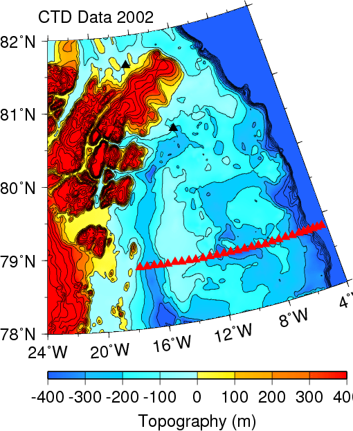
Map of North-East Greenland showing land elevations in red and yellow and bottom depths in blue. Data are from IBCAO-2 and contoured in 100-m intervals.
Δ
This site uses Akismet to reduce spam. Learn how your comment data is processed.

