
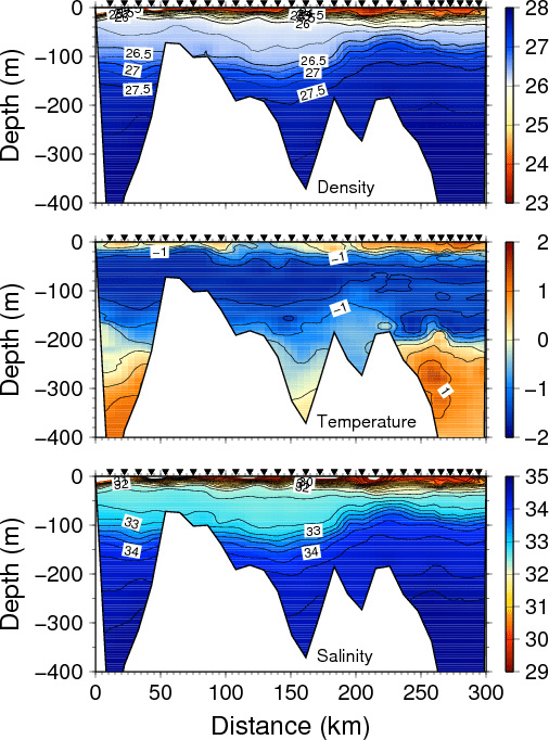
Section of density (top), temperature (middle), and salinity (bottom) across the shelf off North-East Greenland in the summer of 2002. The view is to the north with Greenland on the left (west) and the deep Fram Strait to the right (east). Symbols indicate station locations. White areas indicate bottom topography.
