

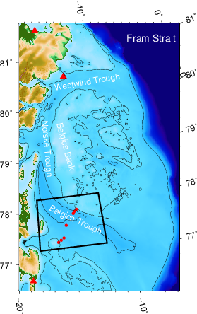
Map of study area with 2014-16 mooring array in box near 78 N across Belgica Trough. Red triangles place weather data from Station Nord (81.2 N), Henrik Kr\o yer Holme (80.5 N), and Denmarkhaven (76.9 N). Black box indicates area of mooring locations.
