
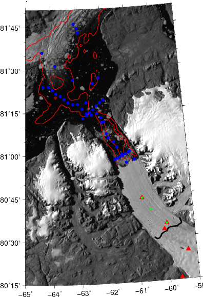
Map of Greenland’s Petermann Gletscher, Fjord, and adjacent Nares Strait. The UDel Ocean-Weather station is the green dot on the floating ice shelf that does not have a red triangle. Blue dots in the ocean are where we collected ocean data from I/B Oden in August 2015. Green dots are ocean moorings which report via Iridium while red triangles are “fancy” GPS locations we instrumented for 12 days to measure vertical tidal elevations of the glacier.
