

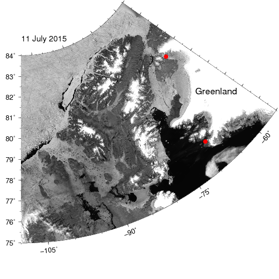
Image of northern Greenland (top right) and Ellesmere Island (center) showing open water as black, land as gray, and sea ice as gray/white. The two red dots are Thule Air Force Base in the south and Petermann Glacier in the north. Note the bands of black water along the coast of Ellesmere Island that result from east to west blowing winds that move ice offshore.
