
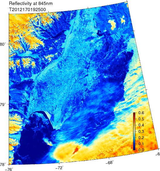
Ice arch in southern Nares Strait as seen by MODIS Terra on June-18, 2012. Greenland is on the right, Canada on the left. The dark blue colors in the bottom-left are open water, yellow are the ice caps of Greenland and Ellesemere Island and lighter shades of blue are warm ice or land. Humbold Glacier is the on the right-center where Narest Strait is at its widest with Kane Basin at about 80N latitude. Greenland’s Washington land is at the top-right. Our moored array is just to the north of this image.
